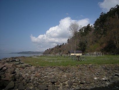
See Saltwater State Park, Des Moines, on the map
Directions to Saltwater State Park (Des Moines) with public transportation
The following transit lines have routes that pass near Saltwater State Park
 Bus:
Bus:
How to get to Saltwater State Park by bus?
Click on the bus route to see step by step directions with maps, line arrival times and updated time schedules.
Which bus lines stop near Saltwater State Park?
These bus lines stop near Saltwater State Park: 166, A LINE.
See Saltwater State Park, Des Moines, on the map
Public Transit to Saltwater State Park in Des Moines
Wondering how to get to Saltwater State Park in Des Moines, United States? Moovit helps you find the best way to get to Saltwater State Park with step-by-step directions from the nearest public transit station.
Moovit provides free maps and live directions to help you navigate through your city. View schedules, routes, timetables, and find out how long does it take to get to Saltwater State Park in real time.
Bus:
Want to see if there’s another route that gets you there at an earlier time? Moovit helps you find alternative routes or times. Get directions from and directions to Saltwater State Park easily from the Moovit App or Website.
We make riding to Saltwater State Park easy, which is why over 1.5 million users, including users in Des Moines, trust Moovit as the best app for public transit. You don’t need to download an individual bus app or train app, Moovit is your all-in-one transit app that helps you find the best bus time or train time available.
For information on prices of bus, costs and ride fares to Saltwater State Park, please check the Moovit app.
Use the app to navigate to popular places including to the airport, hospital, stadium, grocery store, mall, coffee shop, school, college, and university.
Saltwater State Park Address: 25205 8th Pl S street in Des Moines
Attractions near Saltwater State Park
Gmh Consulting Inc,815 S 252nd St,Office Options,Saltwater Cafe,Garage Door 24 Hours,State of Washington Parks and Recreation Commission,Lawrence A Watson,Infinity Funding,8th Pl S,SH-509,Marine View Dr S,WA-509,252nd and WA-509,Highway 509,Highway 509 & S 252nd,S 251st St & Marine View Dr S,S 251st St & 9th Ave S,25742 10th Avenue South,10th Ave,Bridge ShelterHow to get to popular attractions in Des Moines with public transit
Doc's Marina Grill in Bainbridge Island, Bainbridge Island,Red Robin Gourmet Burgers, Bothell,Seattle Children's Hospital, Seattle,Costco Wholesale, Federal Way,The Landing In Renton, Renton,Renton Highlands Connector Stop, Renton,Lake Stevens, Lake Stevens,Amc Pacific Place 11, Seattle,Boeing Flight Test & Delivery Center, Seattle,Space Needle, Seattle,QFC, Edmonds,Freighthouse Square, Tacoma,Tulalip Casino Resort,Jollibee, Tukwila,Providence Southgate II, Renton,The Old Spaghetti Factory, Tacoma,TCC Transit Center, Tacoma,Georgetown Brewing Company, Seattle,QFC, Seattle,Southcenter Mall, TukwilaGet around Des Moines by public transit!
Traveling around Des Moines has never been so easy. See step by step directions as you travel to any attraction, street or major public transit station. View bus and train schedules, arrival times, service alerts and detailed routes on a map, so you know exactly how to get to anywhere in Des Moines.
When traveling to any destination around Des Moines use Moovit's Live Directions with Get Off Notifications to know exactly where and how far to walk, how long to wait for your line, and how many stops are left. Moovit will alert you when it's time to get off — no need to constantly re-check whether yours is the next stop.
Wondering how to use public transit in Des Moines or how to pay for public transit in Des Moines? Moovit public transit app can help you navigate your way with public transit easily, and at minimum cost. It includes public transit fees, ticket prices, and costs. Looking for a map of Des Moines public transit lines? Moovit public transit app shows all public transit maps in Des Moines with all bus routes and stops on an interactive map.
Des Moines has 1 transit type(s), including: bus, operated by several transit agencies, including Sound Transit, Seattle Streetcar, Sound Transit, Metro Transit, Metro Transit, Sound Transit, Whatcom Transportation Authority, Mason Transit Authority, Snoqualmie Valley Transportation (SVT), Snoqualmie Valley Transportation, Amtrak, Island Transit, Kitsap Transit, Intercity Transit and Everett Transit