How to get to Samira by bus?
Click on the bus route to see step by step directions with maps, line arrival times and updated time schedules.
From Sultangazi Ağız Ve Diş Hastanesi, Sultangazi
52 minFrom Çamlıca Kulesi, Küçükçamlıca, Üsküdar
94 minFrom Çamlıca Cami, Burhaniye, Üsküdar
88 minFrom Metroport Avm, Bahçelievler
51 minFrom Emaar Square Mall, Ferah, Üsküdar
100 minFrom Güneşli Meydan, Bagcilar
83 minFrom Galatasaray Stadyum Müzesi, Sariyer
61 minFrom Arnavutköy, Bagcilar
74 minFrom Kadıköy Evlendirme Dairesi, Kadıköy
134 minFrom Bakırköy Meydan, Bagcilar
56 min
How to get to Samira by train?
Click on the train route to see step by step directions with maps, line arrival times and updated time schedules.
How to get to Samira by metro?
Click on the metro route to see step by step directions with maps, line arrival times and updated time schedules.
Bus stops near Samira in Fatih
Dolmus & Minibus station near Samira in Fatih
- Kadınlar Pazarı, 5 min walk,VIEW
Metro station near Samira in Fatih
- Aksaray (M1), 10 min walk,VIEW
Bus lines to Samira in Fatih
- 28, Topkapı-Beşiktaş Meydan,VIEW
- 31E, Kuyumcukent-Kuyumcukent Çarşı,VIEW
- 32, Cevatpaşa-Eminönü,VIEW
- 36A, Vezneciler-Cebeci Peronlar,VIEW
- 36KE, Yeni Mahalle Metro - Eminönü / Ring,VIEW
- 36V, Yayla Mahallesi - Vezneciler / Ring,VIEW
- 38B, Vezneciler-Sultangazi Peronlar,VIEW
- 38E, Yeni Mahalle Metro-Gaziosmanpaşa Eğitim Ve Araştırma Hastanesi,VIEW
- 50P, Çırçır Metro-Eminönü,VIEW
- 50V, Vezneciler-Alibeyköy Metro,VIEW
- 86V, Sakarya Mahallesi-Vezneciler,VIEW
- 87, Harbiye Askeri Müze-Topkapı,VIEW
- 90, Draman-Eminönü,VIEW
- 336E, Malkoçoğlu-Cebeci Peronlar,VIEW
- 90B, Draman - Aksaray / Ring,VIEW
- TAKSIM - TOPKAPI - CEVIZLIBAĞ, Taksim - Topkapı - Cevizlibağ,VIEW
- TAKSIM - ŞIRINEVLER - YENIBOSNA, Taksim - Şirinevler - Yenibosna,VIEW
- 28T, Topkapı - Beşiktaş,VIEW
- 30D, Ortaköy Dereboyu - Yenikapı,VIEW
- 32T, Cevatpaşa - Taksim,VIEW
What are the closest stations to Samira?
The closest stations to Samira are:
- Fatih - Vezneciler Yönü is 96 meters away, 2 min walk.
- Kadınlar Pazarı is 332 meters away, 5 min walk.
- Balipaşa - Aksaray Yönü is 473 meters away, 7 min walk.
- İstanbul Büyükşehir Belediyesi - Taksim Yönü is 491 meters away, 7 min walk.
- İstanbul Büyükşehir Belediyesi - Aksaray Yönü is 508 meters away, 7 min walk.
- Malta - Fatih Yönü is 514 meters away, 7 min walk.
- Aksaray (M1) is 754 meters away, 10 min walk.
Which bus lines stop near Samira?
These bus lines stop near Samira: 28, 38E, 76D, 86V, 87, 97GE.
Which metro lines stop near Samira?
These metro lines stop near Samira: M1A, M1B, M2.
Which train line stops near Samira?
B1 (Halkalı)
Which tram line stops near Samira?
T1 (Bağcılar→Kabataş)
What’s the nearest metro station to Samira in Fatih?
The nearest metro station to Samira in Fatih is Aksaray (M1). It’s a 10 min walk away.
What’s the nearest bus station to Samira in Fatih?
The nearest bus station to Samira in Fatih is Fatih - Vezneciler Yönü. It’s a 2 min walk away.
What’s the nearest Dolmus & Minibus station to Samira in Fatih?
The nearest Dolmus & Minibus station to Samira in Fatih is Kadınlar Pazarı. It’s a 5 min walk away.
What time is the first metro to Samira in Fatih?
The M1B is the first metro that goes to Samira in Fatih. It stops nearby at 6:02 AM.
What time is the last metro to Samira in Fatih?
The M1A is the last metro that goes to Samira in Fatih. It stops nearby at 12:31 AM.
What time is the first bus to Samira in Fatih?
The 36V is the first bus that goes to Samira in Fatih. It stops nearby at 5:34 AM.
What time is the last bus to Samira in Fatih?
The 89C is the last bus that goes to Samira in Fatih. It stops nearby at 1:20 AM.
What time is the first Dolmus & Minibus to Samira in Fatih?
The TAKSIM - AKSARAY - KOCAMUSTAFAPAŞA is the first Dolmus & Minibus that goes to Samira in Fatih. It stops nearby at 3:00 AM.
What time is the last Dolmus & Minibus to Samira in Fatih?
The TAKSIM - BAKIRKÖY is the last Dolmus & Minibus that goes to Samira in Fatih. It stops nearby at 3:38 AM.
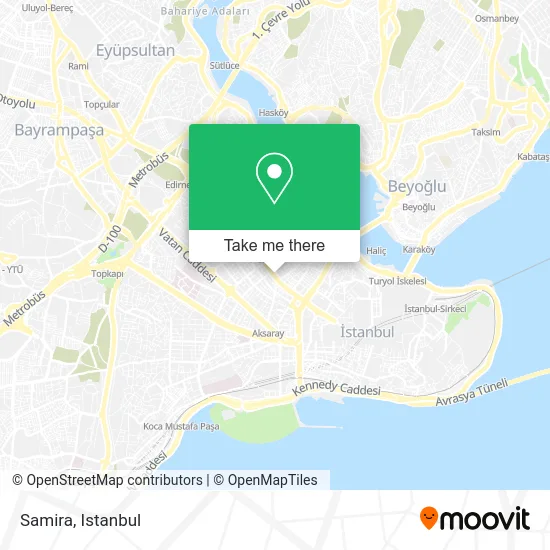
See Samira, Fatih, on the map
Public Transit to Samira in Fatih
Wondering how to get to Samira in Fatih? Moovit helps you find the best way to get to Samira with step-by-step directions from the nearest public transit station.
Moovit provides free maps and live directions to help you navigate through your city. View schedules, routes, timetables, and find out how long does it take to get to Samira in real time.
Looking for the nearest stop or station to Samira? Check out this list of stops closest to your destination: Fatih - Vezneciler Yönü; Kadınlar Pazarı; Balipaşa - Aksaray Yönü; İstanbul Büyükşehir Belediyesi - Taksim Yönü; İstanbul Büyükşehir Belediyesi - Aksaray Yönü; Malta - Fatih Yönü; Aksaray (M1).
Bus: 28, 38E, 76D, 86V, 87, 97GE, 31E, 32, 36A, 36KE, 90B, TAKSIM - TOPKAPI - CEVIZLIBAĞ, TAKSIM - ŞIRINEVLER - YENIBOSNA, 28T, 30D, 32T, 35D.Metro: M1A, M1B, M2.Train: B1.Tram: T1.Dolmus & Minibus: TAKSIM - AKSARAY - KOCAMUSTAFAPAŞA, TAKSIM - BAKIRKÖY.
Want to see if there’s another route that gets you there at an earlier time? Moovit helps you find alternative routes or times. Get directions from and directions to Samira easily from the Moovit App or Website.
We make riding to Samira easy, which is why over 1.5 million users, including users in Fatih, trust Moovit as the best app for public transit. You don’t need to download an individual bus app or train app, Moovit is your all-in-one transit app that helps you find the best bus time or train time available.
For information on prices of bus, metro, train, tram, Dolmus & Minibus and Metrobus, costs and ride fares to Samira, please check the Moovit app.
Use the app to navigate to popular places including to the airport, hospital, stadium, grocery store, mall, coffee shop, school, college, and university.
Samira Address: Fevzi Paşa Caddesi street in Fatih
- fevzipaşa cad. 22,
- Btm Mağazaları Fatih,
- Özel Bezmialem Vakıf Üniversitesi Fatih Semt Polikliniği,
- Balat Merdivenli Yokuşu,
- Bezmialem Fatih Ek Hizmet Binası,
- Erolok,
- Setri Nur Gelinlik Ve Türban Tasarım,
- Tuay Karaca Tasarım Ve Modaevi,
- eser giyim,
- Çin Pazarı,
- Setri Nur Istanbul Fatih,
- Dilek Pastanesi,
- Dermoclinice estetik güzellik merkezi,
- Tekbir Giyim Mağazası,
- T<SHOP Kozmetik,
- Gurbetçi Gençler Dernek,
- Rumeli Cafe & Restaurant,
- Pınar Şems Butik,
- Fatih Akdeniz LC Waikiki,
- bezmialem üniversitesi fatih ek hizmet binası
Places Near Samira (Fatih)
- 2 Nolu Minibüss, Beylikduzu,
- METROPOL IsTaNBuL, Ataşehir,
- 212 AVM, Bagcilar,
- Mehmet Emin Tokadî Hz. Türbesi, Fatih,
- Hilltown AVM, Maltepe,
- Gebze Koop Durağı, Gebze,
- Gebze-Harem Minibüs Hattı, Gebze,
- İstinye Park, Sariyer,
- Tersane İstanbul, Beyoğlu,
- VİALAND AVM, Eyüp,
- Bakırköy Sosyete Pazarı, Bakirköy,
- Başakşehir Çam Ve Sakura Şehir Hastanesi, Basaksehir,
- Hz. Yuşa Tepesi, Beykoz,
- 41 Burda AVM, Kocaeli Merkezi,
- Şehit Prof. Dr. İlhan Varank Eğitim Ve Araştırma Hastanesi, Sancaktepe,
- Beylikdüzü - 4 Nolu Minibüs Hattı, Beylikduzu,
- Mall Of İstanbul, Basaksehir,
- Karaköy Genelevi, Karaköy, Beyoğlu,
- Topkule Kışlası 47.Komando Tugay Komutanlığı, Esenler,
- İstanbul
How to get to popular places in Istanbul with public transit
Get around Fatih by public transit!
Traveling around Fatih has never been so easy. See step by step directions as you travel to any attraction, street or major public transit station. View bus and train schedules, arrival times, service alerts and detailed routes on a map, so you know exactly how to get to anywhere in Fatih.
When traveling to any destination around Fatih use Moovit's Live Directions with Get Off Notifications to know exactly where and how far to walk, how long to wait for your line, and how many stops are left. Moovit will alert you when it's time to get off — no need to constantly re-check whether yours is the next stop.
Wondering how to use public transit in Fatih or how to pay for public transit in Fatih? Moovit public transit app can help you navigate your way with public transit easily, and at minimum cost. It includes public transit fees, ticket prices, and costs. Looking for a map of Fatih public transit lines? Moovit public transit app shows all public transit maps in Fatih with all Bus, Train, Metro, Tram, Ferry, Metrobus and Dolmus & Minibus routes and stops on an interactive map.
Istanbul has 7 transit type(s), including: Bus, Train, Metro, Tram, Ferry, Metrobus and Dolmus & Minibus, operated by several transit agencies, including Marmaray, Metro İstanbul, Metrobüs, UAB, İETT, İETT ÇIFT KATLI HATLAR, İETT BÖLGESEL HATLAR, TCDD, Şehir Hatları, Dentur Avrasya, Beyden, Turyol, Mavi Marmara, Havaist and Prenstur
