Directions to Samuel Bancroft House (Reading) with public transportation
The following transit lines have routes that pass near Samuel Bancroft House
 Bus: 137, 354.
- Train: HAVERHILL, LOWELL, DOWNEASTER.
How to get to Samuel Bancroft House by bus?
Click on the bus route to see step by step directions with maps, line arrival times and updated time schedules.
From Winchester, MA, Winchester
84 minFrom Chevalier Theater, Medford
55 minFrom Melrose Wakefield Hospital, Malden
61 minFrom Burlington, MA, Burlington
72 minFrom Kowloon Restaurant, Saugus
101 minFrom Woburn, MA, Woburn
59 minFrom Lahey Hospital & Medical Center, Burlington
77 minFrom Chevalier Theatre (Chevalier Theater Show Line), Medford
55 minFrom Boda Borg, Malden
64 min
How to get to Samuel Bancroft House by train?
Click on the train route to see step by step directions with maps, line arrival times and updated time schedules.
Train stations near Samuel Bancroft House in Reading
What are the closest stations to Samuel Bancroft House?
The closest stations to Samuel Bancroft House are:
- Reading is 1565 yards away, 19 min walk.
- Anderson/Woburn is 4904 yards away, 57 min walk.
Which bus lines stop near Samuel Bancroft House?
These bus lines stop near Samuel Bancroft House: 137, 354.
Which train lines stop near Samuel Bancroft House?
These train lines stop near Samuel Bancroft House: HAVERHILL, LOWELL.
What’s the nearest train station to Samuel Bancroft House in Reading?
The nearest train station to Samuel Bancroft House in Reading is Reading. It’s a 19 min walk away.
What time is the first train to Samuel Bancroft House in Reading?
The HAVERHILL is the first train that goes to Samuel Bancroft House in Reading. It stops nearby at 5:18 AM.
What time is the last train to Samuel Bancroft House in Reading?
The HAVERHILL is the last train that goes to Samuel Bancroft House in Reading. It stops nearby at 12:13 AM.
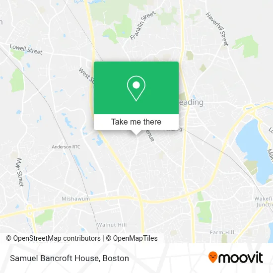
See Samuel Bancroft House, Reading, on the map
Public Transit to Samuel Bancroft House in Reading
Wondering how to get to Samuel Bancroft House in Reading? Moovit helps you find the best way to get to Samuel Bancroft House with step-by-step directions from the nearest public transit station.
Moovit provides free maps and live directions to help you navigate through your city. View schedules, routes, timetables, and find out how long does it take to get to Samuel Bancroft House in real time.
Looking for the nearest stop or station to Samuel Bancroft House? Check out this list of stops closest to your destination: Reading; Anderson/Woburn.
Bus: 137, 354.Train: HAVERHILL, LOWELL, DOWNEASTER.
Want to see if there’s another route that gets you there at an earlier time? Moovit helps you find alternative routes or times. Get directions from and directions to Samuel Bancroft House easily from the Moovit App or Website.
We make riding to Samuel Bancroft House easy, which is why over 1.7 million users, including users in Reading, trust Moovit as the best app for public transit. You don’t need to download an individual bus app or train app, Moovit is your all-in-one transit app that helps you find the best bus time or train time available.
For information on prices of bus and train, costs and ride fares to Samuel Bancroft House, please check the Moovit app.
Use the app to navigate to popular places including to the airport, hospital, stadium, grocery store, mall, coffee shop, school, college, and university.
Location: Reading, Boston
- Nancy D Ramsdell,
- Inwood West (Udr Inwood),
- Georgia S Vasilakis MD,
- Mls Property Information Network, Inc.,
- Maria Fabiano Realty,
- Listing Office,
- MBTA Reading Station,
- Parish Life Pastoral Care Community Involvement Church,
- T W Lyons & Associates,
- Christian Science Committee on Publication,
- Adt,
- LNR Property Stylist,
- Revolve Thrift,
- EV Connect,
- Connor American Lock,
- Intellibeam,
- Reading Recap,
- Frigidaire Certified Appliance Repair,
- Electrolysis by Terri Reading,
- Lisa Vouras, DMD PC
Places Near Samuel Bancroft House (Reading)
- Seaport District, Boston,
- Boston Medical Center, Boston,
- Boston Children's Hospital, Boston,
- Quincy Market, Boston,
- Mgm Music Hall, Boston,
- Cheers, Boston,
- House Of Blues, Boston,
- Leader Bank Pavilion (Leader Bank Pavillion), Boston,
- Massachusetts General Hospital, Boston,
- Castle Island, Boston,
- Museum Of Science, Boston,
- Boston Common, Boston,
- Faneuil Hall, Boston,
- North End, Boston,
- Isabella Stewart Gardner Museum, Boston,
- Boston Convention & Exhibition Center, Boston,
- Wang Theater, Boston,
- Prudential Center, Boston,
- Td Garden, Boston,
- Wilbur Theatre, Boston
How to get to popular places in Boston with public transit
Get around Reading by public transit!
Traveling around Reading has never been so easy. See step by step directions as you travel to any attraction, street or major public transit station. View bus and train schedules, arrival times, service alerts and detailed routes on a map, so you know exactly how to get to anywhere in Reading.
When traveling to any destination around Reading use Moovit's Live Directions with Get Off Notifications to know exactly where and how far to walk, how long to wait for your line, and how many stops are left. Moovit will alert you when it's time to get off — no need to constantly re-check whether yours is the next stop.
Wondering how to use public transit in Reading or how to pay for public transit in Reading? Moovit public transit app can help you navigate your way with public transit easily, and at minimum cost. It includes public transit fees, ticket prices, and costs. Looking for a map of Reading public transit lines? Moovit public transit app shows all public transit maps in Reading with all Bus, Train, Subway and Ferry routes and stops on an interactive map.
Boston has 4 transit type(s), including: Bus, Train, Subway and Ferry, operated by several transit agencies, including MBTA, Southeastern Regional Transit Authority, MetroWest Regional Transit Authority, Rhode Island Public Transit Authority, WRTA, Lowell Regional Transit Authority, Merrimack Valley Transit, Montachusett Regional Transit Authority, Cape Cod Regional Transit Authority, Brockton Area Transit Authority, Martha's Vineyard Transit Authority, the WAVE - Nantucket Regional Transit Authority, GATRA, Cape Ann Transportation Authority and Massport