Directions to San Andres St (Manila) with public transportation
The following transit lines have routes that pass near San Andres St
How to get to San Andres St by bus?
Click on the bus route to see step by step directions with maps, line arrival times and updated time schedules.
How to get to San Andres St by train?
Click on the train route to see step by step directions with maps, line arrival times and updated time schedules.
Bus stations near San Andres St in Manila
- M Adriatico / San Andres Intersection, Manila,2 min walk,
- San Andres Market, San Andres / Leveriza Intersection, Manila,2 min walk,
- Marcelo H. Del Pilar, Manila,5 min walk,
- Remedios / Antonio Vasquez Intersection, Manila,5 min walk,
- A.Mabini, Manila,6 min walk,
- President Quirino Ave / Taft Ave Intersection, Manila,6 min walk,
- Gen M Malvar / M Adriatico Intersection, Manila,8 min walk,
Train stations near San Andres St in Manila
- Pedro Gil Lrt,4 min walk,
- San Andres Pnr,24 min walk,
Bus lines to San Andres St in Manila
- JEEP,Libertad - Retiro via Mabini, Sta. Cruz,
- JEEP,Blumentritt - Pasay RTDA. via Sta. Cruz, Mabini,
- JEEP,Libertad-PCampa,
- JEEP,Munoz - Remedios via Quiapo, L. Guinto,
- JEEP,Blumentritt - Pasay RTDA via Sta. Cruz, L. Guinto,
- JEEP,Escolta - Libertad via L. Guinto,
- JEEP,Dapitan Libertad via L Guinto,
- JEEP,Blumentritt - Libertad via Sta. Cruz, L. Guinto,
- JEEP,Blumentritt - Vito Cruz via Quiapo, Mabini,
- JEEP,Baclaran - Blumentritt via Mabini, Quiapo,
- JEEP,Libertad Retiro via Sta Cruz,
- JEEP,Monumento - Vito Cruz via Rizal Ave., Taft Ave.,
- JEEP,MCU - Vito Cruz via Rizal Ave., Taft Ave.,
- JEEP,BLUMENTRITT - LIBERTAD via MABINI,
- JEEP,Pasay Rtda v Sta Cruz Blumentrit,
- JEEP,Baclaran - Blumentritt via Mabini, Sta. Cruz,
- JEEP,FRISCO-VITO CRUZvia MABINI,
- JEEP,Blumentrit Vito Cruz via L Guinto Sta C,
- JEEP,Escolta-MCU via GDelMundo,
- JEEP,Libertad Monumento via Mabini,
What are the closest stations to San Andres St?
The closest stations to San Andres St are:
- M Adriatico / San Andres Intersection, Manila is 107 meters away, 2 min walk.
- San Andres Market, San Andres / Leveriza Intersection, Manila is 125 meters away, 2 min walk.
- Pedro Gil Lrt is 222 meters away, 4 min walk.
- Marcelo H. Del Pilar, Manila is 345 meters away, 5 min walk.
- Remedios / Antonio Vasquez Intersection, Manila is 385 meters away, 5 min walk.
- A.Mabini, Manila is 401 meters away, 6 min walk.
- President Quirino Ave / Taft Ave Intersection, Manila is 455 meters away, 6 min walk.
- Gen M Malvar / M Adriatico Intersection, Manila is 568 meters away, 8 min walk.
- San Andres Pnr is 1874 meters away, 24 min walk.
Which bus line stops near San Andres St?
JEEP
Which train lines stop near San Andres St?
These train lines stop near San Andres St: LRT 1, PNR MC.
What’s the nearest train station to San Andres St in Manila?
The nearest train station to San Andres St in Manila is Pedro Gil Lrt. It’s a 4 min walk away.
What’s the nearest bus stop to San Andres St in Manila?
The nearest bus stops to San Andres St in Manila are M Adriatico / San Andres Intersection, Manila and San Andres Market, San Andres / Leveriza Intersection, Manila. The closest one is a 2 min walk away.
What time is the first train to San Andres St in Manila?
The LRT 1 is the first train that goes to San Andres St in Manila. It stops nearby at 5:09 AM.
What time is the last train to San Andres St in Manila?
The PNR MC is the last train that goes to San Andres St in Manila. It stops nearby at 1:16 AM.
What time is the first bus to San Andres St in Manila?
The BUS is the first bus that goes to San Andres St in Manila. It stops nearby at 3:17 AM.
What time is the last bus to San Andres St in Manila?
The BUS is the last bus that goes to San Andres St in Manila. It stops nearby at 3:17 AM.
See San Andres St, Manila, on the map
Public Transit to San Andres St in Manila
Wondering how to get to San Andres St in Manila, Philippines? Moovit helps you find the best way to get to San Andres St with step-by-step directions from the nearest public transit station.
Moovit provides free maps and live directions to help you navigate through your city. View schedules, routes, timetables, and find out how long does it take to get to San Andres St in real time.
Looking for the nearest stop or station to San Andres St? Check out this list of stops closest to your destination: M Adriatico / San Andres Intersection; San Andres Market; Pedro Gil Lrt; Marcelo H. Del Pilar; Remedios / Antonio Vasquez Intersection; A.Mabini; President Quirino Ave / Taft Ave Intersection; Gen M Malvar / M Adriatico Intersection; San Andres Pnr.
Bus:JEEPTrain:LRT 1PNR MC
Want to see if there’s another route that gets you there at an earlier time? Moovit helps you find alternative routes or times. Get directions from and directions to San Andres St easily from the Moovit App or Website.
We make riding to San Andres St easy, which is why over 1.5 million users, including users in Manila, trust Moovit as the best app for public transit. You don’t need to download an individual bus app or train app, Moovit is your all-in-one transit app that helps you find the best bus time or train time available.
For information on prices of bus and train, costs and ride fares to San Andres St, please check the Moovit app.
Use the app to navigate to popular places including to the airport, hospital, stadium, grocery store, mall, coffee shop, school, college, and university.
San Andres St Address: Barangay 702, Manila street in Manila
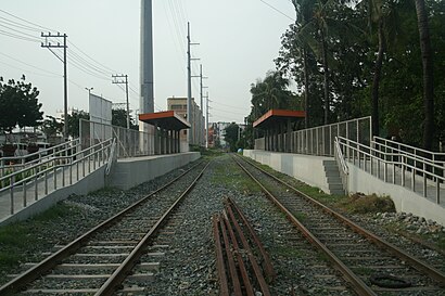
San Andres station is a railway station located on the South Main Line in the city of Manila, Philippines. San Andres station is the seventh station southbound from Tutuban.Wiki
Attractions near San Andres St
Rosario Reyes Health Center,San Andres Sports Complex,San Andres Gym,MDC 178 San Andres - Malate,San Andres Sports Complex, Malate, Manila,Barangay 702 Zone 77 Barangay Hall,Manila Korea Town,Pure Gold Malate,Clinica Malate Medical and Lying-in Clinic,D.R. Hortaleza Vaciador & Beauty Needs,Asiana,Brgy. 702 Zone 77 District V Manila,Villa Ibarra,Dr. Edchelle Montillano Clinic (TMJ Specialist),Brgy 702 Barangay Hall,Maria Y. Orosa St,Dental Clinic Dr. Ariel A. Ilagan,1929 J. Bocobo St,Home 168 Manila Dormitory,MalateHow to get to popular attractions in Manila with public transit
Cartimar Pet Center,C5 Waterfun, Taguig,SM Supercenter Muntinlupa, Muntinlupa,Remington Hotel Manila,The SM Store,Starbucks Coffee, Las Piñas,Newport City,Avida Towers, Parañaque,Tondo, Manila,Army Navy Burger + Burrito, Muntinlupa,Pearl Drive Commercial Center, Quezon City,SPi Global, Parañaque,The Coffee Bean & Tea Leaf, Manila,Ninoy Aquino International Airport (MNL) Terminal 4,Parañaque City, Parañaque,DLTB Co.,SM City Sta. Rosa, Santa Rosa City,World Trade Center,Balibago Complex, Sta. Rosa, Laguna, Santa Rosa City,SM Mall of Asia Passenger TerminalGet around Manila by public transit!
Traveling around Manila has never been so easy. See step by step directions as you travel to any attraction, street or major public transit station. View bus and train schedules, arrival times, service alerts and detailed routes on a map, so you know exactly how to get to anywhere in Manila.
When traveling to any destination around Manila use Moovit's Live Directions with Get Off Notifications to know exactly where and how far to walk, how long to wait for your line, and how many stops are left. Moovit will alert you when it's time to get off — no need to constantly re-check whether yours is the next stop.
Wondering how to use public transit in Manila or how to pay for public transit in Manila? Moovit public transit app can help you navigate your way with public transit easily, and at minimum cost. It includes public transit fees, ticket prices, and costs. Looking for a map of Manila public transit lines? Moovit public transit app shows all public transit maps in Manila with all bus or train routes and stops on an interactive map.
Manila has 2 transit type(s), including: bus or train, operated by several transit agencies, including MRTC, LRTA, PNR, LTFRB, BGC Bus, P2P and UV Express