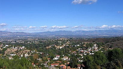
See San Fernando Valley, Los Angeles, on the map
Directions to San Fernando Valley (Los Angeles) with public transportation
The following transit lines have routes that pass near San Fernando Valley
 Bus:
Bus:
How to get to San Fernando Valley by bus?
Click on the bus route to see step by step directions with maps, line arrival times and updated time schedules.
Bus stations near San Fernando Valley in Los Angeles
- Van Nuys / Tupper,4 min walk,
- Nordhoff / Cedros,5 min walk,
Bus lines to San Fernando Valley in Los Angeles
- 233,Expo / Sepulveda Station,
- 166,Sun Valley,
What are the closest stations to San Fernando Valley?
The closest stations to San Fernando Valley are:
- Van Nuys / Tupper is 317 yards away, 4 min walk.
- Nordhoff / Cedros is 383 yards away, 5 min walk.
Which bus line stops near San Fernando Valley?
166/364
What’s the nearest bus stop to San Fernando Valley in Los Angeles?
The nearest bus stop to San Fernando Valley in Los Angeles is Van Nuys / Tupper. It’s a 4 min walk away.
See San Fernando Valley, Los Angeles, on the map
Public Transit to San Fernando Valley in Los Angeles
Wondering how to get to San Fernando Valley in Los Angeles, United States? Moovit helps you find the best way to get to San Fernando Valley with step-by-step directions from the nearest public transit station.
Moovit provides free maps and live directions to help you navigate through your city. View schedules, routes, timetables, and find out how long does it take to get to San Fernando Valley in real time.
Looking for the nearest stop or station to San Fernando Valley? Check out this list of stops closest to your destination: Van Nuys / Tupper; Nordhoff / Cedros.
Bus:
Want to see if there’s another route that gets you there at an earlier time? Moovit helps you find alternative routes or times. Get directions from and directions to San Fernando Valley easily from the Moovit App or Website.
We make riding to San Fernando Valley easy, which is why over 1.5 million users, including users in Los Angeles, trust Moovit as the best app for public transit. You don’t need to download an individual bus app or train app, Moovit is your all-in-one transit app that helps you find the best bus time or train time available.
For information on prices of bus, costs and ride fares to San Fernando Valley, please check the Moovit app.
Use the app to navigate to popular places including to the airport, hospital, stadium, grocery store, mall, coffee shop, school, college, and university.
Location: Los Angeles
Attractions near San Fernando Valley
Randy J's Crib Yo,Tanpebulvong,Riley Cakes Place,Black Mantis West: Command,Sunset Terrace Apartments,My Bed Z__z,Los Compadres,Tommie's burger,Import Fashion,Under The Stars,Primary Academy for Success School,Veronica Abusleme MD,Mi Casa,El Establo,Best West Car Wash,McDonald's,Shoe Palace,Panorama Realty,Richmond American Homes,Metro 233 / 761 bus stop south boundHow to get to popular attractions in Los Angeles with public transit
Hollywood, Hollywood, La,Fry's Electronics, Anaheim,The Water Garden, Santa Monica,The Hollywood Bowl, Hollywood Hills, La,Radiator Springs Racers, Anaheim,Target, Huntington Beach,IKEA, Costa Mesa,Los Olivos Apartment Village, Irvine,Star Tours - The Adventures Continue, Anaheim,The Little Mermaid ~ Ariel's Undersea Adventure, Anaheim,Diamond Jamboree Shopping Center, Irvine,85°C Bakery Cafe, Irvine,East Shuttle Area, Anaheim,World of Disney, Anaheim,Indiana Jones Adventure, Anaheim,Honda Center, Anaheim,Costco Wholesale, Tustin,City of Rancho Cucamonga, Rancho Cucamonga,City of Anaheim, Anaheim,Marina del Rey, Del Rey, LaGet around Los Angeles by public transit!
Traveling around Los Angeles has never been so easy. See step by step directions as you travel to any attraction, street or major public transit station. View bus and train schedules, arrival times, service alerts and detailed routes on a map, so you know exactly how to get to anywhere in Los Angeles.
When traveling to any destination around Los Angeles use Moovit's Live Directions with Get Off Notifications to know exactly where and how far to walk, how long to wait for your line, and how many stops are left. Moovit will alert you when it's time to get off — no need to constantly re-check whether yours is the next stop.
Wondering how to use public transit in Los Angeles or how to pay for public transit in Los Angeles? Moovit public transit app can help you navigate your way with public transit easily, and at minimum cost. It includes public transit fees, ticket prices, and costs. Looking for a map of Los Angeles public transit lines? Moovit public transit app shows all public transit maps in Los Angeles with all bus routes and stops on an interactive map.
Los Angeles has 1 transit type(s), including: bus, operated by several transit agencies, including Metro - Los Angeles, Metro - Los Angeles, Metrolink Trains, METRO, Long Beach Transit, LADOT, OCTA, Foothill Transit, Big Blue Bus, Riverside Transit Agency, LAX FlyAway, Airporter Shuttle, Playa Vista Shuttle, Amtrak and OMNITRANS