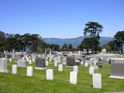
See San Francisco National Cemetery, Presidio, Sf, on the map
Directions to San Francisco National Cemetery (Presidio, Sf) with public transportation
The following transit lines have routes that pass near San Francisco National Cemetery
 Bus:
Bus:
How to get to San Francisco National Cemetery by bus?
Click on the bus route to see step by step directions with maps, line arrival times and updated time schedules.
Bus stations near San Francisco National Cemetery in Presidio, Sf
- Halleck St/Army Headquarters,18 min walk,
- Richardson Av & Francisco St,29 min walk,
- Park Presidio Blvd & Geary Blvd,33 min walk,
- Divisadero St & Bay St,34 min walk,
- 6th Ave & Clement St,39 min walk,
Bus lines to San Francisco National Cemetery in Presidio, Sf
- 43,Munich + Geneva,
- 101,San Rafael,
- 114,Mill Valley,
- 130,Canal via Sausalito,
- 132,San Anselmo,
- 150,San Rafael,
- 154,Novato,
- 164,Petaluma,
- 172,Santa Rosa via Petaluma,
- 172X,Santa Rosa,
- 28,Daly City BART,
- 91,S.F. State University,
- 30,Caltrain Depot,
- 28R,Daly City BART,
- 44,California + 6th Ave,
What are the closest stations to San Francisco National Cemetery?
The closest stations to San Francisco National Cemetery are:
- Halleck St/Army Headquarters is 1459 yards away, 18 min walk.
- Richardson Av & Francisco St is 2299 yards away, 29 min walk.
- Divisadero St & Bay St is 2756 yards away, 34 min walk.
- Park Presidio Blvd & Geary Blvd is 2783 yards away, 33 min walk.
- 6th Ave & Clement St is 3251 yards away, 39 min walk.
Which bus lines stop near San Francisco National Cemetery?
These bus lines stop near San Francisco National Cemetery: 101, 27, 28, 43.
See San Francisco National Cemetery, Presidio, Sf, on the map
Public Transit to San Francisco National Cemetery in Presidio, Sf
Wondering how to get to San Francisco National Cemetery in Presidio, Sf, United States? Moovit helps you find the best way to get to San Francisco National Cemetery with step-by-step directions from the nearest public transit station.
Moovit provides free maps and live directions to help you navigate through your city. View schedules, routes, timetables, and find out how long does it take to get to San Francisco National Cemetery in real time.
Looking for the nearest stop or station to San Francisco National Cemetery? Check out this list of stops closest to your destination: Halleck St/Army Headquarters; Richardson Av & Francisco St; Divisadero St & Bay St; Park Presidio Blvd & Geary Blvd; 6th Ave & Clement St.
Bus:
Want to see if there’s another route that gets you there at an earlier time? Moovit helps you find alternative routes or times. Get directions from and directions to San Francisco National Cemetery easily from the Moovit App or Website.
We make riding to San Francisco National Cemetery easy, which is why over 1.5 million users, including users in Presidio, Sf, trust Moovit as the best app for public transit. You don’t need to download an individual bus app or train app, Moovit is your all-in-one transit app that helps you find the best bus time or train time available.
For information on prices of bus and BART, costs and ride fares to San Francisco National Cemetery, please check the Moovit app.
Use the app to navigate to popular places including to the airport, hospital, stadium, grocery store, mall, coffee shop, school, college, and university.
Location: Presidio, Sf, San Francisco - San Jose, CA
Attractions near San Francisco National Cemetery
US Post Office - Presidio Station,World War Two Memorial,Marina Jogging Loop,McDowell Ave,Juliet Mae Spices and Fine Herbs,JustAnswer,Schofield Rd,Presidio Calvary Stables,West,Dede Braun-Moriarty - Golf Instructor,Blue Ocean Muay Thai SF,Rival10,Rich Talent Group,Golden Gate Nra Park Archives & Records Center,Presidio Park Archives & Records Center,Park Trail,Presidio of San Francisco,Lab Svc LLC,Park Presidio,PresidioHow to get to popular attractions in Presidio, Sf with public transit
City of Fremont, Fremont,Costco Wholesale, Santa Clara,I-80, Emeryville,City of Antioch, Antioch,City of Cupertino, Cupertino,City of Menlo Park, Menlo Park,Golden Gate Park, Golden Gate Park, Sf,Apple Valley Fair, San Jose,LinkedIn,Costco Wholesale, Sunnyvale,Buena Vista Cafe, Russian Hill, Sf,Googleplex,City of Pinole, Pinole,AMC Saratoga 14, San Jose,eBay Headquarters, San Jose,BJ's Restaurant and Brewhouse, Cupertino,Whole Foods Market, Walnut Creek,Googleplex - B40 Gym,Town & Country Village, Palo Alto,Alcatraz Cruises, North Beach, SfGet around Presidio, Sf by public transit!
Traveling around Presidio, Sf has never been so easy. See step by step directions as you travel to any attraction, street or major public transit station. View bus and train schedules, arrival times, service alerts and detailed routes on a map, so you know exactly how to get to anywhere in Presidio, Sf.
When traveling to any destination around Presidio, Sf use Moovit's Live Directions with Get Off Notifications to know exactly where and how far to walk, how long to wait for your line, and how many stops are left. Moovit will alert you when it's time to get off — no need to constantly re-check whether yours is the next stop.
Wondering how to use public transit in Presidio, Sf or how to pay for public transit in Presidio, Sf? Moovit public transit app can help you navigate your way with public transit easily, and at minimum cost. It includes public transit fees, ticket prices, and costs. Looking for a map of Presidio, Sf public transit lines? Moovit public transit app shows all public transit maps in Presidio, Sf with all bus or BART routes and stops on an interactive map.
Presidio, Sf has 2 transit type(s), including: bus or BART, operated by several transit agencies, including BART, Bay Area Rapid Transit, Muni Metro, Caltrain, VTA, Capitol Corridor, Sonoma Marin Area Rail Transit, MUNI, VTA, SF Cable Car, AC Transit, Dumbarton Express, Golden Gate Transit, County Connection and SamTrans