Directions to San Lazaro Tourism and Business Park (Manila) with public transportation
The following transit lines have routes that pass near San Lazaro Tourism and Business Park
How to get to San Lazaro Tourism and Business Park by bus?
Click on the bus route to see step by step directions with maps, line arrival times and updated time schedules.
How to get to San Lazaro Tourism and Business Park by train?
Click on the train route to see step by step directions with maps, line arrival times and updated time schedules.
Bus stops near San Lazaro Tourism and Business Park in Manila
- San Lazaro / Oroquieta Intersection, Manila, 2 min walk,
- Jose R. Reyes Memorial Medical Center, Rizal Avenue, Manila, 2 min walk,
- Quiricada / Felix Huertas Intersection, Manila, 3 min walk,
- San Lazaro / Alfonso Mendoza Intersection, Manila, 4 min walk,
- Quiricada / Ipil Intersection, Manila, 7 min walk,
- Alfonso Mendoza, Manila, 7 min walk,
- Tayuman Road / Serverino Reyes, Manila, 8 min walk,
Train stations near San Lazaro Tourism and Business Park in Manila
- Bambang Lrt, 17 min walk,
- Blumentritt Pnr, 34 min walk,
Bus lines to San Lazaro Tourism and Business Park in Manila
- BUS, Bagong Silang - Sta. Cruz via Malinta Exit,
- BUS, Sapang Palay - Sta Cruz (DJose) Sta Maria NE,
- BUS, Sapang Palay - Sta. Cruz via Marilao Exit,
- JEEP, NAVOTAS - RECTO via DAGAT_DAGATAN C3_C4,
- JEEP, Baclaran - Blumentritt via Mabini, Sta. Cruz,
- JEEP, Blumentritt Recto via F Huertas Oroquit,
- JEEP, Blumentritt - Pasay RTDA via Sta. Cruz, L. Guinto,
- JEEP, RECTO - GASAK,
- JEEP, Pier South - Retiro via Sta. Cruz,
- JEEP, Divisoria - Retiro via J. A. Santos,
- JEEP, MCU - Recto via F. Huertas, Oroquieta,
- JEEP, Baclaran - Blumentritt via L. Guinto, Sta. Cruz,
- JEEP, Blumentritt - Libertad via Sta. Cruz, Mabini,
- JEEP, Navotas Recto,
- JEEP, Gasak-Sta Cruz via,
- JEEP, Blumentritt - Pasay RTDA. via Sta. Cruz, Mabini,
- JEEP, Malinta Recto via F Huertas,
- JEEP, Malanday - Recto via F. Huertas, Oroquieta,
- JEEP, Navotas - Recto via Heroes del 96,
- JEEP, BBB Tullahan Recto via F Huertas Oroqueta,
What are the closest stations to San Lazaro Tourism and Business Park?
The closest stations to San Lazaro Tourism and Business Park are:
- San Lazaro / Oroquieta Intersection, Manila is 67 meters away, 2 min walk.
- Jose R. Reyes Memorial Medical Center, Rizal Avenue, Manila is 107 meters away, 2 min walk.
- Quiricada / Felix Huertas Intersection, Manila is 169 meters away, 3 min walk.
- San Lazaro / Alfonso Mendoza Intersection, Manila is 283 meters away, 4 min walk.
- Quiricada / Ipil Intersection, Manila is 473 meters away, 7 min walk.
- Alfonso Mendoza, Manila is 509 meters away, 7 min walk.
- Tayuman Road / Serverino Reyes, Manila is 530 meters away, 8 min walk.
- Bambang Lrt is 1244 meters away, 17 min walk.
- Blumentritt Pnr is 2631 meters away, 34 min walk.
Which bus line stops near San Lazaro Tourism and Business Park?
JEEP
Which train line stops near San Lazaro Tourism and Business Park?
LRT 1
What’s the nearest train station to San Lazaro Tourism and Business Park in Manila?
The nearest train station to San Lazaro Tourism and Business Park in Manila is Bambang Lrt. It’s a 17 min walk away.
What’s the nearest bus stop to San Lazaro Tourism and Business Park in Manila?
The nearest bus stops to San Lazaro Tourism and Business Park in Manila are San Lazaro / Oroquieta Intersection, Manila and Jose R. Reyes Memorial Medical Center, Rizal Avenue, Manila. The closest one is a 2 min walk away.
What time is the first train to San Lazaro Tourism and Business Park in Manila?
The LRT 1 is the first train that goes to San Lazaro Tourism and Business Park in Manila. It stops nearby at 5:21 AM.
What time is the last train to San Lazaro Tourism and Business Park in Manila?
The PNR MC is the last train that goes to San Lazaro Tourism and Business Park in Manila. It stops nearby at 1:36 AM.
What time is the first bus to San Lazaro Tourism and Business Park in Manila?
The BUS is the first bus that goes to San Lazaro Tourism and Business Park in Manila. It stops nearby at 3:03 AM.
What time is the last bus to San Lazaro Tourism and Business Park in Manila?
The BUS is the last bus that goes to San Lazaro Tourism and Business Park in Manila. It stops nearby at 3:45 AM.
See San Lazaro Tourism and Business Park, Manila, on the map
Public Transit to San Lazaro Tourism and Business Park in Manila
Wondering how to get to San Lazaro Tourism and Business Park in Manila, Philippines? Moovit helps you find the best way to get to San Lazaro Tourism and Business Park with step-by-step directions from the nearest public transit station.
Moovit provides free maps and live directions to help you navigate through your city. View schedules, routes, timetables, and find out how long does it take to get to San Lazaro Tourism and Business Park in real time.
Looking for the nearest stop or station to San Lazaro Tourism and Business Park? Check out this list of stops closest to your destination: San Lazaro / Oroquieta Intersection; Jose R. Reyes Memorial Medical Center; Quiricada / Felix Huertas Intersection; San Lazaro / Alfonso Mendoza Intersection; Quiricada / Ipil Intersection; Alfonso Mendoza; Tayuman Road / Serverino Reyes; Bambang Lrt; Blumentritt Pnr.
Bus: JEEP, BUS, BUS, BUS, BUS.Train: LRT 1, PNR MC.
Want to see if there’s another route that gets you there at an earlier time? Moovit helps you find alternative routes or times. Get directions from and directions to San Lazaro Tourism and Business Park easily from the Moovit App or Website.
We make riding to San Lazaro Tourism and Business Park easy, which is why over 1.5 million users, including users in Manila, trust Moovit as the best app for public transit. You don’t need to download an individual bus app or train app, Moovit is your all-in-one transit app that helps you find the best bus time or train time available.
For information on prices of bus and train, costs and ride fares to San Lazaro Tourism and Business Park, please check the Moovit app.
Use the app to navigate to popular places including to the airport, hospital, stadium, grocery store, mall, coffee shop, school, college, and university.
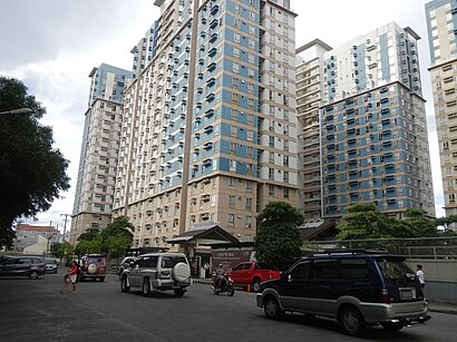
San Lazaro Tourism and Business Park Address: Yuseco St. street in Manila
Attractions near San Lazaro Tourism and Business Park
How to get to popular places in Manila with public transit
Get around Manila by public transit!
Traveling around Manila has never been so easy. See step by step directions as you travel to any attraction, street or major public transit station. View bus and train schedules, arrival times, service alerts and detailed routes on a map, so you know exactly how to get to anywhere in Manila.
When traveling to any destination around Manila use Moovit's Live Directions with Get Off Notifications to know exactly where and how far to walk, how long to wait for your line, and how many stops are left. Moovit will alert you when it's time to get off — no need to constantly re-check whether yours is the next stop.
Wondering how to use public transit in Manila or how to pay for public transit in Manila? Moovit public transit app can help you navigate your way with public transit easily, and at minimum cost. It includes public transit fees, ticket prices, and costs. Looking for a map of Manila public transit lines? Moovit public transit app shows all public transit maps in Manila with all bus or train routes and stops on an interactive map.
Manila has 2 transit type(s), including: bus or train, operated by several transit agencies, including MRTC, LRTA, PNR, LTFRB, BGC Bus, P2P and UV Express