How to get to Sandra Costello Photography by bus?
Click on the bus route to see step by step directions with maps, line arrival times and updated time schedules.
Bus stops near Sandra Costello Photography in Boston
Bus lines to Sandra Costello Photography in Boston
What are the closest stations to Sandra Costello Photography?
The closest stations to Sandra Costello Photography are:
- Four Points, Eastham is 280 yards away, 4 min walk.
- Seaman's Bank @ Route 6, Eastham is 955 yards away, 12 min walk.
- Village Green North Eastham is 1193 yards away, 15 min walk.
Which bus line stops near Sandra Costello Photography?
PETER PAN (Hyannis)
What’s the nearest bus station to Sandra Costello Photography in Boston?
The nearest bus station to Sandra Costello Photography in Boston is Four Points, Eastham. It’s a 4 min walk away.
What time is the first bus to Sandra Costello Photography in Boston?
The FLEX is the first bus that goes to Sandra Costello Photography in Boston. It stops nearby at 4:36 AM.
What time is the last bus to Sandra Costello Photography in Boston?
The FLEX is the last bus that goes to Sandra Costello Photography in Boston. It stops nearby at 9:43 PM.
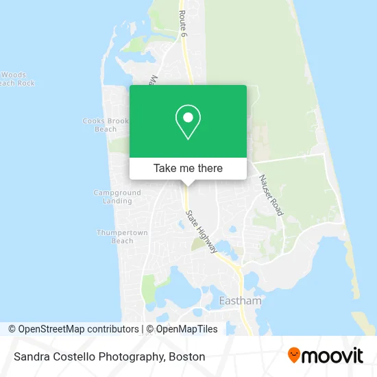
See Sandra Costello Photography, Boston, on the map
Public Transit to Sandra Costello Photography in Boston
Wondering how to get to Sandra Costello Photography in Boston? Moovit helps you find the best way to get to Sandra Costello Photography with step-by-step directions from the nearest public transit station.
Moovit provides free maps and live directions to help you navigate through your city. View schedules, routes, timetables, and find out how long does it take to get to Sandra Costello Photography in real time.
Looking for the nearest stop or station to Sandra Costello Photography? Check out this list of stops closest to your destination: Four Points; Seaman's Bank @ Route 6; Village Green North Eastham.
Bus: PETER PAN, FLEX.
Want to see if there’s another route that gets you there at an earlier time? Moovit helps you find alternative routes or times. Get directions from and directions to Sandra Costello Photography easily from the Moovit App or Website.
We make riding to Sandra Costello Photography easy, which is why over 1.7 million users, including users in Boston, trust Moovit as the best app for public transit. You don’t need to download an individual bus app or train app, Moovit is your all-in-one transit app that helps you find the best bus time or train time available.
For information on prices of bus, costs and ride fares to Sandra Costello Photography, please check the Moovit app.
Use the app to navigate to popular places including to the airport, hospital, stadium, grocery store, mall, coffee shop, school, college, and university.
Sandra Costello Photography Address: 3 Main St street in Boston
- Massachusetts Democratic Partyeastham DTC,
- House of Coco Interiors,
- Nauset Rental,
- Basco Grill,
- Interstate Batteries,
- Lindera Construction,
- Interstate Batteries,
- Master Piano Mover Steven Magliano,
- Holbrook Oyster,
- ChargePoint,
- Bistro 41,
- DUNKIN',
- Sugar Shack Cape Cod,
- Eastham Cafe,
- Cape Cod Vacation Oak Grove Cottages,
- Nei General Contracting,
- Blue Wing Custom Building,
- Capeabilities,
- Cape Cod Five Eastham,
- Envirotech Laboratories Inc
Places Near Sandra Costello Photography (Boston)
- Boston Medical Center, Boston,
- Boston Children's Hospital, Boston,
- Isabella Stewart Gardner Museum, Boston,
- Cheers, Boston,
- Prudential Center, Boston,
- Mgm Music Hall, Boston,
- Castle Island, Boston,
- North End, Boston,
- House Of Blues, Boston,
- Wang Theater, Boston,
- Quincy Market, Boston,
- Faneuil Hall, Boston,
- Leader Bank Pavilion (Leader Bank Pavillion), Boston,
- Boston Common, Boston,
- Td Garden, Boston,
- Seaport District, Boston,
- Massachusetts General Hospital, Boston,
- Boston Convention & Exhibition Center, Boston,
- Museum Of Science, Boston,
- Wilbur Theatre, Boston
How to get to popular places in Boston with public transit
Get around Boston by public transit!
Traveling around Boston has never been so easy. See step by step directions as you travel to any attraction, street or major public transit station. View bus and train schedules, arrival times, service alerts and detailed routes on a map, so you know exactly how to get to anywhere in Boston.
When traveling to any destination around Boston use Moovit's Live Directions with Get Off Notifications to know exactly where and how far to walk, how long to wait for your line, and how many stops are left. Moovit will alert you when it's time to get off — no need to constantly re-check whether yours is the next stop.
Wondering how to use public transit in Boston or how to pay for public transit in Boston? Moovit public transit app can help you navigate your way with public transit easily, and at minimum cost. It includes public transit fees, ticket prices, and costs. Looking for a map of Boston public transit lines? Moovit public transit app shows all public transit maps in Boston with all Bus, Train, Subway and Ferry routes and stops on an interactive map.
Boston has 4 transit type(s), including: Bus, Train, Subway and Ferry, operated by several transit agencies, including MBTA, Southeastern Regional Transit Authority, MetroWest Regional Transit Authority, Rhode Island Public Transit Authority, WRTA, Lowell Regional Transit Authority, Merrimack Valley Transit, Montachusett Regional Transit Authority, Cape Cod Regional Transit Authority, Brockton Area Transit Authority, Martha's Vineyard Transit Authority, the WAVE - Nantucket Regional Transit Authority, GATRA, Cape Ann Transportation Authority and Massport