Directions to Sandra Enterpriseinc (Everett) with public transportation
The following transit lines have routes that pass near Sandra Enterpriseinc
 Bus: 104, 109, 110, 97.
- Train: NEWBURYPORT/ROCKPORT, HAVERHILL.
- Subway: ORANGE LINE.
How to get to Sandra Enterpriseinc by bus?
Click on the bus route to see step by step directions with maps, line arrival times and updated time schedules.
From The Middle East Downstairs, Cambridge
46 minFrom Haymarket Square, Boston
36 minFrom Brigham & Women's Hospital, Boston
69 minFrom Boston Municipal Court (Roxbury District Court), Boston
76 minFrom North Shore Community College Lynn, Lynn
55 minFrom Warrior Ice Arena, Boston
68 minFrom Lynn, MA, Lynn
54 minFrom Residence Inn by Marriott Boston Back Bay/Fenway, Boston
57 minFrom Boston Harborwalk, Boston
42 minFrom Pizzeria Regina, Boston
34 min
How to get to Sandra Enterpriseinc by train?
Click on the train route to see step by step directions with maps, line arrival times and updated time schedules.
How to get to Sandra Enterpriseinc by subway?
Click on the subway route to see step by step directions with maps, line arrival times and updated time schedules.
From The Middle East Downstairs, Cambridge
68 minFrom Haymarket Square, Boston
52 minFrom Brigham & Women's Hospital, Boston
82 minFrom Boston Municipal Court (Roxbury District Court), Boston
80 minFrom Warrior Ice Arena, Boston
109 minFrom Residence Inn by Marriott Boston Back Bay/Fenway, Boston
86 minFrom Boston Harborwalk, Boston
62 minFrom Pizzeria Regina, Boston
57 min
Bus stops near Sandra Enterpriseinc in Everett
Subway station near Sandra Enterpriseinc in Everett
- Wellington, 21 min walk,VIEW
Train stations near Sandra Enterpriseinc in Everett
Bus lines to Sandra Enterpriseinc in Everett
What are the closest stations to Sandra Enterpriseinc?
The closest stations to Sandra Enterpriseinc are:
- Broadway @ Raymond St is 207 yards away, 3 min walk.
- Ferry St @ Elm St is 436 yards away, 6 min walk.
- Broadway @ High St is 458 yards away, 6 min walk.
- Wellington is 1767 yards away, 21 min walk.
- Chelsea is 2371 yards away, 31 min walk.
- Oak Grove is 3118 yards away, 37 min walk.
Which bus lines stop near Sandra Enterpriseinc?
These bus lines stop near Sandra Enterpriseinc: 104, 109.
Which train line stops near Sandra Enterpriseinc?
NEWBURYPORT/ROCKPORT (#125 | Newburyport)
Which subway line stops near Sandra Enterpriseinc?
ORANGE LINE (Oak Grove)
What’s the nearest subway station to Sandra Enterpriseinc in Everett?
The nearest subway station to Sandra Enterpriseinc in Everett is Wellington. It’s a 21 min walk away.
What’s the nearest bus station to Sandra Enterpriseinc in Everett?
The nearest bus station to Sandra Enterpriseinc in Everett is Broadway @ Raymond St. It’s a 3 min walk away.
What time is the first subway to Sandra Enterpriseinc in Everett?
The ORANGE LINE is the first subway that goes to Sandra Enterpriseinc in Everett. It stops nearby at 5:15 AM.
What time is the last subway to Sandra Enterpriseinc in Everett?
The ORANGE LINE is the last subway that goes to Sandra Enterpriseinc in Everett. It stops nearby at 1:59 AM.
What time is the first train to Sandra Enterpriseinc in Everett?
The HAVERHILL is the first train that goes to Sandra Enterpriseinc in Everett. It stops nearby at 5:35 AM.
What time is the last train to Sandra Enterpriseinc in Everett?
The NEWBURYPORT/ROCKPORT is the last train that goes to Sandra Enterpriseinc in Everett. It stops nearby at 12:06 AM.
What time is the first bus to Sandra Enterpriseinc in Everett?
The 104 is the first bus that goes to Sandra Enterpriseinc in Everett. It stops nearby at 4:32 AM.
What time is the last bus to Sandra Enterpriseinc in Everett?
The 110 is the last bus that goes to Sandra Enterpriseinc in Everett. It stops nearby at 2:11 AM.
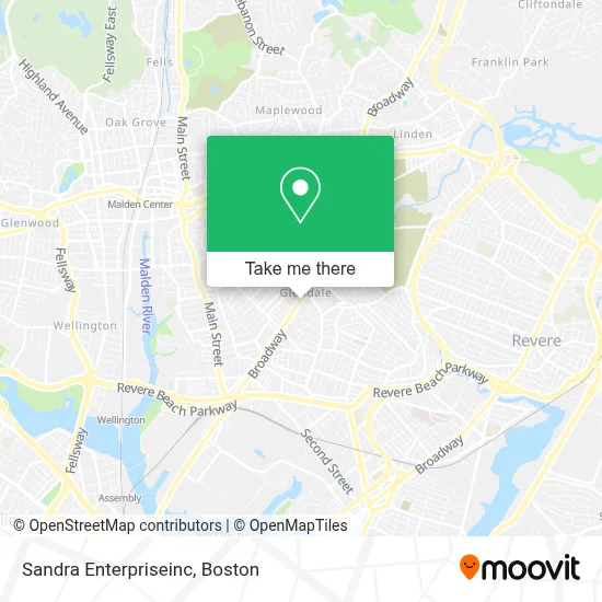
See Sandra Enterpriseinc, Everett, on the map
Public Transit to Sandra Enterpriseinc in Everett
Wondering how to get to Sandra Enterpriseinc in Everett? Moovit helps you find the best way to get to Sandra Enterpriseinc with step-by-step directions from the nearest public transit station.
Moovit provides free maps and live directions to help you navigate through your city. View schedules, routes, timetables, and find out how long does it take to get to Sandra Enterpriseinc in real time.
Looking for the nearest stop or station to Sandra Enterpriseinc? Check out this list of stops closest to your destination: Broadway @ Raymond St; Ferry St @ Elm St; Broadway @ High St; Wellington; Chelsea; Oak Grove.
Bus: 104, 109, 110, 97.Train: NEWBURYPORT/ROCKPORT, HAVERHILL.Subway: ORANGE LINE.
Want to see if there’s another route that gets you there at an earlier time? Moovit helps you find alternative routes or times. Get directions from and directions to Sandra Enterpriseinc easily from the Moovit App or Website.
We make riding to Sandra Enterpriseinc easy, which is why over 1.7 million users, including users in Everett, trust Moovit as the best app for public transit. You don’t need to download an individual bus app or train app, Moovit is your all-in-one transit app that helps you find the best bus time or train time available.
For information on prices of bus, subway and train, costs and ride fares to Sandra Enterpriseinc, please check the Moovit app.
Use the app to navigate to popular places including to the airport, hospital, stadium, grocery store, mall, coffee shop, school, college, and university.
Sandra Enterpriseinc Address: 691 Broadway street in Everett
- Sandra Enterprise Serv,
- Progressive Insurance,
- Mauro Silva of MG Group Everett Ma Real Estate Agent,
- Century 21,
- Bloom Cleaners,
- K-Chivo Market,
- Sky Hookah Lounge,
- Glendale Park (Glendale Laundromat),
- Phoenix Barbershop,
- El Valle De La Sultana Market,
- PSPS Legal Support Services,
- Executive Protection Training Institute,
- Ferry St (broadway ferry),
- Credit Union 1,
- Alex Krisak,
- Brazilian House Cleaning,
- 738 Broadway Parking,
- Foxwoods Drop Off,
- Glendale Convenience Store,
- M & M Retail
Places Near Sandra Enterpriseinc (Everett)
- Faneuil Hall, Boston,
- Quincy Market, Boston,
- Massachusetts General Hospital, Boston,
- Cheers, Boston,
- House Of Blues, Boston,
- Castle Island, Boston,
- Wilbur Theatre, Boston,
- Museum Of Science, Boston,
- Seaport District, Boston,
- Boston Children's Hospital, Boston,
- Td Garden, Boston,
- Isabella Stewart Gardner Museum, Boston,
- North End, Boston,
- Boston Medical Center, Boston,
- Mgm Music Hall, Boston,
- Boston Common, Boston,
- Leader Bank Pavilion (Leader Bank Pavillion), Boston,
- Wang Theater, Boston,
- Prudential Center, Boston,
- Boston Convention & Exhibition Center, Boston
How to get to popular places in Boston with public transit
Get around Everett by public transit!
Traveling around Everett has never been so easy. See step by step directions as you travel to any attraction, street or major public transit station. View bus and train schedules, arrival times, service alerts and detailed routes on a map, so you know exactly how to get to anywhere in Everett.
When traveling to any destination around Everett use Moovit's Live Directions with Get Off Notifications to know exactly where and how far to walk, how long to wait for your line, and how many stops are left. Moovit will alert you when it's time to get off — no need to constantly re-check whether yours is the next stop.
Wondering how to use public transit in Everett or how to pay for public transit in Everett? Moovit public transit app can help you navigate your way with public transit easily, and at minimum cost. It includes public transit fees, ticket prices, and costs. Looking for a map of Everett public transit lines? Moovit public transit app shows all public transit maps in Everett with all Bus, Train, Subway and Ferry routes and stops on an interactive map.
Boston has 4 transit type(s), including: Bus, Train, Subway and Ferry, operated by several transit agencies, including MBTA, Southeastern Regional Transit Authority, MetroWest Regional Transit Authority, Rhode Island Public Transit Authority, WRTA, Lowell Regional Transit Authority, Merrimack Valley Transit, Montachusett Regional Transit Authority, Cape Cod Regional Transit Authority, Brockton Area Transit Authority, Martha's Vineyard Transit Authority, the WAVE - Nantucket Regional Transit Authority, GATRA, Cape Ann Transportation Authority and Massport