Directions to Sandy Bay Provisions (Boston) with public transportation
The following transit lines have routes that pass near Sandy Bay Provisions
How to get to Sandy Bay Provisions by bus?
Click on the bus route to see step by step directions with maps, line arrival times and updated time schedules.
How to get to Sandy Bay Provisions by train?
Click on the train route to see step by step directions with maps, line arrival times and updated time schedules.
Bus stops near Sandy Bay Provisions in Boston
Train station near Sandy Bay Provisions in Boston
- Rockport, 7 min walk,VIEW
Bus lines to Sandy Bay Provisions in Boston
- LANESVILLE, Washington St & Railroad Ave,VIEW
- BEVERLY COMMUTER, Beverly Commuter,VIEW
- CITY OF BEVERLY SHUTTLE, Gloucester-Magnolia,VIEW
- GLOUCESTER - ROCKPORT VIA EASTERN AVE, Rockport Market,VIEW
- GLOUCESTER - ROCKPORT VIA THATCHER ROAD, Rockport Market,VIEW
- NEWBURYPORT LINE SHUTTLE, Rockport - Oak Grove (Express),VIEW
- NEWBURYPORT LINE SHUTTLE, Rockport - Oak Grove (Limited),VIEW
- ROCKPORT LINE SHUTTLE, Rockport - West Gloucester,VIEW
- ROCKPORT LINE SHUTTLE, Beverly - Rockport (Local),VIEW
- ROCKPORT LINE SHUTTLE, Manchester - Rockport,VIEW
- ROCKPORT LINE SHUTTLE, Rockport - Salem (Express),VIEW
- ROCKPORT LINE SHUTTLE, Beverly - Rockport (Express),VIEW
- ROCKPORT LINE SHUTTLE, Rockport - Salem (Local),VIEW
What are the closest stations to Sandy Bay Provisions?
The closest stations to Sandy Bay Provisions are:
- 5 Corners is 106 yards away, 2 min walk.
- Train Station - Rockport is 442 yards away, 6 min walk.
- Toad Hall Bookstore is 487 yards away, 6 min walk.
- Rockport is 553 yards away, 7 min walk.
- Rockport Market is 564 yards away, 7 min walk.
Which bus lines stop near Sandy Bay Provisions?
These bus lines stop near Sandy Bay Provisions: CITY OF BEVERLY SHUTTLE, GLOUCESTER - ROCKPORT VIA EASTERN AVE.
Which train line stops near Sandy Bay Provisions?
NEWBURYPORT/ROCKPORT (#27 | Rockport)
What’s the nearest train station to Sandy Bay Provisions in Boston?
The nearest train station to Sandy Bay Provisions in Boston is Rockport. It’s a 7 min walk away.
What’s the nearest bus station to Sandy Bay Provisions in Boston?
The nearest bus station to Sandy Bay Provisions in Boston is 5 Corners. It’s a 2 min walk away.
What time is the first train to Sandy Bay Provisions in Boston?
The NEWBURYPORT/ROCKPORT is the first train that goes to Sandy Bay Provisions in Boston. It stops nearby at 5:06 AM.
What time is the last train to Sandy Bay Provisions in Boston?
The NEWBURYPORT/ROCKPORT is the last train that goes to Sandy Bay Provisions in Boston. It stops nearby at 1:01 AM.
What time is the first bus to Sandy Bay Provisions in Boston?
The BEVERLY COMMUTER is the first bus that goes to Sandy Bay Provisions in Boston. It stops nearby at 5:35 AM.
What time is the last bus to Sandy Bay Provisions in Boston?
The LANESVILLE is the last bus that goes to Sandy Bay Provisions in Boston. It stops nearby at 6:55 PM.
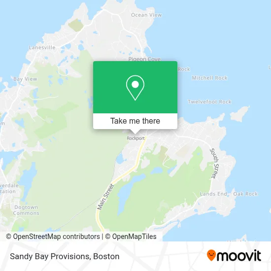
See Sandy Bay Provisions, Boston, on the map
Public Transit to Sandy Bay Provisions in Boston
Wondering how to get to Sandy Bay Provisions in Boston? Moovit helps you find the best way to get to Sandy Bay Provisions with step-by-step directions from the nearest public transit station.
Moovit provides free maps and live directions to help you navigate through your city. View schedules, routes, timetables, and find out how long does it take to get to Sandy Bay Provisions in real time.
Looking for the nearest stop or station to Sandy Bay Provisions? Check out this list of stops closest to your destination: 5 Corners; Train Station - Rockport; Toad Hall Bookstore; Rockport; Rockport Market.
Bus: CITY OF BEVERLY SHUTTLE, GLOUCESTER - ROCKPORT VIA EASTERN AVE, LANESVILLE, BEVERLY COMMUTER, GLOUCESTER - ROCKPORT VIA THATCHER ROAD, NEWBURYPORT LINE SHUTTLE, NEWBURYPORT LINE SHUTTLE, ROCKPORT LINE SHUTTLE, ROCKPORT LINE SHUTTLE, ROCKPORT LINE SHUTTLE.Train: NEWBURYPORT/ROCKPORT.
Want to see if there’s another route that gets you there at an earlier time? Moovit helps you find alternative routes or times. Get directions from and directions to Sandy Bay Provisions easily from the Moovit App or Website.
We make riding to Sandy Bay Provisions easy, which is why over 1.7 million users, including users in Boston, trust Moovit as the best app for public transit. You don’t need to download an individual bus app or train app, Moovit is your all-in-one transit app that helps you find the best bus time or train time available.
For information on prices of train and bus, costs and ride fares to Sandy Bay Provisions, please check the Moovit app.
Use the app to navigate to popular places including to the airport, hospital, stadium, grocery store, mall, coffee shop, school, college, and university.
Sandy Bay Provisions Address: 27 Whistlestop Mall street in Boston
- 26 Summit Ave,
- Green Top,
- Lobsterman's Landing,
- Rockport Ma Real Estate,
- Shalin Liu Performance Center,
- Mls Property Information Network, Inc.,
- Rockport Inn & Suites,
- Fresco's Seaside,
- Manning Park,
- Old Parish Cemetery,
- Back Beach Cottages,
- American Legion Post 98 Rockport Ma,
- Art Longwood Books,
- Morrell Wayne Home & Gallery,
- Town Hall Annex,
- Taking Shape Designs,
- Rockport, MA,
- Rockpile Recording,
- Shepherd's Pie,
- J.R. MacDowell Landscape
Places Near Sandy Bay Provisions (Boston)
- House Of Blues, Boston,
- Isabella Stewart Gardner Museum, Boston,
- Boston Common, Boston,
- Seaport District, Boston,
- Museum Of Science, Boston,
- Massachusetts General Hospital, Boston,
- Cheers, Boston,
- North End, Boston,
- Prudential Center, Boston,
- Quincy Market, Boston,
- Boston Convention & Exhibition Center, Boston,
- Boston Children's Hospital, Boston,
- Faneuil Hall, Boston,
- Mgm Music Hall, Boston,
- Td Garden, Boston,
- Leader Bank Pavilion (Leader Bank Pavillion), Boston,
- Wang Theater, Boston,
- Wilbur Theatre, Boston,
- Castle Island, Boston,
- Boston Medical Center, Boston
How to get to popular places in Boston with public transit
Get around Boston by public transit!
Traveling around Boston has never been so easy. See step by step directions as you travel to any attraction, street or major public transit station. View bus and train schedules, arrival times, service alerts and detailed routes on a map, so you know exactly how to get to anywhere in Boston.
When traveling to any destination around Boston use Moovit's Live Directions with Get Off Notifications to know exactly where and how far to walk, how long to wait for your line, and how many stops are left. Moovit will alert you when it's time to get off — no need to constantly re-check whether yours is the next stop.
Wondering how to use public transit in Boston or how to pay for public transit in Boston? Moovit public transit app can help you navigate your way with public transit easily, and at minimum cost. It includes public transit fees, ticket prices, and costs. Looking for a map of Boston public transit lines? Moovit public transit app shows all public transit maps in Boston with all Bus, Train, Subway and Ferry routes and stops on an interactive map.
Boston has 4 transit type(s), including: Bus, Train, Subway and Ferry, operated by several transit agencies, including MBTA, Southeastern Regional Transit Authority, MetroWest Regional Transit Authority, Rhode Island Public Transit Authority, WRTA, Lowell Regional Transit Authority, Merrimack Valley Transit, Montachusett Regional Transit Authority, Cape Cod Regional Transit Authority, Brockton Area Transit Authority, Martha's Vineyard Transit Authority, the WAVE - Nantucket Regional Transit Authority, GATRA, Cape Ann Transportation Authority and Massport