See Sandymount Avenue, Dublin, on the map
Directions to Sandymount Avenue (Dublin) with public transportation
The following transit lines have routes that pass near Sandymount Avenue
 Bus:
Bus: - Train:
How to get to Sandymount Avenue by bus?
Click on the bus route to see step by step directions with maps, line arrival times and updated time schedules.
How to get to Sandymount Avenue by train?
Click on the train route to see step by step directions with maps, line arrival times and updated time schedules.
Bus stations near Sandymount Avenue in Dublin
- Sandymount Avenue,1 min walk,
- Merrion Road,3 min walk,
- British Embassy,4 min walk,
Train stations near Sandymount Avenue in Dublin
- Grand Canal Dock,26 min walk,
Light Rail stations near Sandymount Avenue in Dublin
- Ranelagh,35 min walk,
Bus lines to Sandymount Avenue in Dublin
- S2,Heuston Station,
- 511,Orwell Park,
- 4,O'Connell St,
- 7,Mountjoy Square,
- 7A,Mountjoy Square,
- 27X,Ucd,
- DUBLIN AIRPORT - CHARLESLAND ROAD (SEABORNE VIEW APTS),Charlesland, Stop 7462,
- DUBLIN AIRPORT - KILLINEY (FITZPATRICK CASTLE HOTEL),Fitzpatrick Castle Hotel,
- DUBLIN CITY SOUTH, D'OLIER STREET - DÚN LAOGHAIRE-RATHDOWN, WOODBROOK GOLF CLUB,Woodbrook College,
What are the closest stations to Sandymount Avenue?
The closest stations to Sandymount Avenue are:
- Sandymount Avenue is 20 meters away, 1 min walk.
- Merrion Road is 169 meters away, 3 min walk.
- British Embassy is 218 meters away, 4 min walk.
- Grand Canal Dock is 1977 meters away, 26 min walk.
- Ranelagh is 2653 meters away, 35 min walk.
Which bus lines stop near Sandymount Avenue?
These bus lines stop near Sandymount Avenue: 4, 7, DUBLIN AIRPORT - CHARLESLAND ROAD (SEABORNE VIEW APTS), S2.
Which train line stops near Sandymount Avenue?
DART
What’s the nearest train station to Sandymount Avenue in Dublin?
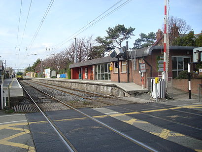
The nearest train station to Sandymount Avenue in Dublin is Grand Canal Dock. It’s a 26 min walk away.
What’s the nearest bus stop to Sandymount Avenue in Dublin?
The nearest bus stop to Sandymount Avenue in Dublin is Sandymount Avenue. It’s a 1 min walk away.
What time is the first light rail to Sandymount Avenue in Dublin?
The GREEN is the first light rail that goes to Sandymount Avenue in Dublin. It stops nearby at 7:29 AM.
What time is the last light rail to Sandymount Avenue in Dublin?
The GREEN is the last light rail that goes to Sandymount Avenue in Dublin. It stops nearby at 11:46 PM.
What time is the first train to Sandymount Avenue in Dublin?
The DART is the first train that goes to Sandymount Avenue in Dublin. It stops nearby at 6:41 AM.
What time is the last train to Sandymount Avenue in Dublin?
The DART is the last train that goes to Sandymount Avenue in Dublin. It stops nearby at 12:01 AM.
What time is the first bus to Sandymount Avenue in Dublin?
The DUBLIN AIRPORT - KILLINEY (FITZPATRICK CASTLE HOTEL) is the first bus that goes to Sandymount Avenue in Dublin. It stops nearby at 4:05 AM.
What time is the last bus to Sandymount Avenue in Dublin?
The S2 is the last bus that goes to Sandymount Avenue in Dublin. It stops nearby at 12:11 AM.
How much is the bus fare to Sandymount Avenue?
The bus fare to Sandymount Avenue costs about €1.30 - €2.00.
See Sandymount Avenue, Dublin, on the map
Public Transit to Sandymount Avenue in Dublin
Wondering how to get to Sandymount Avenue in Dublin, Ireland? Moovit helps you find the best way to get to Sandymount Avenue with step-by-step directions from the nearest public transit station.
Moovit provides free maps and live directions to help you navigate through your city. View schedules, routes, timetables, and find out how long does it take to get to Sandymount Avenue in real time.
Looking for the nearest stop or station to Sandymount Avenue? Check out this list of stops closest to your destination: Sandymount Avenue; Merrion Road; British Embassy; Grand Canal Dock; Ranelagh.
Bus:Train:
Want to see if there’s another route that gets you there at an earlier time? Moovit helps you find alternative routes or times. Get directions from and directions to Sandymount Avenue easily from the Moovit App or Website.
We make riding to Sandymount Avenue easy, which is why over 1.5 million users, including users in Dublin, trust Moovit as the best app for public transit. You don’t need to download an individual bus app or train app, Moovit is your all-in-one transit app that helps you find the best bus time or train time available.
For information on prices of bus and train, costs and ride fares to Sandymount Avenue, please check the Moovit app.
Use the app to navigate to popular places including to the airport, hospital, stadium, grocery store, mall, coffee shop, school, college, and university.
Sandymount Avenue Address: Sandymount Avenue street in Dublin
Attractions near Sandymount Avenue
Dublin Bus Stop 2808,Makeup By Serena Cleary,Adair,Mount Granville LTD,Spafield Terrace,Sandymount Avenue,Wanderers F/Ball Clb,Dublin Bus Stop No. 483,Monica Loughman Elite Ballet,Ballsbridge, British Embassy,Aesthetic Surgery Ireland,Clayton Hotel Ballsbridge,Clayton Hotel Ballsbridge Dublin,InterContinental Dublin,Merrion Square,Prep Physio,Clayton Hotel,Dublin Horse Show,Sandymount DART Station,PREMIER SUITES PLUS Dublin BallsbridgeHow to get to popular attractions in Dublin with public transit
The George Hotel, Henry Street,Stillorgan Luas, Dundrum,Drumcondra, Dublin,Dcu, Dublin,Dingle / An Daingean, Dingle,Griffith College Dublin, Dublin,National Botanic Gardens, Dublin,Workday, Dublin,Shankill, Shankill,Blanchardstown Shopping Centre, Blanchardstown,Spire Of Dublin, Dublin,St. James's Hospital, Dublin,Strand Hotel, Mayorstone,Phibsborough / Baile Phib, Dublin,O'Connell Street, Henry Street,The Fumbally, Dublin,Sandymount DART Station, Dublin,The Brazen Head, Dublin,Ucd Michael Smurfit Graduate Business School,Avoca Handweavers, RathcooleGet around Dublin by public transit!
Traveling around Dublin has never been so easy. See step by step directions as you travel to any attraction, street or major public transit station. View bus and train schedules, arrival times, service alerts and detailed routes on a map, so you know exactly how to get to anywhere in Dublin.
When traveling to any destination around Dublin use Moovit's Live Directions with Get Off Notifications to know exactly where and how far to walk, how long to wait for your line, and how many stops are left. Moovit will alert you when it's time to get off — no need to constantly re-check whether yours is the next stop.
Wondering how to use public transit in Dublin or how to pay for public transit in Dublin? Moovit public transit app can help you navigate your way with public transit easily, and at minimum cost. It includes public transit fees, ticket prices, and costs. Looking for a map of Dublin public transit lines? Moovit public transit app shows all public transit maps in Dublin with all bus or train routes and stops on an interactive map.
Dublin has 2 transit type(s), including: bus or train, operated by several transit agencies, including Luas, Bus Átha Cliath – Dublin Bus, Bus Éireann, Go-Ahead Ireland, Nitelink, Dublin Bus, Citylink, Kenneally's Bus Service, Aircoach, TFI Local Link Mayo, Irish Rail, Express Bus, JJ/Bernard Kavanagh, Dublin Coach, Kearns Transport and Matthews Coach Hire