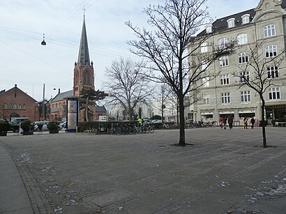
See Sankt Jakobs Plads, København, on the map
Directions to Sankt Jakobs Plads (København) with public transportation
The following transit lines have routes that pass near Sankt Jakobs Plads
 Bus:
Bus: - Train:
- Metro:
How to get to Sankt Jakobs Plads by bus?
Click on the bus route to see step by step directions with maps, line arrival times and updated time schedules.
How to get to Sankt Jakobs Plads by train?
Click on the train route to see step by step directions with maps, line arrival times and updated time schedules.
How to get to Sankt Jakobs Plads by metro?
Click on the metro route to see step by step directions with maps, line arrival times and updated time schedules.
Bus stations near Sankt Jakobs Plads in København
- Gustav Adolfs Gade (Østerbrogade),2 min walk,
- Poul Henningsens Plads St. (Strandboulevarden),2 min walk,
Train stations near Sankt Jakobs Plads in København
- Nordhavn St.,8 min walk,
Metro stations near Sankt Jakobs Plads in København
- Nordhavn St. (Metro),9 min walk,
- Vibenshus Runddel St. (Metro),14 min walk,
Bus lines to Sankt Jakobs Plads in København
- 1A,Hellerup St.,
- 14,Nørreport St.,
- 23,Valby St.,
What are the closest stations to Sankt Jakobs Plads?
The closest stations to Sankt Jakobs Plads are:
- Gustav Adolfs Gade (Østerbrogade) is 84 meters away, 2 min walk.
- Poul Henningsens Plads St. (Strandboulevarden) is 113 meters away, 2 min walk.
- Nordhavn St. is 554 meters away, 8 min walk.
- Nordhavn St. (Metro) is 685 meters away, 9 min walk.
- Vibenshus Runddel St. (Metro) is 1049 meters away, 14 min walk.
Which bus line stops near Sankt Jakobs Plads?
1A
Which train lines stop near Sankt Jakobs Plads?
These train lines stop near Sankt Jakobs Plads: B, E.
Which metro line stops near Sankt Jakobs Plads?
M3
What’s the nearest metro station to Sankt Jakobs Plads in København?
The nearest metro station to Sankt Jakobs Plads in København is Nordhavn St. (Metro). It’s a 9 min walk away.
What’s the nearest train station to Sankt Jakobs Plads in København?
The nearest train station to Sankt Jakobs Plads in København is Nordhavn St.. It’s a 8 min walk away.
What’s the nearest bus stop to Sankt Jakobs Plads in København?
The nearest bus stops to Sankt Jakobs Plads in København are Gustav Adolfs Gade (Østerbrogade) and Poul Henningsens Plads St. (Strandboulevarden). The closest one is a 2 min walk away.
What time is the first metro to Sankt Jakobs Plads in København?
The M3 is the first metro that goes to Sankt Jakobs Plads in København. It stops nearby at 3:00 AM.
What time is the last metro to Sankt Jakobs Plads in København?
The M3 is the last metro that goes to Sankt Jakobs Plads in København. It stops nearby at 3:08 AM.
What time is the first train to Sankt Jakobs Plads in København?
The C is the first train that goes to Sankt Jakobs Plads in København. It stops nearby at 5:07 AM.
What time is the last train to Sankt Jakobs Plads in København?
The B is the last train that goes to Sankt Jakobs Plads in København. It stops nearby at 12:51 AM.
What time is the first bus to Sankt Jakobs Plads in København?
The 1A is the first bus that goes to Sankt Jakobs Plads in København. It stops nearby at 3:03 AM.
What time is the last bus to Sankt Jakobs Plads in København?
The 1A is the last bus that goes to Sankt Jakobs Plads in København. It stops nearby at 3:41 AM.
See Sankt Jakobs Plads, København, on the map
Public Transit to Sankt Jakobs Plads in København
How to get to Sankt Jakobs Plads in København, Denmark?
It’s easy with Moovit. Type in your street address and Moovit’s route finder will locate the fastest way to get you there! Not sure where to get off on the street? Download the Moovit App to find live directions (including where to get off on Sankt Jakobs Plads), see timetables and get the estimated arrival times for your favorite bus, train or metro lines.
Looking for the nearest stop or station to Sankt Jakobs Plads? Check out this list of closest stops available to your destination: Gustav Adolfs Gade (Østerbrogade); Poul Henningsens Plads St. (Strandboulevarden); Nordhavn St.; Nordhavn St. (Metro); Vibenshus Runddel St. (Metro).
Bus:Train:Metro:
Download the Moovit App to see the current schedule and routes available for København. No need to install a special bus app to check the bus time or a train app to get train time. Moovit is the only all-in-one transit app that helps you get where you need to go.
We make riding on public transit to Sankt Jakobs Plads easy, which is why over 1.5 million users, including users in København trust Moovit as the best app for public transit.
Use the app to navigate to popular places including to the airport, hospital, stadium, grocery store, mall, coffee shop, school, college, and university.
Location: København, Denmark
Streets near Sankt Jakobs Plads, København
Rothesgade, København,Kirsteinsgade, København,Ribegade, København,Carl Johans Gade, København,Ålborggade, København,J.E. Ohlsens Gade, København,Victor Borges Plads, København,Krausesvej, København,Brammingegade, København,Ved Hegnet, København,Jellingegade, København,Grenågade, København,Fakse Tværgade, København,Kanonhallerne, København,Petersborgvej, København,Hobrogade, København,A.L. Drewsens Vej, København,Per Henrik Lings Allé, København,Ved Vænget, København,Faksegade, KøbenhavnHow to get to popular attractions in København with public transit
Hasle Torv, Århus,Åmarken Station, Hvidovre,Vejle Transportcenter, Vejle,Regionaltog (Østerport st - Ringsted st), Roskilde,Aarhus Rutebilstation, Århus,Roskilde Dyrskueplads, Roskilde,Ry, Skanderborg,AARHUS TECH, Århus,Rødding, Viborg,Svendborgsund Broen,Høje Taastrup Station, Busholdepladsen, Høje Taastrup,Memphis Mansion, Randers,Aalborg Universitet Strandvejen, Aalborg,Vilhelm Kiers Kollegium, Århus,Linie 888, Abildskou, København,Skejbyparken, Århus,Lille Torv, Århus,Virum, Lyngby-Taarbæk,Albertslund Bibliotek, Hovedbiblioteket, Albertslund,Svendborg, SvendborgGet around København by public transit!
Traveling around København has never been so easy. See step by step directions as you travel to any attraction, street or major public transit station. View bus and train schedules, arrival times, service alerts and detailed routes on a map, so you know exactly how to get to anywhere in København.
When traveling to any destination around København use Moovit's Live Directions with Get Off Notifications to know exactly where and how far to walk, how long to wait for your line, and how many stops are left. Moovit will alert you when it's time to get off — no need to constantly re-check whether yours is the next stop.
Wondering how to use public transit in København or how to pay for public transit in København? Moovit public transit app can help you navigate your way with public transit easily, and at minimum cost. It includes public transit fees, ticket prices, and costs. Looking for a map of København public transit lines? Moovit public transit app shows all public transit maps in København with all bus, train or metro routes and stops on an interactive map.
København has 3 transit type(s), including: bus, train or metro, operated by several transit agencies, including Metroselskabet, DSB S-tog, Lokaltog A/S, DSB S-tog, Midttrafik, Odense Letbane, DSB, NT, GoCollective, Midttrafik, Skånetrafiken, Metroselskabet, Movia, NT and Midttrafik