See Santa Clara Metrorail Station, Miami, on the map
Directions to Santa Clara Metrorail Station (Miami) with public transportation
The following transit lines have routes that pass near Santa Clara Metrorail Station
 Bus:
Bus: - Subway:
How to get to Santa Clara Metrorail Station by bus?
Click on the bus route to see step by step directions with maps, line arrival times and updated time schedules.
How to get to Santa Clara Metrorail Station by subway?
Click on the subway route to see step by step directions with maps, line arrival times and updated time schedules.
Bus stations near Santa Clara Metrorail Station in Miami
- Nw 12 Av@Nw 21 St,2 min walk,
- NW 20 St & NW 11 Av,4 min walk,
- NW 20 St & NW 12 Av,5 min walk,
Light Rail stations near Santa Clara Metrorail Station in Miami
- School Board,4 min walk,
Subway stations near Santa Clara Metrorail Station in Miami
- Civic Center Station,31 min walk,
Bus lines to Santa Clara Metrorail Station in Miami
- 106,Miramar Regional Prk Park & Ride,
- 108,Civic Center,
- 114,Sunrise Park & Ride Via Davie Park & Ride,
- 12,12 - Mercy Hospital,
- 21,21 - Downtown Miami,
- 95,95a - Aventura Mall Terminal Via Golden Glades Park & Ride,
- 401,401 - Downtown Miami,
- MIAALP,27 Avenue,
- MIASTA,Stadium Route,
- 20,20 - Airport Station Via Alton Rd,
What are the closest stations to Santa Clara Metrorail Station?
The closest stations to Santa Clara Metrorail Station are:
- Nw 12 Av@Nw 21 St is 128 yards away, 2 min walk.
- School Board is 284 yards away, 4 min walk.
- NW 20 St & NW 11 Av is 316 yards away, 4 min walk.
- NW 20 St & NW 12 Av is 363 yards away, 5 min walk.
- Civic Center Station is 2534 yards away, 31 min walk.
Which bus lines stop near Santa Clara Metrorail Station?
These bus lines stop near Santa Clara Metrorail Station: 108, 12, 20.
Which subway lines stop near Santa Clara Metrorail Station?
These subway lines stop near Santa Clara Metrorail Station: GREEN, ORANGE.
What’s the nearest light rail station to Santa Clara Metrorail Station in Miami?
The nearest light rail station to Santa Clara Metrorail Station in Miami is School Board. It’s a 4 min walk away.
What’s the nearest bus stop to Santa Clara Metrorail Station in Miami?
The nearest bus stop to Santa Clara Metrorail Station in Miami is Nw 12 Av@Nw 21 St. It’s a 2 min walk away.
What time is the first light rail to Santa Clara Metrorail Station in Miami?
The OMNI is the first light rail that goes to Santa Clara Metrorail Station in Miami. It stops nearby at 5:17 AM.
What time is the last light rail to Santa Clara Metrorail Station in Miami?
The OMNI is the last light rail that goes to Santa Clara Metrorail Station in Miami. It stops nearby at 10:50 PM.
What time is the first subway to Santa Clara Metrorail Station in Miami?
The ORANGE is the first subway that goes to Santa Clara Metrorail Station in Miami. It stops nearby at 5:08 AM.
What time is the last subway to Santa Clara Metrorail Station in Miami?
The ORANGE is the last subway that goes to Santa Clara Metrorail Station in Miami. It stops nearby at 12:32 AM.
What time is the first bus to Santa Clara Metrorail Station in Miami?
The 401 is the first bus that goes to Santa Clara Metrorail Station in Miami. It stops nearby at 3:16 AM.
What time is the last bus to Santa Clara Metrorail Station in Miami?
The 401 is the last bus that goes to Santa Clara Metrorail Station in Miami. It stops nearby at 2:48 AM.
How much is the bus fare to Santa Clara Metrorail Station?
The bus fare to Santa Clara Metrorail Station costs about $2.25.
How much is the subway fare to Santa Clara Metrorail Station?
The subway fare to Santa Clara Metrorail Station costs about $2.25.
See Santa Clara Metrorail Station, Miami, on the map
Public Transit to Santa Clara Metrorail Station in Miami
Wondering how to get to Santa Clara Metrorail Station in Miami, United States? Moovit helps you find the best way to get to Santa Clara Metrorail Station with step-by-step directions from the nearest public transit station.
Moovit provides free maps and live directions to help you navigate through your city. View schedules, routes, timetables, and find out how long does it take to get to Santa Clara Metrorail Station in real time.
Looking for the nearest stop or station to Santa Clara Metrorail Station? Check out this list of stops closest to your destination: Nw 12 Av@Nw 21 St; School Board; NW 20 St & NW 11 Av; NW 20 St & NW 12 Av; Civic Center Station.
Bus:Subway:
Want to see if there’s another route that gets you there at an earlier time? Moovit helps you find alternative routes or times. Get directions from and directions to Santa Clara Metrorail Station easily from the Moovit App or Website.
We make riding to Santa Clara Metrorail Station easy, which is why over 1.5 million users, including users in Miami, trust Moovit as the best app for public transit. You don’t need to download an individual bus app or train app, Moovit is your all-in-one transit app that helps you find the best bus time or train time available.
For information on prices of bus and subway, costs and ride fares to Santa Clara Metrorail Station, please check the Moovit app.
Use the app to navigate to popular places including to the airport, hospital, stadium, grocery store, mall, coffee shop, school, college, and university.
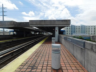
Santa Clara Metrorail Station Address: 2109 NW 12th Ave street in Miami
Attractions near Santa Clara Metrorail Station
Jetro Cash & Carry,Jetro/Restaurant Depot,Bismillah Cash and Carry,FAA Truck Parts,WM - Miami Dumpster Rental,NW 20 St@NW 12 Av,Northwest 12th Avenue & Northwest 22nd Street,City Of Miami Department Of Fire & Rescue-Station 5,Fresh Paradise Market,Mavy Produce,J&J / Coldflow,Orange Blossom Food Market,Emergency Plumbing Miami Fl,Elpidio Jr. Produce,Rubell Museum,Trujillo and Sons,Rubell Museum,Manso Products Corp,Jackson Behavioral Health Hospital - North (Blue Garage),ChargePointHow to get to popular attractions in Miami with public transit
Haulover Beach Park, Miami Beach,Palm Beach Gardens, Jupiter,Publix, Fort Lauderdale,Carpaccio, Miami Beach,Buffalo Wild Wings, North Westside,Claude Pepper Federal Building, Miami,Mizner Park, Boca Raton,Duffy's Sports Grill, Miami,Red Lobster, Kendall-Palmetto Bay,City of Plantation, Plantation,South Dade Senior High School, Homestead,Venetian Pool, Miami,Hiatus & red road, Miramar-Pembroke Pines,Citrix Systems, Inc, Fort Lauderdale,The Cheesecake Factory, Miramar-Pembroke Pines,City of Sunrise, Plantation,SeaCoast Suites Apartment Hotel Miami, Miami Beach,Lester's Diner, Fort Lauderdale,The Cheesecake Factory, Boca Raton,The Pub Pembroke, Miramar-Pembroke PinesGet around Miami by public transit!
Traveling around Miami has never been so easy. See step by step directions as you travel to any attraction, street or major public transit station. View bus and train schedules, arrival times, service alerts and detailed routes on a map, so you know exactly how to get to anywhere in Miami.
When traveling to any destination around Miami use Moovit's Live Directions with Get Off Notifications to know exactly where and how far to walk, how long to wait for your line, and how many stops are left. Moovit will alert you when it's time to get off — no need to constantly re-check whether yours is the next stop.
Wondering how to use public transit in Miami or how to pay for public transit in Miami? Moovit public transit app can help you navigate your way with public transit easily, and at minimum cost. It includes public transit fees, ticket prices, and costs. Looking for a map of Miami public transit lines? Moovit public transit app shows all public transit maps in Miami with all bus or subway routes and stops on an interactive map.
Miami has 2 transit type(s), including: bus or subway, operated by several transit agencies, including Miami-Dade Transit, Miami-Dade Transit, Miami Dade Transit-Rail, Tri-Rail, Miami-Dade Transit, Broward County Transit, Palm Tran, Brightline, Brightline, MARTY, City of Homestead Trolley, Key West Transit, Treasure Coast Connector, GoLine IRT and Amtrak