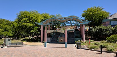
Santa Clarita Metrolink stop - Thursday schedule
| Line | Direction | Time |
|---|---|---|
| 502 | Commerce Center | 6:25 AM |
| 502 | Sc Metrolink | 7:18 AM |
| 502 | Commerce Center | 7:44 AM |
| 501 | Sc Metrolink | 7:45 AM |
| 501 | Sc Metrolink | 8:21 AM |
| 502 | Commerce Center | 8:24 AM |
| 501 | Magic Mtn | 8:25 AM |
| 501 | Magic Mtn | 9:25 AM |
| 502 | Sc Metrolink | 4:13 PM |
| 502 | Commerce Center | 4:14 PM |
| 501 | Magic Mtn | 4:25 PM |
| 502 | Sc Metrolink | 4:33 PM |
| 502 | Sc Metrolink | 5:13 PM |
| 501 | Sc Metrolink | 5:26 PM |
| 502 | Sc Metrolink | 5:33 PM |
Directions to Santa Clarita Metrolink with public transportation
The following transit lines have routes that pass near Santa Clarita Metrolink
How to get to Santa Clarita Metrolink by bus?
Click on the bus route to see step by step directions with maps, line arrival times and updated time schedules.
How to get to Santa Clarita Metrolink by train?
Click on the train route to see step by step directions with maps, line arrival times and updated time schedules.
Train stations near Santa Clarita Metrolink
- Santa Clarita Metrolink, 1 min walk,
Bus stations near Santa Clarita Metrolink
- Santa Clarita Metrolink Station (2505059), 2 min walk,
- Santa Clarita Metrolink Lower Plaza, 3 min walk,
- Santa Clarita Metrolink Station, 4 min walk,
- Commuter Wy & Soledad Canyon Rd, 5 min walk,
- Soledad Canyon Rd & Commuter Wy, 6 min walk,
Bus lines to Santa Clarita Metrolink
- 130, Santa Clarita,
- 796, Sc Metrolink,
- 797, Santa Clarita,
- 799, Los Angeles,
- ACTON & AGUA DULCE SHUTTLE, Acton,
- 501, Magic Mtn,
- 502, Commerce Center,
- 5, Stevenson Ranch/Vasquez Cyn,
- 6, Stevenson Ranch/Shadow Pines,
What are the closest stations to Santa Clarita Metrolink?
The closest stations to Santa Clarita Metrolink are:
- Santa Clarita Metrolink is 14 yards away, 1 min walk.
- Santa Clarita Metrolink Station (2505059) is 82 yards away, 2 min walk.
- Santa Clarita Metrolink Lower Plaza is 223 yards away, 3 min walk.
- Santa Clarita Metrolink Station is 283 yards away, 4 min walk.
- Commuter Wy & Soledad Canyon Rd is 359 yards away, 5 min walk.
- Soledad Canyon Rd & Commuter Wy is 477 yards away, 6 min walk.
Which bus lines stop near Santa Clarita Metrolink?
These bus lines stop near Santa Clarita Metrolink: 5, 501, 6, 757.
Which train line stops near Santa Clarita Metrolink?
ANTELOPE VALLEY LINE
What’s the nearest train station to Santa Clarita Metrolink?
The nearest train station to Santa Clarita Metrolink is Santa Clarita Metrolink. It’s a 1 min walk away.
What’s the nearest bus stop to Santa Clarita Metrolink?
The nearest bus stop to Santa Clarita Metrolink is Santa Clarita Metrolink Station (2505059). It’s a 2 min walk away.
What time is the first train to Santa Clarita Metrolink?
The ANTELOPE VALLEY LINE is the first train that goes to Santa Clarita Metrolink. It stops nearby at 5:20 AM.
What time is the last train to Santa Clarita Metrolink?
The ANTELOPE VALLEY LINE is the last train that goes to Santa Clarita Metrolink. It stops nearby at 12:40 AM.
What time is the first bus to Santa Clarita Metrolink?
The 799 is the first bus that goes to Santa Clarita Metrolink. It stops nearby at 4:55 AM.
What time is the last bus to Santa Clarita Metrolink?
The 6 is the last bus that goes to Santa Clarita Metrolink. It stops nearby at 9:59 PM.
See Santa Clarita Metrolink on the map
Public transit to Santa Clarita Metrolink stop (ID: 13323)
Looking for directions to Santa Clarita Metrolink in Santa Clarita, United States?
Download the Moovit App to find the current schedule and step-by-step directions for Bus or Train routes that pass through Santa Clarita Metrolink.
Looking for the nearest stops closest to Santa Clarita Metrolink ? Check out this list of closest stops to your destination: Santa Clarita Metrolink; Santa Clarita Metrolink Station (2505059); Santa Clarita Metrolink Lower Plaza; Santa Clarita Metrolink Station; Commuter Wy & Soledad Canyon Rd; Soledad Canyon Rd & Commuter Wy.
Bus: 5, 501, 6, 757, 130, 796, 797, 799, ACTON & AGUA DULCE SHUTTLE, 502.Train: ANTELOPE VALLEY LINE.
We make riding on public transit to Santa Clarita Metrolink easy, which is why over 1.5 million users, including users in Santa Clarita trust Moovit as the best app for public transit.
Get to Santa Clarita Metrolink with public transit and pay for the ride in the Moovit app. In addition to all info you may need for your trip to Santa Clarita Metrolink, including live directions, real-time arrivals and fare prices, you can also buy public transit passes for your rides. No need for cash or paper tickets to get to Santa Clarita Metrolink - everything you need is accessible in the app with a click of the button.
Use the app to navigate to popular places including to the airport, hospital, stadium, grocery store, mall, coffee shop, school, college, and university.
Santa Clarita Metrolink stop’s code is 13323
The first line to this stop is 502, at 6:25 AM, and the last line is 502 at 5:33 PM.
22122 Soledad Canyon Rd, Santa Clarita, CA, USA
This stop serves Santa Clarita Transit’s lines
Train station near Santa Clarita Metrolink
Santa Clarita MetrolinkBus stops near Santa Clarita Metrolink
Santa Clarita Metrolink Station (2505059),Santa Clarita Metrolink Lower Plaza,Santa Clarita Metrolink Station,Commuter Wy & Soledad Canyon Rd,Soledad Canyon Rd & Commuter WyPopular public transit stations in Santa Clarita
Montrose at Pennsylvania,Downey & Artesia SW,Santa Ana / California,Pacific Coast Hwy & Narbonne Ave (Eastbound),Lakewood / Imperial,Mariposa / Pacific Coast Highway,G Shuttle Stop at Int'L Terminal Lower Level,Obama / LA Cienega,Foothill Blvd & Lowell Ave (Westbound),Olive View Medical Center,Brand / Chevy Chase,Central FS San Diego,42nd & San Pedro St. (CW),6th / Bonnie Brae,Sherman Way / Corbin,Crenshaw Station,Figueroa / 3rd,Sherman Way / Winnetka,Figueroa & 12th St (Crypto.Com Arena),Florence / AvalonGet around Los Angeles by public transit!
Traveling around Los Angeles has never been so easy. See step by step directions as you travel to any attraction, street or major public transit station. View bus and train schedules, arrival times, service alerts and detailed routes on a map, so you know exactly how to get to anywhere in Los Angeles.
When traveling to any destination around Los Angeles use Moovit's Live Directions with Get Off Notifications to know exactly where and how far to walk, how long to wait for your line, and how many stops are left. Moovit will alert you when it's time to get off — no need to constantly re-check whether yours is the next stop.
Wondering how to use public transit in Los Angeles or how to pay for public transit in Los Angeles? Moovit public transit app can help you navigate your way with public transit easily, and at minimum cost. It includes public transit fees, ticket prices, and costs. Looking for a map of Los Angeles public transit lines? Moovit public transit app shows all public transit maps in Los Angeles with all Bus, Train, Subway, Light Rail, Ferry and Funicular routes and stops on an interactive map.
Los Angeles has 6 transit type(s), including: Bus, Train, Subway, Light Rail, Ferry and Funicular, operated by several transit agencies, including Metro - Los Angeles, Metrolink Trains, METRO, Long Beach Transit, LADOT, OCTA, Foothill Transit, Big Blue Bus, Riverside Transit Agency, LAX FlyAway, Airporter Shuttle, Playa Vista Shuttle, Amtrak, OMNITRANS, Pasadena Transit