Directions to Santander Bank Atm (Boston) with public transportation
The following transit lines have routes that pass near Santander Bank Atm
 Bus: 13.
How to get to Santander Bank Atm by bus?
Click on the bus route to see step by step directions with maps, line arrival times and updated time schedules.
From Lawrence, Massachusetts, Lawrence
73 minFrom Parque de las ardillas, Lawrence
71 minFrom Rockingham Mall Salem New Hampshire, Lawrence
74 minFrom Lawrence, MA, Lawrence
74 minFrom Methuen, Methuen Town
80 minFrom Northern Essex Community College, Haverhill
52 minFrom QRD, Methuen Town
79 minFrom Amesbury, MA, Amesbury
74 min
Bus stop near Santander Bank Atm in Boston
- Plaistow Walmart, 14 min walk,VIEW
Bus lines to Santander Bank Atm in Boston
- 13, Stateline Plaza (T.J. Maxx),VIEW
What are the closest stations to Santander Bank Atm?
The closest stations to Santander Bank Atm are:
- Plaistow Walmart is 1090 yards away, 14 min walk.
Which bus line stops near Santander Bank Atm?
13 (Stateline Plaza (T.J. Maxx))
What’s the nearest bus station to Santander Bank Atm in Boston?
The nearest bus station to Santander Bank Atm in Boston is Plaistow Walmart. It’s a 14 min walk away.
What time is the first bus to Santander Bank Atm in Boston?
The 13 is the first bus that goes to Santander Bank Atm in Boston. It stops nearby at 5:20 AM.
What time is the last bus to Santander Bank Atm in Boston?
The 13 is the last bus that goes to Santander Bank Atm in Boston. It stops nearby at 9:23 PM.
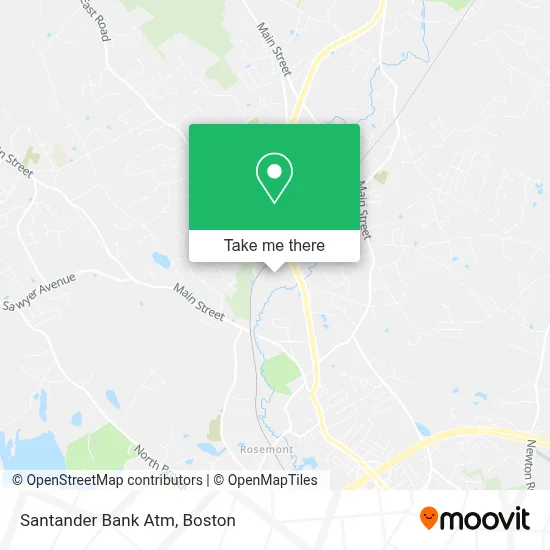
See Santander Bank Atm, Boston, on the map
Public Transit to Santander Bank Atm in Boston
Wondering how to get to Santander Bank Atm in Boston? Moovit helps you find the best way to get to Santander Bank Atm with step-by-step directions from the nearest public transit station.
Moovit provides free maps and live directions to help you navigate through your city. View schedules, routes, timetables, and find out how long does it take to get to Santander Bank Atm in real time.
Looking for the nearest stop or station to Santander Bank Atm? Check out this list of stops closest to your destination: Plaistow Walmart.
Bus: 13.
Want to see if there’s another route that gets you there at an earlier time? Moovit helps you find alternative routes or times. Get directions from and directions to Santander Bank Atm easily from the Moovit App or Website.
We make riding to Santander Bank Atm easy, which is why over 1.7 million users, including users in Boston, trust Moovit as the best app for public transit. You don’t need to download an individual bus app or train app, Moovit is your all-in-one transit app that helps you find the best bus time or train time available.
For information on prices of bus, costs and ride fares to Santander Bank Atm, please check the Moovit app.
Use the app to navigate to popular places including to the airport, hospital, stadium, grocery store, mall, coffee shop, school, college, and university.
Santander Bank Atm Address: 58 Plaistow Road Pentucket Shopping Center street in Boston
- Minute Key,
- Plaistow,
- Ashley's Collection, Plaistow,
- Penske Auto Center,
- Five Below,
- USPS Collection Box - Blue Box,
- BED BATH & BEYOND,
- Amazon Locker-Tanja,
- Gxo,
- Xtreme Auto Sales,
- U-Haul,
- German American Bank Itm,
- Vera Bradley,
- Ed's Flooring Clearance Center,
- Ultimate Confidence Guarantee,
- New Hampshire Liquor & Wine Outlet,
- Blossom Rental & Leasing,
- Isc Properties,
- The Angus Group,
- Park & Ride-Westville Rd
Places Near Santander Bank Atm (Boston)
- Isabella Stewart Gardner Museum, Boston,
- Mgm Music Hall, Boston,
- Wilbur Theatre, Boston,
- Boston Medical Center, Boston,
- Quincy Market, Boston,
- Leader Bank Pavilion (Leader Bank Pavillion), Boston,
- Cheers, Boston,
- Castle Island, Boston,
- House Of Blues, Boston,
- Wang Theater, Boston,
- Boston Children's Hospital, Boston,
- Seaport District, Boston,
- Faneuil Hall, Boston,
- Boston Convention & Exhibition Center, Boston,
- Massachusetts General Hospital, Boston,
- Prudential Center, Boston,
- North End, Boston,
- Td Garden, Boston,
- Museum Of Science, Boston,
- Boston Common, Boston
How to get to popular places in Boston with public transit
Get around Boston by public transit!
Traveling around Boston has never been so easy. See step by step directions as you travel to any attraction, street or major public transit station. View bus and train schedules, arrival times, service alerts and detailed routes on a map, so you know exactly how to get to anywhere in Boston.
When traveling to any destination around Boston use Moovit's Live Directions with Get Off Notifications to know exactly where and how far to walk, how long to wait for your line, and how many stops are left. Moovit will alert you when it's time to get off — no need to constantly re-check whether yours is the next stop.
Wondering how to use public transit in Boston or how to pay for public transit in Boston? Moovit public transit app can help you navigate your way with public transit easily, and at minimum cost. It includes public transit fees, ticket prices, and costs. Looking for a map of Boston public transit lines? Moovit public transit app shows all public transit maps in Boston with all Bus, Train, Subway and Ferry routes and stops on an interactive map.
Boston has 4 transit type(s), including: Bus, Train, Subway and Ferry, operated by several transit agencies, including MBTA, Southeastern Regional Transit Authority, MetroWest Regional Transit Authority, Rhode Island Public Transit Authority, WRTA, Lowell Regional Transit Authority, Merrimack Valley Transit, Montachusett Regional Transit Authority, Cape Cod Regional Transit Authority, Brockton Area Transit Authority, Martha's Vineyard Transit Authority, the WAVE - Nantucket Regional Transit Authority, GATRA, Cape Ann Transportation Authority and Massport