Directions to Santander Bank Atm (Malden) with public transportation
The following transit lines have routes that pass near Santander Bank Atm
 Bus: 104, 105, 108, 411, 430.
- Train: HAVERHILL, ORANGE LINE, NEWBURYPORT/ROCKPORT.
- Subway: ORANGE LINE.
How to get to Santander Bank Atm by bus?
Click on the bus route to see step by step directions with maps, line arrival times and updated time schedules.
From Beth Israel Hospital, Boston
69 minFrom Warrior Ice Arena, Boston
88 minFrom The Track at New Balance, Boston
87 minFrom Laugh Boston, Boston
62 minFrom Tip O'Neil Building, Boston
49 minFrom Museum Of Fine Arts MBTA Station, Boston
89 minFrom Boston Harborwalk, Boston
52 minFrom moakley federal court house, Boston
45 minFrom Boston Harbor Hotel, Boston
57 minFrom MBTA-Museum of Fine Arts, Boston
89 min
How to get to Santander Bank Atm by train?
Click on the train route to see step by step directions with maps, line arrival times and updated time schedules.
How to get to Santander Bank Atm by subway?
Click on the subway route to see step by step directions with maps, line arrival times and updated time schedules.
From Beth Israel Hospital, Boston
63 minFrom Warrior Ice Arena, Boston
83 minFrom The Track at New Balance, Boston
83 minFrom Laugh Boston, Boston
50 minFrom Tip O'Neil Building, Boston
27 minFrom Museum Of Fine Arts MBTA Station, Boston
45 minFrom Boston Harborwalk, Boston
35 minFrom moakley federal court house, Boston
44 minFrom Boston Harbor Hotel, Boston
36 minFrom MBTA-Museum of Fine Arts, Boston
45 min
Bus stops near Santander Bank Atm in Malden
Train stations near Santander Bank Atm in Malden
Bus lines to Santander Bank Atm in Malden
What are the closest stations to Santander Bank Atm?
The closest stations to Santander Bank Atm are:
- Salem St Opp Sprague St is 106 yards away, 2 min walk.
- 310 Main St is 243 yards away, 3 min walk.
- Ferry St @ Eastern Ave is 340 yards away, 5 min walk.
- Main St @ Salem St is 344 yards away, 5 min walk.
- Oak Grove is 1728 yards away, 21 min walk.
- Chelsea is 4767 yards away, 60 min walk.
Which bus lines stop near Santander Bank Atm?
These bus lines stop near Santander Bank Atm: 104, 105, 108, 411, 430.
Which train line stops near Santander Bank Atm?
HAVERHILL (#223 | Haverhill)
Which subway line stops near Santander Bank Atm?
ORANGE LINE (Oak Grove)
What’s the nearest train station to Santander Bank Atm in Malden?
The nearest train station to Santander Bank Atm in Malden is Oak Grove. It’s a 21 min walk away.
What’s the nearest bus station to Santander Bank Atm in Malden?
The nearest bus station to Santander Bank Atm in Malden is Salem St Opp Sprague St. It’s a 2 min walk away.
What time is the first subway to Santander Bank Atm in Malden?
The ORANGE LINE is the first subway that goes to Santander Bank Atm in Malden. It stops nearby at 5:15 AM.
What time is the last subway to Santander Bank Atm in Malden?
The ORANGE LINE is the last subway that goes to Santander Bank Atm in Malden. It stops nearby at 1:59 AM.
What time is the first train to Santander Bank Atm in Malden?
The HAVERHILL is the first train that goes to Santander Bank Atm in Malden. It stops nearby at 5:35 AM.
What time is the last train to Santander Bank Atm in Malden?
The NEWBURYPORT/ROCKPORT is the last train that goes to Santander Bank Atm in Malden. It stops nearby at 12:06 AM.
What time is the first bus to Santander Bank Atm in Malden?
The 104 is the first bus that goes to Santander Bank Atm in Malden. It stops nearby at 4:27 AM.
What time is the last bus to Santander Bank Atm in Malden?
The 108 is the last bus that goes to Santander Bank Atm in Malden. It stops nearby at 1:38 AM.
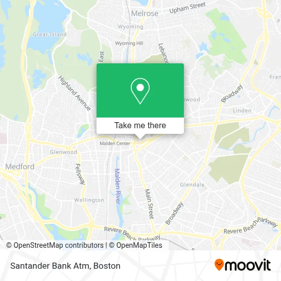
See Santander Bank Atm, Malden, on the map
Public Transit to Santander Bank Atm in Malden
Wondering how to get to Santander Bank Atm in Malden? Moovit helps you find the best way to get to Santander Bank Atm with step-by-step directions from the nearest public transit station.
Moovit provides free maps and live directions to help you navigate through your city. View schedules, routes, timetables, and find out how long does it take to get to Santander Bank Atm in real time.
Looking for the nearest stop or station to Santander Bank Atm? Check out this list of stops closest to your destination: Salem St Opp Sprague St; 310 Main St; Ferry St @ Eastern Ave; Main St @ Salem St; Oak Grove; Chelsea.
Bus: 104, 105, 108, 411, 430, 106, 99, 131, 137.Train: HAVERHILL, ORANGE LINE, NEWBURYPORT/ROCKPORT.Subway: ORANGE LINE.
Want to see if there’s another route that gets you there at an earlier time? Moovit helps you find alternative routes or times. Get directions from and directions to Santander Bank Atm easily from the Moovit App or Website.
We make riding to Santander Bank Atm easy, which is why over 1.7 million users, including users in Malden, trust Moovit as the best app for public transit. You don’t need to download an individual bus app or train app, Moovit is your all-in-one transit app that helps you find the best bus time or train time available.
For information on prices of bus, subway and train, costs and ride fares to Santander Bank Atm, please check the Moovit app.
Use the app to navigate to popular places including to the airport, hospital, stadium, grocery store, mall, coffee shop, school, college, and university.
Santander Bank Atm Address: 32 Ferry St street in Malden
- Pestagon Termite and Pest Services,
- Cvs,
- Cheverus Elementary,
- Nails for You & Spa,
- Fallon Christopher G PC Attorney,
- Malden Education Assoc,
- Cha Malden Teen Health Center,
- Malden, MA,
- Wildcat Realty Trust,
- Cambridge Investment Research, Inc.,
- Commonwealth Communications Group,
- Synergy Business & Financial Consultants,
- Floramo's Restaurants,
- Peking Gourmet,
- Volpicelli House of Quality,
- Xfinity Store by Comcast,
- Cushion Clinic,
- Smile Land Dental- Malden,
- Luva Hair and Day Spa (Lana Beauty Spa),
- Cantina la Mexicana
Places Near Santander Bank Atm (Malden)
- Prudential Center, Boston,
- Boston Children's Hospital, Boston,
- Mgm Music Hall, Boston,
- Museum Of Science, Boston,
- Boston Medical Center, Boston,
- Wang Theater, Boston,
- Td Garden, Boston,
- Cheers, Boston,
- Massachusetts General Hospital, Boston,
- North End, Boston,
- Leader Bank Pavilion (Leader Bank Pavillion), Boston,
- Boston Convention & Exhibition Center, Boston,
- Quincy Market, Boston,
- Seaport District, Boston,
- House Of Blues, Boston,
- Boston Common, Boston,
- Wilbur Theatre, Boston,
- Faneuil Hall, Boston,
- Isabella Stewart Gardner Museum, Boston,
- Castle Island, Boston
How to get to popular places in Boston with public transit
Get around Malden by public transit!
Traveling around Malden has never been so easy. See step by step directions as you travel to any attraction, street or major public transit station. View bus and train schedules, arrival times, service alerts and detailed routes on a map, so you know exactly how to get to anywhere in Malden.
When traveling to any destination around Malden use Moovit's Live Directions with Get Off Notifications to know exactly where and how far to walk, how long to wait for your line, and how many stops are left. Moovit will alert you when it's time to get off — no need to constantly re-check whether yours is the next stop.
Wondering how to use public transit in Malden or how to pay for public transit in Malden? Moovit public transit app can help you navigate your way with public transit easily, and at minimum cost. It includes public transit fees, ticket prices, and costs. Looking for a map of Malden public transit lines? Moovit public transit app shows all public transit maps in Malden with all Bus, Train, Subway and Ferry routes and stops on an interactive map.
Boston has 4 transit type(s), including: Bus, Train, Subway and Ferry, operated by several transit agencies, including MBTA, Southeastern Regional Transit Authority, MetroWest Regional Transit Authority, Rhode Island Public Transit Authority, WRTA, Lowell Regional Transit Authority, Merrimack Valley Transit, Montachusett Regional Transit Authority, Cape Cod Regional Transit Authority, Brockton Area Transit Authority, Martha's Vineyard Transit Authority, the WAVE - Nantucket Regional Transit Authority, GATRA, Cape Ann Transportation Authority and Massport