How to get to Santander Bank Atm by bus?
Click on the bus route to see step by step directions with maps, line arrival times and updated time schedules.
From Saint Vincent Hospital at Worcester Medical Center, Worcester
85 minFrom Walmart Supercenter, Worcester
71 minFrom Worcester, MA, Worcester
59 minFrom Registry Of Motor Vehicles (Rmv) Branch Office, Worcester
66 minFrom Polar Park, Worcester
60 minFrom South High Community School, Worcester
105 minFrom St Vincent Hospital TH Medical, Worcester
61 minFrom Dcu Center, Worcester
57 minFrom Palladium, Worcester
71 min
Bus stops near Santander Bank Atm in Southbridge Town
Bus lines to Santander Bank Atm in Southbridge Town
What are the closest stations to Santander Bank Atm?
The closest stations to Santander Bank Atm are:
- Central Southbridge & Hook St is 281 yards away, 4 min walk.
- North St & Optical Dr is 1026 yards away, 13 min walk.
Which bus line stops near Santander Bank Atm?
29 (Central Hub→Big Bunny Plaza Southbridge)
What’s the nearest bus station to Santander Bank Atm in Southbridge Town?
The nearest bus station to Santander Bank Atm in Southbridge Town is Central Southbridge & Hook St. It’s a 4 min walk away.
What time is the first bus to Santander Bank Atm in Southbridge Town?
The 51 is the first bus that goes to Santander Bank Atm in Southbridge Town. It stops nearby at 5:14 AM.
What time is the last bus to Santander Bank Atm in Southbridge Town?
The 51 is the last bus that goes to Santander Bank Atm in Southbridge Town. It stops nearby at 7:06 PM.
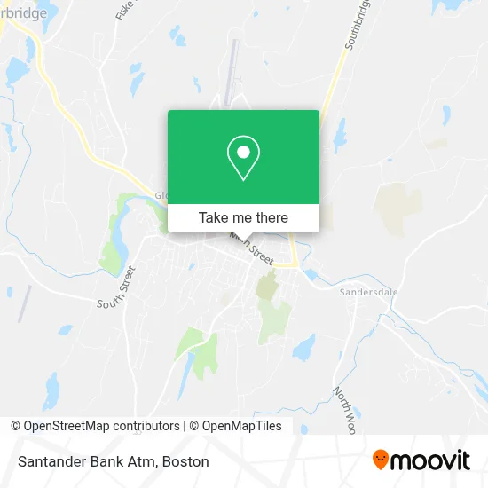
See Santander Bank Atm, Southbridge Town, on the map
Public Transit to Santander Bank Atm in Southbridge Town
Wondering how to get to Santander Bank Atm in Southbridge Town? Moovit helps you find the best way to get to Santander Bank Atm with step-by-step directions from the nearest public transit station.
Moovit provides free maps and live directions to help you navigate through your city. View schedules, routes, timetables, and find out how long does it take to get to Santander Bank Atm in real time.
Looking for the nearest stop or station to Santander Bank Atm? Check out this list of stops closest to your destination: Central Southbridge & Hook St; North St & Optical Dr.
Bus: 29, 51.
Want to see if there’s another route that gets you there at an earlier time? Moovit helps you find alternative routes or times. Get directions from and directions to Santander Bank Atm easily from the Moovit App or Website.
We make riding to Santander Bank Atm easy, which is why over 1.7 million users, including users in Southbridge Town, trust Moovit as the best app for public transit. You don’t need to download an individual bus app or train app, Moovit is your all-in-one transit app that helps you find the best bus time or train time available.
For information on prices of bus, costs and ride fares to Santander Bank Atm, please check the Moovit app.
Use the app to navigate to popular places including to the airport, hospital, stadium, grocery store, mall, coffee shop, school, college, and university.
Santander Bank Atm Address: 399 Main St street in Southbridge Town
- Next Street - Southbridge Driving School,
- Casa de Amor y Gloria Inc.,
- Kyoko's Closet,
- Stebblins Auto Repair,
- The Logo Shop,
- Frances Alvarez School of Real Estate,
- Central Trophy Award & Engraving,
- Casella Waste Services,
- Relax Spa by Gea,
- Morse Woodworking,
- Slydes Moped Rentals LLC,
- Big Daddy Collectibles,
- The Thread Connect,
- Techman International,
- Sturbridge Insurance,
- Pentecostal Church,
- Maintenance and Prevention Tire Services,
- Thomas T K, MD,
- Southbridge Intervention Paint Co.,
- Movement Pentecostal Church
Places Near Santander Bank Atm (Southbridge Town)
- Prudential Center, Boston,
- Td Garden, Boston,
- Boston Medical Center, Boston,
- House Of Blues, Boston,
- North End, Boston,
- Mgm Music Hall, Boston,
- Wang Theater, Boston,
- Boston Common, Boston,
- Boston Convention & Exhibition Center, Boston,
- Quincy Market, Boston,
- Cheers, Boston,
- Castle Island, Boston,
- Wilbur Theatre, Boston,
- Isabella Stewart Gardner Museum, Boston,
- Leader Bank Pavilion (Leader Bank Pavillion), Boston,
- Museum Of Science, Boston,
- Faneuil Hall, Boston,
- Seaport District, Boston,
- Boston Children's Hospital, Boston,
- Massachusetts General Hospital, Boston
How to get to popular places in Boston with public transit
Get around Southbridge Town by public transit!
Traveling around Southbridge Town has never been so easy. See step by step directions as you travel to any attraction, street or major public transit station. View bus and train schedules, arrival times, service alerts and detailed routes on a map, so you know exactly how to get to anywhere in Southbridge Town.
When traveling to any destination around Southbridge Town use Moovit's Live Directions with Get Off Notifications to know exactly where and how far to walk, how long to wait for your line, and how many stops are left. Moovit will alert you when it's time to get off — no need to constantly re-check whether yours is the next stop.
Wondering how to use public transit in Southbridge Town or how to pay for public transit in Southbridge Town? Moovit public transit app can help you navigate your way with public transit easily, and at minimum cost. It includes public transit fees, ticket prices, and costs. Looking for a map of Southbridge Town public transit lines? Moovit public transit app shows all public transit maps in Southbridge Town with all Bus, Train, Subway and Ferry routes and stops on an interactive map.
Boston has 4 transit type(s), including: Bus, Train, Subway and Ferry, operated by several transit agencies, including MBTA, Southeastern Regional Transit Authority, MetroWest Regional Transit Authority, Rhode Island Public Transit Authority, WRTA, Lowell Regional Transit Authority, Merrimack Valley Transit, Montachusett Regional Transit Authority, Cape Cod Regional Transit Authority, Brockton Area Transit Authority, Martha's Vineyard Transit Authority, the WAVE - Nantucket Regional Transit Authority, GATRA, Cape Ann Transportation Authority and Massport