Directions to Santander Bank Branch (Boston) with public transportation
The following transit lines have routes that pass near Santander Bank Branch
 Bus: 22, 39, 42, 44, 29.
- Subway: ORANGE LINE, GREEN LINE E.
How to get to Santander Bank Branch by bus?
Click on the bus route to see step by step directions with maps, line arrival times and updated time schedules.
From Staybridge Suites Boston-Quincy, Quincy
69 minFrom Massport Bus 77 Chelsea Employee Parking, Chelsea
69 minFrom Reelhouse, Boston
90 minFrom Lynch Family Skate Park, Cambridge
65 minFrom Ac Hotel Cambridge, Cambridge
91 minFrom TownePlace Suites Boston Logan Airport/Chelsea, Chelsea
69 minFrom Costco Wholesale, Everett
102 minFrom Sheraton-Needham Hotel (Sheraton Boston Needham Hotel), Needham
112 minFrom AC Hotel Boston Cambridge, Cambridge
97 minFrom Hampton Inn & Suites-Hampton Watertown Boston (Hampton Inn & Suites Watertown Boston), Watertown Town
73 min
How to get to Santander Bank Branch by subway?
Click on the subway route to see step by step directions with maps, line arrival times and updated time schedules.
From Staybridge Suites Boston-Quincy, Quincy
48 minFrom Massport Bus 77 Chelsea Employee Parking, Chelsea
53 minFrom Reelhouse, Boston
41 minFrom Lynch Family Skate Park, Cambridge
44 minFrom Ac Hotel Cambridge, Cambridge
56 minFrom TownePlace Suites Boston Logan Airport/Chelsea, Chelsea
52 minFrom Costco Wholesale, Everett
57 minFrom AC Hotel Boston Cambridge, Cambridge
62 min
Bus stops near Santander Bank Branch in Boston
Subway stations near Santander Bank Branch in Boston
Bus lines to Santander Bank Branch in Boston
What are the closest stations to Santander Bank Branch?
The closest stations to Santander Bank Branch are:
- Washington St @ Iffley Rd is 106 yards away, 2 min walk.
- Columbus Ave @ Weld Ave - Egleston Sq is 451 yards away, 6 min walk.
- Stony Brook is 557 yards away, 7 min walk.
- Heath Street is 2399 yards away, 29 min walk.
Which bus lines stop near Santander Bank Branch?
These bus lines stop near Santander Bank Branch: 22, 39, 42, 44.
Which subway line stops near Santander Bank Branch?
ORANGE LINE (Forest Hills)
What’s the nearest subway station to Santander Bank Branch in Boston?
The nearest subway station to Santander Bank Branch in Boston is Stony Brook. It’s a 7 min walk away.
What’s the nearest bus station to Santander Bank Branch in Boston?
The nearest bus station to Santander Bank Branch in Boston is Washington St @ Iffley Rd. It’s a 2 min walk away.
What time is the first subway to Santander Bank Branch in Boston?
The ORANGE LINE is the first subway that goes to Santander Bank Branch in Boston. It stops nearby at 5:16 AM.
What time is the last subway to Santander Bank Branch in Boston?
The GREEN LINE E is the last subway that goes to Santander Bank Branch in Boston. It stops nearby at 2:00 AM.
What time is the first bus to Santander Bank Branch in Boston?
The 42 is the first bus that goes to Santander Bank Branch in Boston. It stops nearby at 5:02 AM.
What time is the last bus to Santander Bank Branch in Boston?
The 22 is the last bus that goes to Santander Bank Branch in Boston. It stops nearby at 2:11 AM.
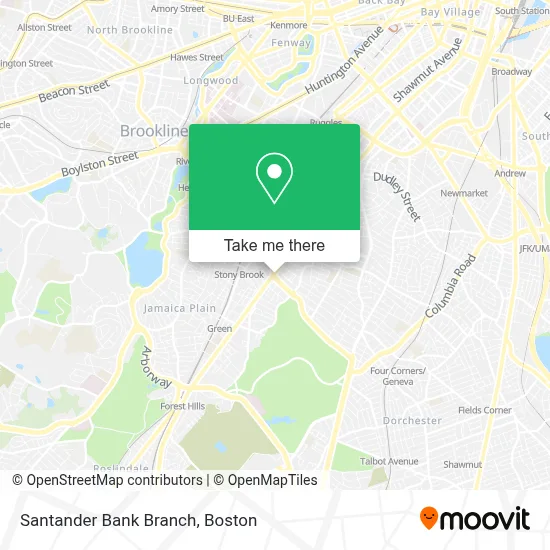
See Santander Bank Branch, Boston, on the map
Public Transit to Santander Bank Branch in Boston
Wondering how to get to Santander Bank Branch in Boston? Moovit helps you find the best way to get to Santander Bank Branch with step-by-step directions from the nearest public transit station.
Moovit provides free maps and live directions to help you navigate through your city. View schedules, routes, timetables, and find out how long does it take to get to Santander Bank Branch in real time.
Looking for the nearest stop or station to Santander Bank Branch? Check out this list of stops closest to your destination: Washington St @ Iffley Rd; Columbus Ave @ Weld Ave - Egleston Sq; Stony Brook; Heath Street.
Bus: 22, 39, 42, 44, 29.Subway: ORANGE LINE, GREEN LINE E.
Want to see if there’s another route that gets you there at an earlier time? Moovit helps you find alternative routes or times. Get directions from and directions to Santander Bank Branch easily from the Moovit App or Website.
We make riding to Santander Bank Branch easy, which is why over 1.7 million users, including users in Boston, trust Moovit as the best app for public transit. You don’t need to download an individual bus app or train app, Moovit is your all-in-one transit app that helps you find the best bus time or train time available.
For information on prices of bus and subway, costs and ride fares to Santander Bank Branch, please check the Moovit app.
Use the app to navigate to popular places including to the airport, hospital, stadium, grocery store, mall, coffee shop, school, college, and university.
Santander Bank Branch Address: 3060 Washington St street in Boston
- Santander Bank,
- T-Mobile,
- Egleston Square,
- Roxbury Vtm2,
- Exclusive Wireless,
- Exxon,
- Kevins Jewelry,
- Tito & Manny,
- Taxit Financial Services,
- Tonys Barber Shop,
- Boost Mobile,
- Egleston Substation,
- Black Ministerial Alliance of Greater Boston,
- DUNKIN',
- Amazon Locker-Effervescent,
- El Barrio Convenience,
- Latino Beauty Salon (Latino Salon Roxbury),
- Eleven,
- Heading Home,
- TD Bank
Places Near Santander Bank Branch (Boston)
- Faneuil Hall, Boston,
- Castle Island, Boston,
- Prudential Center, Boston,
- Wilbur Theatre, Boston,
- Isabella Stewart Gardner Museum, Boston,
- House Of Blues, Boston,
- Boston Children's Hospital, Boston,
- Td Garden, Boston,
- Boston Convention & Exhibition Center, Boston,
- Boston Medical Center, Boston,
- Leader Bank Pavilion (Leader Bank Pavillion), Boston,
- North End, Boston,
- Mgm Music Hall, Boston,
- Cheers, Boston,
- Quincy Market, Boston,
- Museum Of Science, Boston,
- Massachusetts General Hospital, Boston,
- Seaport District, Boston,
- Boston Common, Boston,
- Wang Theater, Boston
How to get to popular places in Boston with public transit
Get around Boston by public transit!
Traveling around Boston has never been so easy. See step by step directions as you travel to any attraction, street or major public transit station. View bus and train schedules, arrival times, service alerts and detailed routes on a map, so you know exactly how to get to anywhere in Boston.
When traveling to any destination around Boston use Moovit's Live Directions with Get Off Notifications to know exactly where and how far to walk, how long to wait for your line, and how many stops are left. Moovit will alert you when it's time to get off — no need to constantly re-check whether yours is the next stop.
Wondering how to use public transit in Boston or how to pay for public transit in Boston? Moovit public transit app can help you navigate your way with public transit easily, and at minimum cost. It includes public transit fees, ticket prices, and costs. Looking for a map of Boston public transit lines? Moovit public transit app shows all public transit maps in Boston with all Bus, Train, Subway and Ferry routes and stops on an interactive map.
Boston has 4 transit type(s), including: Bus, Train, Subway and Ferry, operated by several transit agencies, including MBTA, Southeastern Regional Transit Authority, MetroWest Regional Transit Authority, Rhode Island Public Transit Authority, WRTA, Lowell Regional Transit Authority, Merrimack Valley Transit, Montachusett Regional Transit Authority, Cape Cod Regional Transit Authority, Brockton Area Transit Authority, Martha's Vineyard Transit Authority, the WAVE - Nantucket Regional Transit Authority, GATRA, Cape Ann Transportation Authority and Massport