Directions to Sante Healthcare System (Somerville) with public transportation
The following transit lines have routes that pass near Sante Healthcare System
 Bus: 77, 83, 87, 109.
- Train: FITCHBURG, RED LINE.
- Subway: RED LINE, GREEN LINE D, GREEN LINE E, GREEN LINE B, GREEN LINE C.
How to get to Sante Healthcare System by bus?
Click on the bus route to see step by step directions with maps, line arrival times and updated time schedules.
From Roslindale, Boston
91 minFrom Boston Omni Parker House Hotel, Boston
56 minFrom JFK Library, Boston
103 minFrom Codman Square, Boston
97 minFrom Dorchester District Court, Boston
92 minFrom Waltham, MA, Waltham
72 minFrom Boston Opera House (Citizens Bank Opera House), Boston
60 minFrom Home2 Suites-Boston South Bay (Home2 Stes by Hilton Boston S Bay), Boston
61 minFrom Hyatt Regency Boston, Boston
59 min
How to get to Sante Healthcare System by train?
Click on the train route to see step by step directions with maps, line arrival times and updated time schedules.
How to get to Sante Healthcare System by subway?
Click on the subway route to see step by step directions with maps, line arrival times and updated time schedules.
From Roslindale, Boston
73 minFrom Boston Omni Parker House Hotel, Boston
34 minFrom JFK Library, Boston
65 minFrom Codman Square, Boston
61 minFrom Dorchester District Court, Boston
59 minFrom Boston Opera House (Citizens Bank Opera House), Boston
36 minFrom Home2 Suites-Boston South Bay (Home2 Stes by Hilton Boston S Bay), Boston
48 minFrom Hyatt Regency Boston, Boston
37 min
Bus stops near Sante Healthcare System in Somerville
Train station near Sante Healthcare System in Somerville
- Porter, 11 min walk,VIEW
Subway stations near Sante Healthcare System in Somerville
Bus lines to Sante Healthcare System in Somerville
What are the closest stations to Sante Healthcare System?
The closest stations to Sante Healthcare System are:
- Park St @ Beacon St is 133 yards away, 2 min walk.
- Somerville Ave @ Sacramento St is 201 yards away, 3 min walk.
- Kirkland St @ Irving St is 314 yards away, 4 min walk.
- Porter is 888 yards away, 11 min walk.
- Union Square is 1884 yards away, 23 min walk.
- Gilman Square is 2362 yards away, 28 min walk.
Which bus lines stop near Sante Healthcare System?
These bus lines stop near Sante Healthcare System: 77, 83, 87.
Which train line stops near Sante Healthcare System?
FITCHBURG (#410 | North Station)
Which subway line stops near Sante Healthcare System?
RED LINE (Alewife)
What’s the nearest subway station to Sante Healthcare System in Somerville?
The nearest subway station to Sante Healthcare System in Somerville is Union Square. It’s a 23 min walk away.
What’s the nearest train station to Sante Healthcare System in Somerville?
The nearest train station to Sante Healthcare System in Somerville is Porter. It’s a 11 min walk away.
What’s the nearest bus station to Sante Healthcare System in Somerville?
The nearest bus station to Sante Healthcare System in Somerville is Park St @ Beacon St. It’s a 2 min walk away.
What time is the first subway to Sante Healthcare System in Somerville?
The GREEN LINE E is the first subway that goes to Sante Healthcare System in Somerville. It stops nearby at 4:50 AM.
What time is the last subway to Sante Healthcare System in Somerville?
The GREEN LINE E is the last subway that goes to Sante Healthcare System in Somerville. It stops nearby at 2:38 AM.
What time is the first train to Sante Healthcare System in Somerville?
The FITCHBURG is the first train that goes to Sante Healthcare System in Somerville. It stops nearby at 5:47 AM.
What time is the last train to Sante Healthcare System in Somerville?
The FITCHBURG is the last train that goes to Sante Healthcare System in Somerville. It stops nearby at 12:17 AM.
What time is the first bus to Sante Healthcare System in Somerville?
The 109 is the first bus that goes to Sante Healthcare System in Somerville. It stops nearby at 4:57 AM.
What time is the last bus to Sante Healthcare System in Somerville?
The 109 is the last bus that goes to Sante Healthcare System in Somerville. It stops nearby at 1:33 AM.
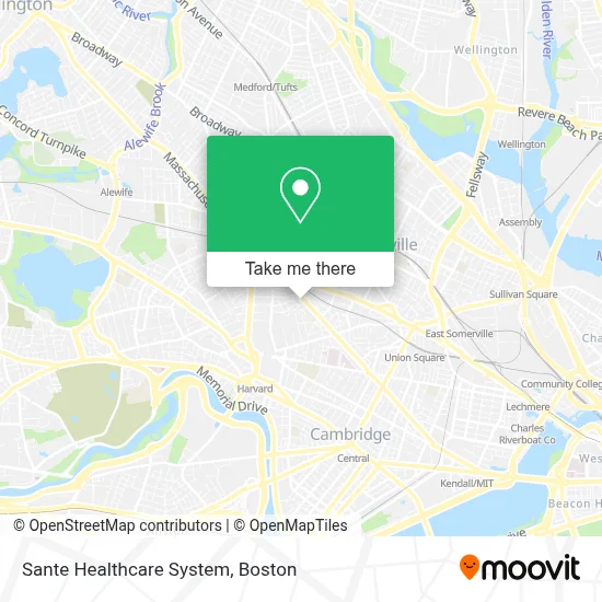
See Sante Healthcare System, Somerville, on the map
Public Transit to Sante Healthcare System in Somerville
Wondering how to get to Sante Healthcare System in Somerville? Moovit helps you find the best way to get to Sante Healthcare System with step-by-step directions from the nearest public transit station.
Moovit provides free maps and live directions to help you navigate through your city. View schedules, routes, timetables, and find out how long does it take to get to Sante Healthcare System in real time.
Looking for the nearest stop or station to Sante Healthcare System? Check out this list of stops closest to your destination: Park St @ Beacon St; Somerville Ave @ Sacramento St; Kirkland St @ Irving St; Porter; Union Square; Gilman Square.
Bus: 77, 83, 87, 109.Train: FITCHBURG, RED LINE.Subway: RED LINE, GREEN LINE D, GREEN LINE E, GREEN LINE B, GREEN LINE C.
Want to see if there’s another route that gets you there at an earlier time? Moovit helps you find alternative routes or times. Get directions from and directions to Sante Healthcare System easily from the Moovit App or Website.
We make riding to Sante Healthcare System easy, which is why over 1.7 million users, including users in Somerville, trust Moovit as the best app for public transit. You don’t need to download an individual bus app or train app, Moovit is your all-in-one transit app that helps you find the best bus time or train time available.
For information on prices of bus, subway and train, costs and ride fares to Sante Healthcare System, please check the Moovit app.
Use the app to navigate to popular places including to the airport, hospital, stadium, grocery store, mall, coffee shop, school, college, and university.
Sante Healthcare System Address: 7 beckwith Circle Unit 2 street in Somerville
- The Skincareapist,
- Kimura Realty,
- Cornerstone,
- RF Osullivan & Son (R F O'Sullivan's),
- American Locksmith,
- Coinstar - Bitcoin ATM,
- Shaw's,
- Assembleia de Deus Celebrar,
- 5brt,
- Edward Jones Investments (Edward Jones - Financial Advisor: Haley C Adams, Aamstm),
- Amazon Locker-Jell,
- Beauty Works Hair & Spa,
- Lf Beauty Lounge,
- Hair by Mirian Marques,
- Murphy Picture Framing,
- Somerville Locksmith PRO,
- Thrifty,
- Loyal Auto Glass,
- 619 Somerville Ave Somerville Ma (Somerville Used Auto Sales),
- Kesher Nevatim Preschool
Places Near Sante Healthcare System (Somerville)
- Boston Convention & Exhibition Center, Boston,
- Wilbur Theatre, Boston,
- House Of Blues, Boston,
- North End, Boston,
- Isabella Stewart Gardner Museum, Boston,
- Mgm Music Hall, Boston,
- Boston Medical Center, Boston,
- Castle Island, Boston,
- Td Garden, Boston,
- Quincy Market, Boston,
- Leader Bank Pavilion (Leader Bank Pavillion), Boston,
- Museum Of Science, Boston,
- Prudential Center, Boston,
- Boston Children's Hospital, Boston,
- Faneuil Hall, Boston,
- Massachusetts General Hospital, Boston,
- Wang Theater, Boston,
- Seaport District, Boston,
- Boston Common, Boston,
- Cheers, Boston
How to get to popular places in Boston with public transit
Get around Somerville by public transit!
Traveling around Somerville has never been so easy. See step by step directions as you travel to any attraction, street or major public transit station. View bus and train schedules, arrival times, service alerts and detailed routes on a map, so you know exactly how to get to anywhere in Somerville.
When traveling to any destination around Somerville use Moovit's Live Directions with Get Off Notifications to know exactly where and how far to walk, how long to wait for your line, and how many stops are left. Moovit will alert you when it's time to get off — no need to constantly re-check whether yours is the next stop.
Wondering how to use public transit in Somerville or how to pay for public transit in Somerville? Moovit public transit app can help you navigate your way with public transit easily, and at minimum cost. It includes public transit fees, ticket prices, and costs. Looking for a map of Somerville public transit lines? Moovit public transit app shows all public transit maps in Somerville with all Bus, Train, Subway and Ferry routes and stops on an interactive map.
Boston has 4 transit type(s), including: Bus, Train, Subway and Ferry, operated by several transit agencies, including MBTA, Southeastern Regional Transit Authority, MetroWest Regional Transit Authority, Rhode Island Public Transit Authority, WRTA, Lowell Regional Transit Authority, Merrimack Valley Transit, Montachusett Regional Transit Authority, Cape Cod Regional Transit Authority, Brockton Area Transit Authority, Martha's Vineyard Transit Authority, the WAVE - Nantucket Regional Transit Authority, GATRA, Cape Ann Transportation Authority and Massport