Directions to Sarah Carroll (Boston) with public transportation
The following transit lines have routes that pass near Sarah Carroll
 Bus: 39, 43, 504, 9, SL4.
- Train: LOWELL, NEEDHAM, NEWBURYPORT/ROCKPORT, FOXBORO EVENT SERVICE, FRAMINGHAM/WORCESTER.
- Subway: ORANGE LINE, GREEN LINE B, GREEN LINE C, GREEN LINE D, GREEN LINE E.
How to get to Sarah Carroll by bus?
Click on the bus route to see step by step directions with maps, line arrival times and updated time schedules.
From VFW Parkway, Boston
62 minFrom Lemuel Shattuck Hospital, Boston
60 minFrom Regent Theatre, Arlington
71 minFrom Assembly Square Mall Shopping Center, Somerville
85 minFrom TownePlace Suites Boston Logan Airport/Chelsea, Chelsea
53 minFrom Beth Israel Deaconess Hospital-Milton, Milton
77 minFrom West Roxbury, Boston
65 minFrom Mount Auburn Hospital, Cambridge
53 minFrom Ac Hotel Cambridge, Cambridge
74 minFrom Milton, MA, Milton
87 min
How to get to Sarah Carroll by train?
Click on the train route to see step by step directions with maps, line arrival times and updated time schedules.
How to get to Sarah Carroll by subway?
Click on the subway route to see step by step directions with maps, line arrival times and updated time schedules.
From Lemuel Shattuck Hospital, Boston
35 minFrom Assembly Square Mall Shopping Center, Somerville
32 minFrom TownePlace Suites Boston Logan Airport/Chelsea, Chelsea
39 minFrom Beth Israel Deaconess Hospital-Milton, Milton
75 minFrom Mount Auburn Hospital, Cambridge
43 minFrom Ac Hotel Cambridge, Cambridge
42 minFrom Milton, MA, Milton
77 min
Subway station near Sarah Carroll in Boston
- Arlington, 1 min walk,VIEW
Bus stops near Sarah Carroll in Boston
Train station near Sarah Carroll in Boston
- Back Bay - South End, 8 min walk,VIEW
Bus lines to Sarah Carroll in Boston
- 43, Ruggles,VIEW
- 9, Kenmore Via Boston Latin,VIEW
- 10, Arlington Via South Bay Center,VIEW
- 39, Back Bay,VIEW
- WORCESTER LINE SHUTTLE, Back Bay (Shuttle),VIEW
- BB, Airport,VIEW
- ORANGE LINE SHUTTLE, Ruggles (Shuttle),VIEW
- ORANGE LINE SHUTTLE, Forest Hills (Shuttle),VIEW
- ORANGE LINE SHUTTLE, Jackson Square (Shuttle),VIEW
What are the closest stations to Sarah Carroll?
The closest stations to Sarah Carroll are:
- Arlington is 63 yards away, 1 min walk.
- Tremont St @ E Berkeley St is 132 yards away, 2 min walk.
- E Berkeley St @ Tremont St is 141 yards away, 2 min walk.
- Dartmouth St @ Tremont St is 285 yards away, 4 min walk.
- Back Bay is 299 yards away, 4 min walk.
- Announcement #5 - Back Bay To Airport is 472 yards away, 6 min walk.
- Back Bay - Columbus Ave @ Dartmouth St is 609 yards away, 8 min walk.
- Back Bay - South End is 632 yards away, 8 min walk.
Which bus lines stop near Sarah Carroll?
These bus lines stop near Sarah Carroll: 39, 43, 504, 9, SL4.
Which train lines stop near Sarah Carroll?
These train lines stop near Sarah Carroll: LOWELL, NEEDHAM, NEWBURYPORT/ROCKPORT.
Which subway line stops near Sarah Carroll?
ORANGE LINE (Oak Grove)
What’s the nearest subway station to Sarah Carroll in Boston?
The nearest subway station to Sarah Carroll in Boston is Arlington. It’s a 1 min walk away.
What’s the nearest train station to Sarah Carroll in Boston?
The nearest train station to Sarah Carroll in Boston is Back Bay - South End. It’s a 8 min walk away.
What’s the nearest bus station to Sarah Carroll in Boston?
The nearest bus stations to Sarah Carroll in Boston are Tremont St @ E Berkeley St and E Berkeley St @ Tremont St. The closest one is a 2 min walk away.
What time is the first subway to Sarah Carroll in Boston?
The GREEN LINE D is the first subway that goes to Sarah Carroll in Boston. It stops nearby at 5:05 AM.
What time is the last subway to Sarah Carroll in Boston?
The GREEN LINE E is the last subway that goes to Sarah Carroll in Boston. It stops nearby at 2:14 AM.
What time is the first train to Sarah Carroll in Boston?
The PROVIDENCE/STOUGHTON is the first train that goes to Sarah Carroll in Boston. It stops nearby at 4:25 AM.
What time is the last train to Sarah Carroll in Boston?
The LAKE SHORE LIMITED is the last train that goes to Sarah Carroll in Boston. It stops nearby at 8:26 PM.
What time is the first bus to Sarah Carroll in Boston?
The BB is the first bus that goes to Sarah Carroll in Boston. It stops nearby at 5:01 AM.
What time is the last bus to Sarah Carroll in Boston?
The 10 is the last bus that goes to Sarah Carroll in Boston. It stops nearby at 1:20 AM.
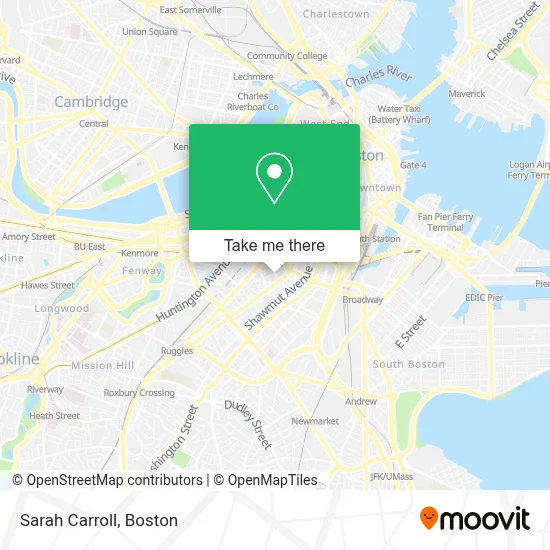
See Sarah Carroll, Boston, on the map
Public Transit to Sarah Carroll in Boston
Wondering how to get to Sarah Carroll in Boston? Moovit helps you find the best way to get to Sarah Carroll with step-by-step directions from the nearest public transit station.
Moovit provides free maps and live directions to help you navigate through your city. View schedules, routes, timetables, and find out how long does it take to get to Sarah Carroll in real time.
Looking for the nearest stop or station to Sarah Carroll? Check out this list of stops closest to your destination: Arlington; Tremont St @ E Berkeley St; E Berkeley St @ Tremont St; Dartmouth St @ Tremont St; Back Bay; Announcement #5 - Back Bay To Airport; Back Bay - Columbus Ave @ Dartmouth St; Back Bay - South End.
Bus: 39, 43, 504, 9, SL4, 10, WORCESTER LINE SHUTTLE.Train: LOWELL, NEEDHAM, NEWBURYPORT/ROCKPORT, FOXBORO EVENT SERVICE, FRAMINGHAM/WORCESTER, FRANKLIN/FOXBORO, ORANGE LINE.Subway: ORANGE LINE, GREEN LINE B, GREEN LINE C, GREEN LINE D, GREEN LINE E.
Want to see if there’s another route that gets you there at an earlier time? Moovit helps you find alternative routes or times. Get directions from and directions to Sarah Carroll easily from the Moovit App or Website.
We make riding to Sarah Carroll easy, which is why over 1.7 million users, including users in Boston, trust Moovit as the best app for public transit. You don’t need to download an individual bus app or train app, Moovit is your all-in-one transit app that helps you find the best bus time or train time available.
For information on prices of bus, subway and train, costs and ride fares to Sarah Carroll, please check the Moovit app.
Use the app to navigate to popular places including to the airport, hospital, stadium, grocery store, mall, coffee shop, school, college, and university.
Sarah Carroll Address: 16 Clarendon St street in Boston
- Boston Ballet Headquarters & School,
- Susan Reardon Wellness,
- Dandelion Massage Boston (Nick Papavasiliou Massage),
- Boston Ballet,
- Banyan Bar & Refuge,
- Cyclorama Building,
- Beehive,
- Laura Preshong,
- B&G Oysters,
- Aquitaine,
- Calderwood Pavilion at the BCA,
- Boston Center For the Arts,
- Calderwood Pavilion,
- Stanford Calderwood Pavilion,
- Laura Preshong Ethical Fine Jewelry (Laura Preshong Gallery),
- Virginia Wimberly Theatre at the Calderwood Pavilion at the BCA,
- The Beehive,
- Barcelona Wine Bar South End,
- Barcelona Wine Bar,
- Life Alive Organic Cafe (Life Alive Urban Oasis and Organic Caf)
Places Near Sarah Carroll (Boston)
- Td Garden, Boston,
- Museum Of Science, Boston,
- Mgm Music Hall, Boston,
- Isabella Stewart Gardner Museum, Boston,
- Faneuil Hall, Boston,
- Cheers, Boston,
- Massachusetts General Hospital, Boston,
- House Of Blues, Boston,
- Boston Medical Center, Boston,
- Quincy Market, Boston,
- North End, Boston,
- Castle Island, Boston,
- Boston Common, Boston,
- Wang Theater, Boston,
- Prudential Center, Boston,
- Boston Children's Hospital, Boston,
- Seaport District, Boston,
- Leader Bank Pavilion (Leader Bank Pavillion), Boston,
- Boston Convention & Exhibition Center, Boston,
- Wilbur Theatre, Boston
How to get to popular places in Boston with public transit
Get around Boston by public transit!
Traveling around Boston has never been so easy. See step by step directions as you travel to any attraction, street or major public transit station. View bus and train schedules, arrival times, service alerts and detailed routes on a map, so you know exactly how to get to anywhere in Boston.
When traveling to any destination around Boston use Moovit's Live Directions with Get Off Notifications to know exactly where and how far to walk, how long to wait for your line, and how many stops are left. Moovit will alert you when it's time to get off — no need to constantly re-check whether yours is the next stop.
Wondering how to use public transit in Boston or how to pay for public transit in Boston? Moovit public transit app can help you navigate your way with public transit easily, and at minimum cost. It includes public transit fees, ticket prices, and costs. Looking for a map of Boston public transit lines? Moovit public transit app shows all public transit maps in Boston with all Bus, Train, Subway and Ferry routes and stops on an interactive map.
Boston has 4 transit type(s), including: Bus, Train, Subway and Ferry, operated by several transit agencies, including MBTA, Southeastern Regional Transit Authority, MetroWest Regional Transit Authority, Rhode Island Public Transit Authority, WRTA, Lowell Regional Transit Authority, Merrimack Valley Transit, Montachusett Regional Transit Authority, Cape Cod Regional Transit Authority, Brockton Area Transit Authority, Martha's Vineyard Transit Authority, the WAVE - Nantucket Regional Transit Authority, GATRA, Cape Ann Transportation Authority and Massport