Directions to Sarah Moses, Md (Watertown Town) with public transportation
The following transit lines have routes that pass near Sarah Moses, Md
 Bus: 504, 57, 59, 70, 71.
- Train: FITCHBURG, FRAMINGHAM/WORCESTER.
- Subway: GREEN LINE B.
How to get to Sarah Moses, Md by bus?
Click on the bus route to see step by step directions with maps, line arrival times and updated time schedules.
From Prudential Center, Boston
34 minFrom Coolidge Corner Theatre, Brookline
48 minFrom Paradise Rock Club, Boston
35 minFrom Royal Sonesta, Cambridge
59 minFrom SoWa Winter Market, Boston
47 minFrom Maggiano's (Maggiano's Little Italy), Boston
34 minFrom Lasell College, Newton
42 minFrom Boston Medical Center, Boston
66 minFrom Wyndham Boston Beacon Hill, Boston
69 minFrom Babson College, Wellesley
167 min
How to get to Sarah Moses, Md by train?
Click on the train route to see step by step directions with maps, line arrival times and updated time schedules.
From Babson College, Wellesley
59 minFrom Prudential Center, Boston
60 minFrom Coolidge Corner Theatre, Brookline
131 minFrom Paradise Rock Club, Boston
129 minFrom Royal Sonesta, Cambridge
72 minFrom SoWa Winter Market, Boston
65 minFrom Maggiano's (Maggiano's Little Italy), Boston
62 minFrom Lasell College, Newton
48 minFrom Boston Medical Center, Boston
168 minFrom Wyndham Boston Beacon Hill, Boston
67 min
Bus stops near Sarah Moses, Md in Watertown Town
Train stations near Sarah Moses, Md in Watertown Town
Subway station near Sarah Moses, Md in Watertown Town
- Boston College, 40 min walk,VIEW
Bus lines to Sarah Moses, Md in Watertown Town
What are the closest stations to Sarah Moses, Md?
The closest stations to Sarah Moses, Md are:
- Main St @ Thaxter St is 40 yards away, 1 min walk.
- Watertown Square is 381 yards away, 5 min walk.
- Belmont is 489 yards away, 6 min walk.
- Galen St @ Water St is 630 yards away, 8 min walk.
- Boston College is 3362 yards away, 40 min walk.
- Newtonville is 5117 yards away, 61 min walk.
Which bus lines stop near Sarah Moses, Md?
These bus lines stop near Sarah Moses, Md: 504, 57, 59, 70.
Which train lines stop near Sarah Moses, Md?
These train lines stop near Sarah Moses, Md: FITCHBURG, FRAMINGHAM/WORCESTER.
What’s the nearest train station to Sarah Moses, Md in Watertown Town?
The nearest train station to Sarah Moses, Md in Watertown Town is Belmont. It’s a 6 min walk away.
What’s the nearest bus station to Sarah Moses, Md in Watertown Town?
The nearest bus station to Sarah Moses, Md in Watertown Town is Main St @ Thaxter St. It’s a 1 min walk away.
What time is the first subway to Sarah Moses, Md in Watertown Town?
The GREEN LINE B is the first subway that goes to Sarah Moses, Md in Watertown Town. It stops nearby at 5:01 AM.
What time is the last subway to Sarah Moses, Md in Watertown Town?
The GREEN LINE B is the last subway that goes to Sarah Moses, Md in Watertown Town. It stops nearby at 2:39 AM.
What time is the first train to Sarah Moses, Md in Watertown Town?
The FRAMINGHAM/WORCESTER is the first train that goes to Sarah Moses, Md in Watertown Town. It stops nearby at 5:25 AM.
What time is the last train to Sarah Moses, Md in Watertown Town?
The FRAMINGHAM/WORCESTER is the last train that goes to Sarah Moses, Md in Watertown Town. It stops nearby at 12:17 AM.
What time is the first bus to Sarah Moses, Md in Watertown Town?
The 57 is the first bus that goes to Sarah Moses, Md in Watertown Town. It stops nearby at 4:30 AM.
What time is the last bus to Sarah Moses, Md in Watertown Town?
The 57 is the last bus that goes to Sarah Moses, Md in Watertown Town. It stops nearby at 2:34 AM.
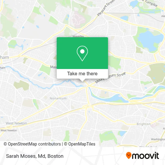
See Sarah Moses, Md, Watertown Town, on the map
Public Transit to Sarah Moses, Md in Watertown Town
Wondering how to get to Sarah Moses, Md in Watertown Town? Moovit helps you find the best way to get to Sarah Moses, Md with step-by-step directions from the nearest public transit station.
Moovit provides free maps and live directions to help you navigate through your city. View schedules, routes, timetables, and find out how long does it take to get to Sarah Moses, Md in real time.
Looking for the nearest stop or station to Sarah Moses, Md? Check out this list of stops closest to your destination: Main St @ Thaxter St; Watertown Square; Belmont; Galen St @ Water St; Boston College; Newtonville.
Bus: 504, 57, 59, 70, 71, 52.Train: FITCHBURG, FRAMINGHAM/WORCESTER.Subway: GREEN LINE B.
Want to see if there’s another route that gets you there at an earlier time? Moovit helps you find alternative routes or times. Get directions from and directions to Sarah Moses, Md easily from the Moovit App or Website.
We make riding to Sarah Moses, Md easy, which is why over 1.7 million users, including users in Watertown Town, trust Moovit as the best app for public transit. You don’t need to download an individual bus app or train app, Moovit is your all-in-one transit app that helps you find the best bus time or train time available.
For information on prices of bus, train and subway, costs and ride fares to Sarah Moses, Md, please check the Moovit app.
Use the app to navigate to popular places including to the airport, hospital, stadium, grocery store, mall, coffee shop, school, college, and university.
Sarah Moses, Md Address: 63 Pleasant St street in Watertown Town
- Amethyst Chiropractic,
- 63 pleasant st, watertown, ma,
- Innovative Promotional CNCPTS,
- Fablevision Studios,
- The Law Office of Alan D. Humbert,
- Laura Graye,
- Soho Nails & Spa,
- Flat Earth Theatre,
- The Watertown Catholic Collaborative of Sacred Heart and Saint Patrick,
- Goddard School,
- Bling,
- Xfinity,
- Watertown,
- Applied Image of Watertown,
- Brewbound Experience,
- Ginger Exchange - Watertown,
- Aspergers Association of New England,
- Farmers' Market Location & Hours,
- Locks,
- Beaverbrook Step, Inc.
Places Near Sarah Moses, Md (Watertown Town)
- Boston Common, Boston,
- Boston Medical Center, Boston,
- Td Garden, Boston,
- Seaport District, Boston,
- Massachusetts General Hospital, Boston,
- Castle Island, Boston,
- Museum Of Science, Boston,
- Boston Children's Hospital, Boston,
- Wilbur Theatre, Boston,
- Quincy Market, Boston,
- Cheers, Boston,
- House Of Blues, Boston,
- Wang Theater, Boston,
- Leader Bank Pavilion (Leader Bank Pavillion), Boston,
- Mgm Music Hall, Boston,
- Prudential Center, Boston,
- Isabella Stewart Gardner Museum, Boston,
- North End, Boston,
- Faneuil Hall, Boston,
- Boston Convention & Exhibition Center, Boston
How to get to popular places in Boston with public transit
Get around Watertown Town by public transit!
Traveling around Watertown Town has never been so easy. See step by step directions as you travel to any attraction, street or major public transit station. View bus and train schedules, arrival times, service alerts and detailed routes on a map, so you know exactly how to get to anywhere in Watertown Town.
When traveling to any destination around Watertown Town use Moovit's Live Directions with Get Off Notifications to know exactly where and how far to walk, how long to wait for your line, and how many stops are left. Moovit will alert you when it's time to get off — no need to constantly re-check whether yours is the next stop.
Wondering how to use public transit in Watertown Town or how to pay for public transit in Watertown Town? Moovit public transit app can help you navigate your way with public transit easily, and at minimum cost. It includes public transit fees, ticket prices, and costs. Looking for a map of Watertown Town public transit lines? Moovit public transit app shows all public transit maps in Watertown Town with all Bus, Train, Subway and Ferry routes and stops on an interactive map.
Boston has 4 transit type(s), including: Bus, Train, Subway and Ferry, operated by several transit agencies, including MBTA, Southeastern Regional Transit Authority, MetroWest Regional Transit Authority, Rhode Island Public Transit Authority, WRTA, Lowell Regional Transit Authority, Merrimack Valley Transit, Montachusett Regional Transit Authority, Cape Cod Regional Transit Authority, Brockton Area Transit Authority, Martha's Vineyard Transit Authority, the WAVE - Nantucket Regional Transit Authority, GATRA, Cape Ann Transportation Authority and Massport