Directions to Sarno Glass (Boston) with public transportation
The following transit lines have routes that pass near Sarno Glass
 Bus: 24, 32, 50.
- Train: FAIRMOUNT, PROVIDENCE/STOUGHTON, FRANKLIN/FOXBORO, FAIRMOUNT LINE SHUTTLE.
- Subway: MATTAPAN LINE.
How to get to Sarno Glass by bus?
Click on the bus route to see step by step directions with maps, line arrival times and updated time schedules.
From Mission Hill, Boston
54 minFrom Andrew Square, Boston
63 minFrom Beth Israel Deaconess Medical Center, Boston
79 minFrom Andrew Station - MBTA - Red Line, Boston
62 minFrom South Shore Plaza, Braintree Town
108 minFrom 1 Brookline Place, Brookline
57 minFrom UMass Boston Campus Center, Boston
91 minFrom Northeastern University, Boston
78 minFrom Boston Children's Hospital, Boston
71 min
How to get to Sarno Glass by train?
Click on the train route to see step by step directions with maps, line arrival times and updated time schedules.
From Mission Hill, Boston
76 minFrom Andrew Square, Boston
45 minFrom Beth Israel Deaconess Medical Center, Boston
68 minFrom Andrew Station - MBTA - Red Line, Boston
45 minFrom UMass Boston Campus Center, Boston
75 minFrom Northeastern University, Boston
72 minFrom Boston Children's Hospital, Boston
72 min
How to get to Sarno Glass by subway?
Click on the subway route to see step by step directions with maps, line arrival times and updated time schedules.
Bus stop near Sarno Glass in Boston
- Summit St @ Neponset Ave, 1 min walk,VIEW
Bus lines to Sarno Glass in Boston
- 24, Wakefield Ave,VIEW
What are the closest stations to Sarno Glass?
The closest stations to Sarno Glass are:
- Summit St @ Neponset Ave is 13 yards away, 1 min walk.
- Hyde Park is 2094 yards away, 25 min walk.
- Fairmount is 3273 yards away, 39 min walk.
Which bus lines stop near Sarno Glass?
These bus lines stop near Sarno Glass: 24, 32, 50.
Which train lines stop near Sarno Glass?
These train lines stop near Sarno Glass: FAIRMOUNT, PROVIDENCE/STOUGHTON.
Which subway line stops near Sarno Glass?
MATTAPAN LINE (Mattapan)
What’s the nearest train station to Sarno Glass in Boston?
The nearest train station to Sarno Glass in Boston is Hyde Park. It’s a 25 min walk away.
What’s the nearest bus station to Sarno Glass in Boston?
The nearest bus station to Sarno Glass in Boston is Summit St @ Neponset Ave. It’s a 1 min walk away.
What time is the first train to Sarno Glass in Boston?
The FAIRMOUNT is the first train that goes to Sarno Glass in Boston. It stops nearby at 4:33 AM.
What time is the last train to Sarno Glass in Boston?
The PROVIDENCE/STOUGHTON is the last train that goes to Sarno Glass in Boston. It stops nearby at 12:22 AM.
What time is the first bus to Sarno Glass in Boston?
The 24 is the first bus that goes to Sarno Glass in Boston. It stops nearby at 5:06 AM.
What time is the last bus to Sarno Glass in Boston?
The 24 is the last bus that goes to Sarno Glass in Boston. It stops nearby at 1:31 AM.
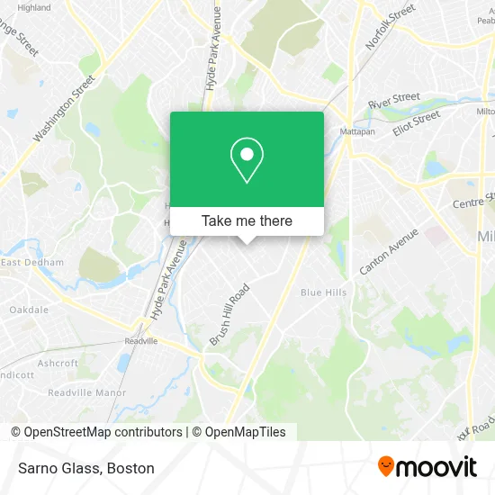
See Sarno Glass, Boston, on the map
Public Transit to Sarno Glass in Boston
Wondering how to get to Sarno Glass in Boston? Moovit helps you find the best way to get to Sarno Glass with step-by-step directions from the nearest public transit station.
Moovit provides free maps and live directions to help you navigate through your city. View schedules, routes, timetables, and find out how long does it take to get to Sarno Glass in real time.
Looking for the nearest stop or station to Sarno Glass? Check out this list of stops closest to your destination: Summit St @ Neponset Ave; Hyde Park; Fairmount.
Bus: 24, 32, 50.Train: FAIRMOUNT, PROVIDENCE/STOUGHTON, FRANKLIN/FOXBORO, FAIRMOUNT LINE SHUTTLE.Subway: MATTAPAN LINE.
Want to see if there’s another route that gets you there at an earlier time? Moovit helps you find alternative routes or times. Get directions from and directions to Sarno Glass easily from the Moovit App or Website.
We make riding to Sarno Glass easy, which is why over 1.7 million users, including users in Boston, trust Moovit as the best app for public transit. You don’t need to download an individual bus app or train app, Moovit is your all-in-one transit app that helps you find the best bus time or train time available.
For information on prices of bus, subway and train, costs and ride fares to Sarno Glass, please check the Moovit app.
Use the app to navigate to popular places including to the airport, hospital, stadium, grocery store, mall, coffee shop, school, college, and university.
Sarno Glass Address: 72 Summit St street in Boston
- Ampm Locksmith,
- Monalisa Handmade,
- Parlon Services,
- Truman 24 7 Available Locksmith,
- Merriweather's Flowers,
- Sergeant at Arms Office,
- USPS,
- American Criminal Justice Solution,
- Recap Investments,
- Paladin Personnel,
- Forever Young Adulting Health Center,
- Mahoney James J,
- Pernix Equity Investments,
- The UPS Store,
- Krispy Krunchy Chicken,
- Qualified Plumbing Service,
- MBTA Fairmount,
- March Iron,
- bp,
- Varian Medical Systems
Places Near Sarno Glass (Boston)
- Cheers, Boston,
- Museum Of Science, Boston,
- House Of Blues, Boston,
- Seaport District, Boston,
- Boston Children's Hospital, Boston,
- Wang Theater, Boston,
- Massachusetts General Hospital, Boston,
- Leader Bank Pavilion (Leader Bank Pavillion), Boston,
- Boston Convention & Exhibition Center, Boston,
- Td Garden, Boston,
- Prudential Center, Boston,
- Boston Common, Boston,
- Mgm Music Hall, Boston,
- Wilbur Theatre, Boston,
- Quincy Market, Boston,
- Isabella Stewart Gardner Museum, Boston,
- Castle Island, Boston,
- Boston Medical Center, Boston,
- North End, Boston,
- Faneuil Hall, Boston
How to get to popular places in Boston with public transit
Get around Boston by public transit!
Traveling around Boston has never been so easy. See step by step directions as you travel to any attraction, street or major public transit station. View bus and train schedules, arrival times, service alerts and detailed routes on a map, so you know exactly how to get to anywhere in Boston.
When traveling to any destination around Boston use Moovit's Live Directions with Get Off Notifications to know exactly where and how far to walk, how long to wait for your line, and how many stops are left. Moovit will alert you when it's time to get off — no need to constantly re-check whether yours is the next stop.
Wondering how to use public transit in Boston or how to pay for public transit in Boston? Moovit public transit app can help you navigate your way with public transit easily, and at minimum cost. It includes public transit fees, ticket prices, and costs. Looking for a map of Boston public transit lines? Moovit public transit app shows all public transit maps in Boston with all Bus, Train, Subway and Ferry routes and stops on an interactive map.
Boston has 4 transit type(s), including: Bus, Train, Subway and Ferry, operated by several transit agencies, including MBTA, Southeastern Regional Transit Authority, MetroWest Regional Transit Authority, Rhode Island Public Transit Authority, WRTA, Lowell Regional Transit Authority, Merrimack Valley Transit, Montachusett Regional Transit Authority, Cape Cod Regional Transit Authority, Brockton Area Transit Authority, Martha's Vineyard Transit Authority, the WAVE - Nantucket Regional Transit Authority, GATRA, Cape Ann Transportation Authority and Massport