Directions to Saugus Bike Trail with public transportation
The following transit lines have routes that pass near Saugus Bike Trail
 Bus: 429, 430, 428.
- Train: NEWBURYPORT/ROCKPORT.
How to get to Saugus Bike Trail by bus?
Click on the bus route to see step by step directions with maps, line arrival times and updated time schedules.
From Courtyard by Marriott Boston Logan Airport
84 minFrom Rental Car Center - Logan Airport
72 minFrom DoubleTree by Hilton Boston Logan Airport Chelsea
59 minFrom North Shore Mall
107 minFrom Massachusetts Water Resource Authority (MWRA)
75 minFrom Malden, MA
26 minFrom East Boston
76 minFrom The Schrafft Center
45 minFrom Mass Eye And Ear
50 minFrom Costco
56 min
Bus stop near Saugus Bike Trail
- Central St @ Hamilton St, 1 min walk,VIEW
Train station near Saugus Bike Trail
- River Works, 53 min walk,VIEW
Bus lines to Saugus Bike Trail
What are the closest stations to Saugus Bike Trail?
The closest stations to Saugus Bike Trail are:
- Central St @ Hamilton St is 28 yards away, 1 min walk.
- River Works is 4534 yards away, 53 min walk.
Which bus lines stop near Saugus Bike Trail?
These bus lines stop near Saugus Bike Trail: 429, 430.
What’s the nearest bus station to Saugus Bike Trail?
The nearest bus station to Saugus Bike Trail is Central St @ Hamilton St. It’s a 1 min walk away.
What time is the first train to Saugus Bike Trail?
The NEWBURYPORT/ROCKPORT is the first train that goes to Saugus Bike Trail. It stops nearby at 5:33 AM.
What time is the last train to Saugus Bike Trail?
The NEWBURYPORT/ROCKPORT is the last train that goes to Saugus Bike Trail. It stops nearby at 12:13 AM.
What time is the first bus to Saugus Bike Trail?
The 428 is the first bus that goes to Saugus Bike Trail. It stops nearby at 6:03 AM.
What time is the last bus to Saugus Bike Trail?
The 430 is the last bus that goes to Saugus Bike Trail. It stops nearby at 10:15 PM.
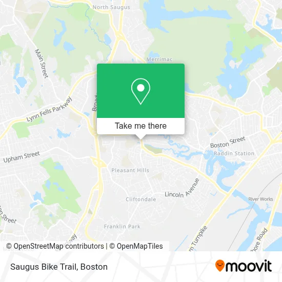
See Saugus Bike Trail on the map
Public Transportation to Saugus Bike Trail
Wondering how to get to Saugus Bike Trail? Moovit helps you find the best way to get to Saugus Bike Trail with step-by-step directions from the nearest public transit station.
Moovit provides free maps and live directions to help you navigate through your city. View schedules, routes, timetables, and find out how long does it take to get to Saugus Bike Trail in real time.
Looking for the nearest stop or station to Saugus Bike Trail? Check out this list of stops closest to your destination: Central St @ Hamilton St; River Works.
Bus: 429, 430, 428.Train: NEWBURYPORT/ROCKPORT.
Want to see if there’s another route that gets you there at an earlier time? Moovit helps you find alternative routes or times. Get directions from and directions to Saugus Bike Trail easily from the Moovit App or Website.
We make riding to Saugus Bike Trail easy, which is why over 1.7 million users, including users in Saugus, trust Moovit as the best app for public transit. You don’t need to download an individual bus app or train app, Moovit is your all-in-one transit app that helps you find the best bus time or train time available.
For information on prices of bus and subway, costs and ride fares to Saugus Bike Trail, please check the Moovit app.
Use the app to navigate to popular places including to the airport, hospital, stadium, grocery store, mall, coffee shop, school, college, and university.
Location: Saugus, Boston
- Kavida Healthcare, Inc.,
- Quality Homecare,
- USA Car Service,
- Law Office of Charles C. Donoghue,
- Briggs,
- National Life Insurance,
- Congregation Ahavas Sholom,
- Greg Tully's Realty Page,
- Exclusive Precision Barbers,
- Root One Salon (Rootone Hair Salon Day Spa),
- Yayi's Juice and Smoothies,
- Saugus Karate,
- First Congregational Church-Ucc Saugus,
- William Sutton Lodge A.F. & A.M.,
- Marao Burgers Saugus,
- Plumbers Water Heater Replacement,
- Lauren Angelo,
- Dance Junction,
- Saugus Town Police Department,
- Saugus, Massachusetts
Places Near Saugus Bike Trail
- Wang Theater, Boston,
- Museum Of Science, Boston,
- Massachusetts General Hospital, Boston,
- Isabella Stewart Gardner Museum, Boston,
- Seaport District, Boston,
- Boston Common, Boston,
- Wilbur Theatre, Boston,
- Boston Medical Center, Boston,
- Td Garden, Boston,
- House Of Blues, Boston,
- Boston Convention & Exhibition Center, Boston,
- Leader Bank Pavilion (Leader Bank Pavillion), Boston,
- North End, Boston,
- Castle Island, Boston,
- Cheers, Boston,
- Prudential Center, Boston,
- Mgm Music Hall, Boston,
- Faneuil Hall, Boston,
- Quincy Market, Boston,
- Boston Children's Hospital, Boston
How to get to popular places in Boston with public transit
Get around Saugus by public transit!
Traveling around Saugus has never been so easy. See step by step directions as you travel to any attraction, street or major public transit station. View bus and train schedules, arrival times, service alerts and detailed routes on a map, so you know exactly how to get to anywhere in Saugus.
When traveling to any destination around Saugus use Moovit's Live Directions with Get Off Notifications to know exactly where and how far to walk, how long to wait for your line, and how many stops are left. Moovit will alert you when it's time to get off — no need to constantly re-check whether yours is the next stop.
Wondering how to use public transit in Saugus or how to pay for public transit in Saugus? Moovit public transit app can help you navigate your way with public transit easily, and at minimum cost. It includes public transit fees, ticket prices, and costs. Looking for a map of Saugus public transit lines? Moovit public transit app shows all public transit maps in Saugus with all Bus, Train, Subway and Ferry routes and stops on an interactive map.
Boston has 4 transit type(s), including: Bus, Train, Subway and Ferry, operated by several transit agencies, including MBTA, Southeastern Regional Transit Authority, MetroWest Regional Transit Authority, Rhode Island Public Transit Authority, WRTA, Lowell Regional Transit Authority, Merrimack Valley Transit, Montachusett Regional Transit Authority, Cape Cod Regional Transit Authority, Brockton Area Transit Authority, Martha's Vineyard Transit Authority, the WAVE - Nantucket Regional Transit Authority, GATRA, Cape Ann Transportation Authority and Massport