Directions to Sbarro (Arlington County) with public transportation
The following transit lines have routes that pass near Sbarro
 Bus: 35, 42, DC, 393, 394.
- Train: MANASSAS LINE, FREDERICKSBURG LINE.
- Metro: BLUE, YELLOW, METRO STATION CLOSURE SHUTTLE.
How to get to Sbarro by bus?
Click on the bus route to see step by step directions with maps, line arrival times and updated time schedules.
From The Westin Arlington Gateway, Arlington County
40 minFrom The Cheesecake Factory, Washington
92 minFrom Fannie Mae, Washington
81 minFrom The Capital Wheel at the National Harbor, Prince George's County
77 minFrom Arboretum, Washington
140 minFrom Walmart Supercenter, Washington
123 minFrom St John's College High School, Washington
140 minFrom REI, Washington
109 minFrom Capital Turnaround, Washington
108 minFrom Embassy Suites at the Chevy Chase Pavilion, Washington
92 min
How to get to Sbarro by train?
Click on the train route to see step by step directions with maps, line arrival times and updated time schedules.
How to get to Sbarro by metro?
Click on the metro route to see step by step directions with maps, line arrival times and updated time schedules.
From The Westin Arlington Gateway, Arlington County
29 minFrom The Cheesecake Factory, Washington
34 minFrom Fannie Mae, Washington
47 minFrom Walmart Supercenter, Washington
59 minFrom REI, Washington
28 minFrom Capital Turnaround, Washington
31 minFrom Embassy Suites at the Chevy Chase Pavilion, Washington
34 min
Bus stops near Sbarro in Arlington County
- Pentagon Metrorail Station (Bus Bay L7), 6 min walk,VIEW
- Metro Pentagon Bay L7, 6 min walk,VIEW
- Pentagon Transit Ctr + Bus Bay U7, 6 min walk,VIEW
- Pentagon Station & Bus Bay U10, 6 min walk,VIEW
- Pentagon Station & Bus Bay U11, 6 min walk,VIEW
- Pentagon+Bay U6, 7 min walk,VIEW
- Pentagon Transit Ctr + Bus Bay U5, 7 min walk,VIEW
- Pentagon Station & Bus Bay L4 (Hov), 7 min walk,VIEW
- Pentagon Metro, 7 min walk,VIEW
- Pentagon+Bay U13, 7 min walk,VIEW
- Pentagon Transit Center Bay U3, 8 min walk,VIEW
- Metro Pentagon Bay L4, 8 min walk,VIEW
- Pentagon Bus Bay L6, 8 min walk,VIEW
- Pentagon+Bay L3, 8 min walk,VIEW
Metro stations near Sbarro in Arlington County
Train station near Sbarro in Arlington County
- Crystal City, 40 min walk,VIEW
Bus lines to Sbarro in Arlington County
- DC, Front Royal,VIEW
- 393, 393 Saratoga,VIEW
- 394, 394 Saratoga,VIEW
- 395, 395 Pentagon,VIEW
- 396, 396 Springfield,VIEW
- 35, Pentagon Transit Center,VIEW
- F44, East To Pentagon,VIEW
- A11, North To Pentagon,VIEW
- A25, South To Landmark,VIEW
- A66, East To Pentagon,VIEW
- A90, North To Pentagon,VIEW
- A27, North To Pentagon,VIEW
- F85, West To Annandale,VIEW
- SLC, Route 17 & Spotsy Lots,VIEW
- 563, Woodbridge - Neabsco Garage,VIEW
- 612, Gainesville - Xfer at Pentagon To Woodbridge/Spotsy,VIEW
- 612-WAR, Pentagon / Gainesville / Warrenton,VIEW
- 923, Pentagon / L'Enfant / Navy Yard,VIEW
- 932, Rosslyn Ballston / Xfer at Pentagon To 981 For State Department,VIEW
- 942, Staffordboro Lot,VIEW
What are the closest stations to Sbarro?
The closest stations to Sbarro are:
- Pentagon Metrorail Station (Bus Bay L7) is 435 yards away, 6 min walk.
- Metro Pentagon Bay L7 is 456 yards away, 6 min walk.
- Pentagon Transit Ctr + Bus Bay U7 is 481 yards away, 6 min walk.
- Pentagon Station & Bus Bay U10 is 492 yards away, 6 min walk.
- Pentagon Station & Bus Bay U11 is 507 yards away, 6 min walk.
- Pentagon+Bay U6 is 512 yards away, 7 min walk.
- Pentagon Transit Ctr + Bus Bay U5 is 536 yards away, 7 min walk.
- Pentagon Station & Bus Bay L4 (Hov) is 552 yards away, 7 min walk.
- Pentagon Metro is 553 yards away, 7 min walk.
- Pentagon+Bay U13 is 562 yards away, 7 min walk.
- Pentagon Transit Center Bay U3 is 594 yards away, 8 min walk.
- Metro Pentagon Bay L4 is 606 yards away, 8 min walk.
- Pentagon Bus Bay L6 is 644 yards away, 8 min walk.
- Pentagon+Bay L3 is 669 yards away, 8 min walk.
- Arlington Cemetery is 1224 yards away, 15 min walk.
- Pentagon is 3099 yards away, 38 min walk.
- Crystal City is 3260 yards away, 38 min walk.
Which bus lines stop near Sbarro?
These bus lines stop near Sbarro: 35, 42.
Which train line stops near Sbarro?
MANASSAS LINE (Broad Run)
Which metro lines stop near Sbarro?
These metro lines stop near Sbarro: BLUE, YELLOW.
What’s the nearest metro station to Sbarro in Arlington County?
The nearest metro station to Sbarro in Arlington County is Arlington Cemetery. It’s a 15 min walk away.
What’s the nearest bus station to Sbarro in Arlington County?
The nearest bus stations to Sbarro in Arlington County are Pentagon Metrorail Station (Bus Bay L7), Metro Pentagon Bay L7, Pentagon Transit Ctr + Bus Bay U7, Pentagon Station & Bus Bay U10 and Pentagon Station & Bus Bay U11. The closest one is a 6 min walk away.
What time is the first metro to Sbarro in Arlington County?
The YELLOW is the first metro that goes to Sbarro in Arlington County. It stops nearby at 5:13 AM.
What time is the last metro to Sbarro in Arlington County?
The BLUE is the last metro that goes to Sbarro in Arlington County. It stops nearby at 12:24 AM.
What time is the first train to Sbarro in Arlington County?
The MANASSAS LINE is the first train that goes to Sbarro in Arlington County. It stops nearby at 6:04 AM.
What time is the last train to Sbarro in Arlington County?
The MANASSAS LINE is the last train that goes to Sbarro in Arlington County. It stops nearby at 7:15 PM.
What time is the first bus to Sbarro in Arlington County?
The 35 is the first bus that goes to Sbarro in Arlington County. It stops nearby at 4:49 AM.
What time is the last bus to Sbarro in Arlington County?
The 35 is the last bus that goes to Sbarro in Arlington County. It stops nearby at 2:16 AM.
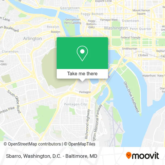
See Sbarro, Arlington County, on the map
Public Transit to Sbarro in Arlington County
Wondering how to get to Sbarro in Arlington County? Moovit helps you find the best way to get to Sbarro with step-by-step directions from the nearest public transit station.
Moovit provides free maps and live directions to help you navigate through your city. View schedules, routes, timetables, and find out how long does it take to get to Sbarro in real time.
Looking for the nearest stop or station to Sbarro? Check out this list of stops closest to your destination: Pentagon Metrorail Station (Bus Bay L7); Metro Pentagon Bay L7; Pentagon Transit Ctr + Bus Bay U7; Pentagon Station & Bus Bay U10; Pentagon Station & Bus Bay U11; Pentagon+Bay U6; Pentagon Transit Ctr + Bus Bay U5; Pentagon Station & Bus Bay L4 (Hov); Pentagon Metro; Pentagon+Bay U13; Pentagon Transit Center Bay U3; Metro Pentagon Bay L4; Pentagon Bus Bay L6; Pentagon+Bay L3; Arlington Cemetery; Pentagon; Crystal City.
Bus: 35, 42, DC, 393, 394, 395, 396.Train: MANASSAS LINE, FREDERICKSBURG LINE.Metro: BLUE, YELLOW, METRO STATION CLOSURE SHUTTLE.
Want to see if there’s another route that gets you there at an earlier time? Moovit helps you find alternative routes or times. Get directions from and directions to Sbarro easily from the Moovit App or Website.
We make riding to Sbarro easy, which is why over 1.7 million users, including users in Arlington County, trust Moovit as the best app for public transit. You don’t need to download an individual bus app or train app, Moovit is your all-in-one transit app that helps you find the best bus time or train time available.
For information on prices of metro, bus and train, costs and ride fares to Sbarro, please check the Moovit app.
Use the app to navigate to popular places including to the airport, hospital, stadium, grocery store, mall, coffee shop, school, college, and university.
Sbarro Address: 2025 Concessions Pent street in Arlington County
- Burger King,
- O Pentágono,
- Pentagon Office Building Complex,
- Pentagon Library and Conference Center,
- DiLorenzo Tricare Healthcare Clinic,
- The Pentagon,
- Pentagon Transit Center,
- Pentagon Metro Station,
- Pentagon,
- Pentagon Memorial,
- The Pentagon 9/11 Memorial,
- 2 North Rotary Road,
- South Parking Pentagon,
- Pentagon Connector Parking Lot,
- Pentagon North Parking Lot,
- Pentagon Visitor Center,
- Pentagon Pass Office,
- Slug Lines (Pentagon),
- The Pentagon, Hall Of Heroes,
- Marine Corps Marathon
Places Near Sbarro (Arlington County)
- Rock Creek Tennis Center, Washington,
- The Anthem, Washington,
- National Theatre, Washington,
- Capital One Arena, Washington,
- Camden Yards, Baltimore,
- Westfield Montgomery Mall, Montgomery County,
- Museum Of The Bible, Washington,
- Sibley Memorial Hospital, Washington,
- Amazon Hq2, Arlington County,
- PG Mall, Prince George's County,
- Basilica of the National Shrine, Washington,
- National Museum of African American History and Culture, Washington,
- Warner Theatre, Washington,
- Georgetown, Washington,
- M&T Bank Stadium, Baltimore,
- Pennsylvania Ave NW (3rd st and pennsylvania), Washington,
- Washington DC VA Medical Center, Washington,
- Washington National Cathedral, Washington,
- Marriott Marquis Washington, DC, Washington,
- National Zoo, Washington
How to get to popular places in Washington, D.C. - Baltimore, MD with public transit
Get around Arlington County by public transit!
Traveling around Arlington County has never been so easy. See step by step directions as you travel to any attraction, street or major public transit station. View bus and train schedules, arrival times, service alerts and detailed routes on a map, so you know exactly how to get to anywhere in Arlington County.
When traveling to any destination around Arlington County use Moovit's Live Directions with Get Off Notifications to know exactly where and how far to walk, how long to wait for your line, and how many stops are left. Moovit will alert you when it's time to get off — no need to constantly re-check whether yours is the next stop.
Wondering how to use public transit in Arlington County or how to pay for public transit in Arlington County? Moovit public transit app can help you navigate your way with public transit easily, and at minimum cost. It includes public transit fees, ticket prices, and costs. Looking for a map of Arlington County public transit lines? Moovit public transit app shows all public transit maps in Arlington County with all Bus, Train, Metro, Light Rail and Ferry routes and stops on an interactive map.
Washington, D.C. - Baltimore, MD has 5 transit type(s), including: Bus, Train, Metro, Light Rail and Ferry, operated by several transit agencies, including WMATA, Montgomery County Ride On, Fairfax Connector, TheBus, PRTC, DASH - Alexandria, Arlington Transit (ART), RTA of Central Maryland, MDOT MTA, MDOT MTA Light RailLink, MDOT MTA Commuter Bus, MDOT MTA Local Bus, FXBGO!, Virginia Railway Express (VRE) and MARC