Directions to Ups Access Point Location (Arlington County) with public transportation
The following transit lines have routes that pass near Ups Access Point Location
 Bus: 35, 42, 612-WAR, A28, 306.
- Train: MANASSAS LINE, FREDERICKSBURG LINE.
- Metro: BLUE, YELLOW, METRO STATION CLOSURE SHUTTLE.
How to get to Ups Access Point Location by bus?
Click on the bus route to see step by step directions with maps, line arrival times and updated time schedules.
From C&O Canal Towpath, Washington
89 minFrom The Churchill Hotel, Washington
92 minFrom The Capital Wheel at the National Harbor, Prince George's County
77 minFrom St John's College High School, Washington
139 minFrom Kaiser Permanente - Falls Church Medical Center, Falls Church
61 minFrom AMC Theatres-Hoffman Center 22, Alexandria
54 minFrom Chevy Chase Metro Plaza, Washington
88 minFrom Anacostia Park, Washington
68 minFrom Rock Creek Tennis Center, Washington
110 minFrom The Cheesecake Factory, Washington
91 min
How to get to Ups Access Point Location by train?
Click on the train route to see step by step directions with maps, line arrival times and updated time schedules.
How to get to Ups Access Point Location by metro?
Click on the metro route to see step by step directions with maps, line arrival times and updated time schedules.
Bus stops near Ups Access Point Location in Arlington County
- Metro Pentagon Bay L4, 7 min walk,VIEW
- Metro Pentagon Bay L7, 10 min walk,VIEW
- Pentagon Transit Ctr + Bus Bay U7, 10 min walk,VIEW
- Pentagon Station & Bus Bay U10, 11 min walk,VIEW
- Pentagon Station & Bus Bay U11, 11 min walk,VIEW
- Pentagon+Bay U6, 11 min walk,VIEW
- Pentagon Transit Ctr + Bus Bay U5, 11 min walk,VIEW
- Pentagon Station & Bus Bay L4 (Hov), 11 min walk,VIEW
- Pentagon Metro, 11 min walk,VIEW
- Pentagon+Bay U13, 11 min walk,VIEW
- Pentagon+Bay L3, 12 min walk,VIEW
- Pentagon Transit Center Bay U3, 12 min walk,VIEW
- Pentagon Bus Bay L6, 12 min walk,VIEW
- Pentagon Metrorail Station (Bus Bay L7), 13 min walk,VIEW
Metro stations near Ups Access Point Location in Arlington County
Train station near Ups Access Point Location in Arlington County
- Crystal City, 42 min walk,VIEW
Bus lines to Ups Access Point Location in Arlington County
- 306, 306 G.M.U. Via Braddock Rd,VIEW
- 834, 834 Pentagon,VIEW
- 835, 835 Pentagon,VIEW
- 393, 393 Saratoga,VIEW
- 394, 394 Saratoga,VIEW
- 395, 395 Pentagon,VIEW
- 396, 396 Springfield,VIEW
- 35, Pentagon Transit Center,VIEW
- F44, East To Pentagon,VIEW
- A11, North To Pentagon,VIEW
- A25, South To Landmark,VIEW
- A66, East To Pentagon,VIEW
- A90, North To Pentagon,VIEW
- A27, North To Pentagon,VIEW
- F85, West To Annandale,VIEW
- SLC, Route 17 & Spotsy Lots,VIEW
- 563, Woodbridge - Neabsco Garage,VIEW
- 612, Gainesville - Xfer at Pentagon To Woodbridge/Spotsy,VIEW
- 612-WAR, Pentagon / Gainesville / Warrenton,VIEW
- 923, Pentagon / L'Enfant / Navy Yard,VIEW
What are the closest stations to Ups Access Point Location?
The closest stations to Ups Access Point Location are:
- Metro Pentagon Bay L4 is 538 yards away, 7 min walk.
- Metro Pentagon Bay L7 is 825 yards away, 10 min walk.
- Pentagon Transit Ctr + Bus Bay U7 is 851 yards away, 10 min walk.
- Pentagon Station & Bus Bay U10 is 862 yards away, 11 min walk.
- Pentagon Station & Bus Bay U11 is 877 yards away, 11 min walk.
- Pentagon+Bay U6 is 881 yards away, 11 min walk.
- Pentagon Transit Ctr + Bus Bay U5 is 906 yards away, 11 min walk.
- Pentagon Station & Bus Bay L4 (Hov) is 921 yards away, 11 min walk.
- Pentagon Metro is 923 yards away, 11 min walk.
- Pentagon+Bay U13 is 932 yards away, 11 min walk.
- Pentagon+Bay L3 is 973 yards away, 12 min walk.
- Pentagon Transit Center Bay U3 is 985 yards away, 12 min walk.
- Pentagon Bus Bay L6 is 997 yards away, 12 min walk.
- Pentagon is 1032 yards away, 13 min walk.
- Pentagon Metrorail Station (Bus Bay L7) is 1042 yards away, 13 min walk.
- Crystal City is 3570 yards away, 42 min walk.
Which bus lines stop near Ups Access Point Location?
These bus lines stop near Ups Access Point Location: 35, 42, 612-WAR, A28.
Which train line stops near Ups Access Point Location?
MANASSAS LINE (Broad Run)
Which metro lines stop near Ups Access Point Location?
These metro lines stop near Ups Access Point Location: BLUE, YELLOW.
What’s the nearest metro station to Ups Access Point Location in Arlington County?
The nearest metro station to Ups Access Point Location in Arlington County is Pentagon. It’s a 13 min walk away.
What’s the nearest bus station to Ups Access Point Location in Arlington County?
The nearest bus station to Ups Access Point Location in Arlington County is Metro Pentagon Bay L4. It’s a 7 min walk away.
What time is the first metro to Ups Access Point Location in Arlington County?
The YELLOW is the first metro that goes to Ups Access Point Location in Arlington County. It stops nearby at 5:13 AM.
What time is the last metro to Ups Access Point Location in Arlington County?
The BLUE is the last metro that goes to Ups Access Point Location in Arlington County. It stops nearby at 12:24 AM.
What time is the first train to Ups Access Point Location in Arlington County?
The MANASSAS LINE is the first train that goes to Ups Access Point Location in Arlington County. It stops nearby at 6:04 AM.
What time is the last train to Ups Access Point Location in Arlington County?
The MANASSAS LINE is the last train that goes to Ups Access Point Location in Arlington County. It stops nearby at 7:15 PM.
What time is the first bus to Ups Access Point Location in Arlington County?
The 35 is the first bus that goes to Ups Access Point Location in Arlington County. It stops nearby at 4:49 AM.
What time is the last bus to Ups Access Point Location in Arlington County?
The 35 is the last bus that goes to Ups Access Point Location in Arlington County. It stops nearby at 2:16 AM.
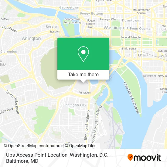
See Ups Access Point Location, Arlington County, on the map
Public Transit to Ups Access Point Location in Arlington County
Wondering how to get to Ups Access Point Location in Arlington County? Moovit helps you find the best way to get to Ups Access Point Location with step-by-step directions from the nearest public transit station.
Moovit provides free maps and live directions to help you navigate through your city. View schedules, routes, timetables, and find out how long does it take to get to Ups Access Point Location in real time.
Looking for the nearest stop or station to Ups Access Point Location? Check out this list of stops closest to your destination: Metro Pentagon Bay L4; Metro Pentagon Bay L7; Pentagon Transit Ctr + Bus Bay U7; Pentagon Station & Bus Bay U10; Pentagon Station & Bus Bay U11; Pentagon+Bay U6; Pentagon Transit Ctr + Bus Bay U5; Pentagon Station & Bus Bay L4 (Hov); Pentagon Metro; Pentagon+Bay U13; Pentagon+Bay L3; Pentagon Transit Center Bay U3; Pentagon Bus Bay L6; Pentagon; Pentagon Metrorail Station (Bus Bay L7); Crystal City.
Bus: 35, 42, 612-WAR, A28, 306, 834, 835, 393, 394, 395, 396.Train: MANASSAS LINE, FREDERICKSBURG LINE.Metro: BLUE, YELLOW, METRO STATION CLOSURE SHUTTLE.
Want to see if there’s another route that gets you there at an earlier time? Moovit helps you find alternative routes or times. Get directions from and directions to Ups Access Point Location easily from the Moovit App or Website.
We make riding to Ups Access Point Location easy, which is why over 1.7 million users, including users in Arlington County, trust Moovit as the best app for public transit. You don’t need to download an individual bus app or train app, Moovit is your all-in-one transit app that helps you find the best bus time or train time available.
For information on prices of metro, bus and train, costs and ride fares to Ups Access Point Location, please check the Moovit app.
Use the app to navigate to popular places including to the airport, hospital, stadium, grocery store, mall, coffee shop, school, college, and university.
Ups Access Point Location Address: ROOM 2B1080 THE PENTAGON street in Arlington County
- O Pentágono,
- Pentagon Office Building Complex,
- Burger King,
- Pentagon Library and Conference Center,
- DiLorenzo Tricare Healthcare Clinic,
- The Pentagon,
- Pentagon Transit Center,
- Pentagon Connector Parking Lot,
- Pentagon Metro Station,
- Pentagon,
- Pentagon Memorial,
- 2 North Rotary Road,
- The Pentagon 9/11 Memorial,
- South Parking Pentagon,
- Pentagon Pass Office,
- Pentagon Heating & Refrigeration Plant,
- Pentagon Visitor Center,
- Marine Corps Marathon,
- The Pentagon, Hall Of Heroes,
- Pentagon North Parking Lot
Places Near Ups Access Point Location (Arlington County)
- The Anthem, Washington,
- Basilica of the National Shrine, Washington,
- Amazon Hq2, Arlington County,
- Pennsylvania Ave NW (3rd st and pennsylvania), Washington,
- Warner Theatre, Washington,
- Washington DC VA Medical Center, Washington,
- M&T Bank Stadium, Baltimore,
- Capital One Arena, Washington,
- Sibley Memorial Hospital, Washington,
- PG Mall, Prince George's County,
- Washington National Cathedral, Washington,
- Westfield Montgomery Mall, Montgomery County,
- Museum Of The Bible, Washington,
- Camden Yards, Baltimore,
- National Zoo, Washington,
- Georgetown, Washington,
- National Museum of African American History and Culture, Washington,
- Rock Creek Tennis Center, Washington,
- National Theatre, Washington,
- Marriott Marquis Washington, DC, Washington
How to get to popular places in Washington, D.C. - Baltimore, MD with public transit
Get around Arlington County by public transit!
Traveling around Arlington County has never been so easy. See step by step directions as you travel to any attraction, street or major public transit station. View bus and train schedules, arrival times, service alerts and detailed routes on a map, so you know exactly how to get to anywhere in Arlington County.
When traveling to any destination around Arlington County use Moovit's Live Directions with Get Off Notifications to know exactly where and how far to walk, how long to wait for your line, and how many stops are left. Moovit will alert you when it's time to get off — no need to constantly re-check whether yours is the next stop.
Wondering how to use public transit in Arlington County or how to pay for public transit in Arlington County? Moovit public transit app can help you navigate your way with public transit easily, and at minimum cost. It includes public transit fees, ticket prices, and costs. Looking for a map of Arlington County public transit lines? Moovit public transit app shows all public transit maps in Arlington County with all Bus, Train, Metro, Light Rail and Ferry routes and stops on an interactive map.
Washington, D.C. - Baltimore, MD has 5 transit type(s), including: Bus, Train, Metro, Light Rail and Ferry, operated by several transit agencies, including WMATA, Montgomery County Ride On, Fairfax Connector, TheBus, PRTC, DASH - Alexandria, Arlington Transit (ART), RTA of Central Maryland, MDOT MTA, MDOT MTA Light RailLink, MDOT MTA Commuter Bus, MDOT MTA Local Bus, FXBGO!, Virginia Railway Express (VRE) and MARC