How to get to Scalp Resolution Micropigmentation by bus?
Click on the bus route to see step by step directions with maps, line arrival times and updated time schedules.
Bus stop near Scalp Resolution Micropigmentation in Boston
- Hartford Opp Elsie, 3 min walk,VIEW
Bus lines to Scalp Resolution Micropigmentation in Boston
What are the closest stations to Scalp Resolution Micropigmentation?
The closest stations to Scalp Resolution Micropigmentation are:
- Hartford Opp Elsie is 163 yards away, 3 min walk.
Which bus line stops near Scalp Resolution Micropigmentation?
28 (Job Lot (Johnston))
What’s the nearest bus station to Scalp Resolution Micropigmentation in Boston?
The nearest bus station to Scalp Resolution Micropigmentation in Boston is Hartford Opp Elsie. It’s a 3 min walk away.
What time is the first bus to Scalp Resolution Micropigmentation in Boston?
The 28 is the first bus that goes to Scalp Resolution Micropigmentation in Boston. It stops nearby at 5:22 AM.
What time is the last bus to Scalp Resolution Micropigmentation in Boston?
The 28 is the last bus that goes to Scalp Resolution Micropigmentation in Boston. It stops nearby at 10:21 PM.
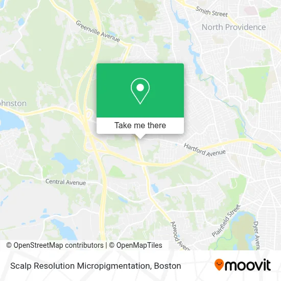
See Scalp Resolution Micropigmentation, Boston, on the map
Public Transit to Scalp Resolution Micropigmentation in Boston
Wondering how to get to Scalp Resolution Micropigmentation in Boston? Moovit helps you find the best way to get to Scalp Resolution Micropigmentation with step-by-step directions from the nearest public transit station.
Moovit provides free maps and live directions to help you navigate through your city. View schedules, routes, timetables, and find out how long does it take to get to Scalp Resolution Micropigmentation in real time.
Looking for the nearest stop or station to Scalp Resolution Micropigmentation? Check out this list of stops closest to your destination: Hartford Opp Elsie.
Bus: 28, 10X.
Want to see if there’s another route that gets you there at an earlier time? Moovit helps you find alternative routes or times. Get directions from and directions to Scalp Resolution Micropigmentation easily from the Moovit App or Website.
We make riding to Scalp Resolution Micropigmentation easy, which is why over 1.7 million users, including users in Boston, trust Moovit as the best app for public transit. You don’t need to download an individual bus app or train app, Moovit is your all-in-one transit app that helps you find the best bus time or train time available.
For information on prices of bus and train, costs and ride fares to Scalp Resolution Micropigmentation, please check the Moovit app.
Use the app to navigate to popular places including to the airport, hospital, stadium, grocery store, mall, coffee shop, school, college, and university.
Scalp Resolution Micropigmentation Address: 1481 Atwood Ave street in Boston
- Freshmen Barbershop,
- Eminence Salon Suites,
- Sicp Enterprises,
- All 4 Paws,
- Dad's Place Cigar Bar & Lounge,
- Murph's Card Town,
- Future Fashion 401,
- Johnston Locksmith Shop,
- Nancy Ragosta Optometrist,
- QSPS Housing Solutions,
- Wise Guys Deli,
- Ledoux Petruska & Co.,
- A Gazerro & Associates,
- Johnston, RI,
- Store,
- Town Hall Plaza,
- T-Mobile,
- Town Fair Tire in Johnston, Ri,
- STARBUCKS,
- Either Ore Jewelers
Places Near Scalp Resolution Micropigmentation (Boston)
- Quincy Market, Boston,
- Museum Of Science, Boston,
- Cheers, Boston,
- North End, Boston,
- Castle Island, Boston,
- Seaport District, Boston,
- Wilbur Theatre, Boston,
- Td Garden, Boston,
- Mgm Music Hall, Boston,
- Isabella Stewart Gardner Museum, Boston,
- Boston Children's Hospital, Boston,
- Boston Medical Center, Boston,
- Wang Theater, Boston,
- House Of Blues, Boston,
- Prudential Center, Boston,
- Faneuil Hall, Boston,
- Leader Bank Pavilion (Leader Bank Pavillion), Boston,
- Boston Common, Boston,
- Massachusetts General Hospital, Boston,
- Boston Convention & Exhibition Center, Boston
How to get to popular places in Boston with public transit
Get around Boston by public transit!
Traveling around Boston has never been so easy. See step by step directions as you travel to any attraction, street or major public transit station. View bus and train schedules, arrival times, service alerts and detailed routes on a map, so you know exactly how to get to anywhere in Boston.
When traveling to any destination around Boston use Moovit's Live Directions with Get Off Notifications to know exactly where and how far to walk, how long to wait for your line, and how many stops are left. Moovit will alert you when it's time to get off — no need to constantly re-check whether yours is the next stop.
Wondering how to use public transit in Boston or how to pay for public transit in Boston? Moovit public transit app can help you navigate your way with public transit easily, and at minimum cost. It includes public transit fees, ticket prices, and costs. Looking for a map of Boston public transit lines? Moovit public transit app shows all public transit maps in Boston with all Bus, Train, Subway and Ferry routes and stops on an interactive map.
Boston has 4 transit type(s), including: Bus, Train, Subway and Ferry, operated by several transit agencies, including MBTA, Southeastern Regional Transit Authority, MetroWest Regional Transit Authority, Rhode Island Public Transit Authority, WRTA, Lowell Regional Transit Authority, Merrimack Valley Transit, Montachusett Regional Transit Authority, Cape Cod Regional Transit Authority, Brockton Area Transit Authority, Martha's Vineyard Transit Authority, the WAVE - Nantucket Regional Transit Authority, GATRA, Cape Ann Transportation Authority and Massport