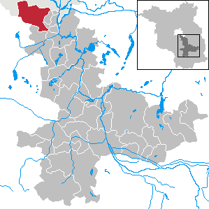
See Schönefeld on the map
Directions to Schönefeld with public transportation
The following transit lines have routes that pass near Schönefeld
 Train:
 - Bus:
How to get to Schönefeld by bus?
Click on the bus route to see step by step directions with maps, line arrival times and updated time schedules.
How to get to Schönefeld by train?
Click on the train route to see step by step directions with maps, line arrival times and updated time schedules.
Which train line stops near Schönefeld?
RE7
Which bus lines stop near Schönefeld?
These bus lines stop near Schönefeld: 160, 163, 742.
See Schönefeld on the map
Public Transportation to Schönefeld
Wondering how to get to Schönefeld, Germany? Moovit helps you find the best way to get to Schönefeld with step-by-step directions from the nearest public transit station.
Moovit provides free maps and live directions to help you navigate through your city. View schedules, routes, timetables, and find out how long does it take to get to Schönefeld in real time.
Train:Bus:
Want to see if there’s another route that gets you there at an earlier time? Moovit helps you find alternative routes or times. Get directions from and directions to Schönefeld easily from the Moovit App or Website.
We make riding to Schönefeld easy, which is why over 1.5 million users, including users in Schönefeld, trust Moovit as the best app for public transit. You don’t need to download an individual bus app or train app, Moovit is your all-in-one transit app that helps you find the best bus time or train time available.
For information on prices of bus, train and subway, costs and ride fares to Schönefeld, please check the Moovit app.
Use the app to navigate to popular places including to the airport, hospital, stadium, grocery store, mall, coffee shop, school, college, and university.
Schönefeld Address: Dahme-Spreewald, Brandenburg street in Schönefeld
Schönefeld is a suburban municipality in the Dahme-Spreewald district, Brandenburg, Germany. It borders the southeastern districts of Berlin. The municipal area encompasses Berlin Schönefeld Airport.Wiki
Attractions near Schönefeld
Pension Schwalbenweg,ehcon,Lufthansa Flight Training Center (LFTC Berlin),Praxis für Physiotherapie Cathleen Sternal,Billard 4 Fun,Saturnring,Dipl. med. Gudrun Großkopf,P+R Grünbergallee,Bernd,MEININGER Hotel Berlin Airport,Meininger Airliner Lounge,Deutschland,Meininger Berlin Airport,Getränke Hoffmann,Altglienicker Chaussee,Gate 64,Tesla Motors GmbH Berlin,Gate 65,Gate 63,Gate 62How to get to popular attractions in Schönefeld with public transit
Bundesnachrichtendienst, Lichterfelde,Bushaltestelle Schlossbrücke, Charlottenburg,Adik's Stehcafe, Westend,Ringhotel Schorfheide Tagungszentrum der Wirtschaft, Barnim,Zoo Eberswalde, Eberswalde,Straussee, Strausberg,Baumgarteninsel, Köpenick,Mosquito - Bar, Restaurant, Café, Cottbus,Gorinsee, Schönwalde,Comenius-Garten, Neukölln,Weihnachtszauber Gendarmenmarkt, Berlin Mitte,Berlin Pavillon, Tiergarten,Kleingartenanlage Kohlhasenbrück, Wannsee,Parkcafé Berlin, Wilmersdorf,Eberswalde Hauptbahnhof, Eberswalde,Bahnhof Templin Stadt, Uckermark,eBay Kleinanzeigen, Kleinmachnow,GRIPS Theater, Hansaviertel,Schloss Neuhardenberg, Märkisch-Oderland,Neuer Garten, PotsdamGet around Schönefeld by public transit!
Traveling around Schönefeld has never been so easy. See step by step directions as you travel to any attraction, street or major public transit station. View bus and train schedules, arrival times, service alerts and detailed routes on a map, so you know exactly how to get to anywhere in Schönefeld.
When traveling to any destination around Schönefeld use Moovit's Live Directions with Get Off Notifications to know exactly where and how far to walk, how long to wait for your line, and how many stops are left. Moovit will alert you when it's time to get off — no need to constantly re-check whether yours is the next stop.
Wondering how to use public transit in Schönefeld or how to pay for public transit in Schönefeld? Moovit public transit app can help you navigate your way with public transit easily, and at minimum cost. It includes public transit fees, ticket prices, and costs. Looking for a map of Schönefeld public transit lines? Moovit public transit app shows all public transit maps in Schönefeld with all bus, train or subway routes and stops on an interactive map.
Schönefeld has 3 transit type(s), including: bus, train or subway, operated by several transit agencies, including BVG, BVG, BVG, VBB, S-Bahn, Cottbusverkehr, Schöneicher Rüdersdorfer Straßenbahn, Strausberger Eisenbahn GmbH, Stadtverkehrsgesellschaft Tram, Verkehrsbetriebe Brandenburg, Verkehrsverbund Potsdam, BVG, DB Regio Bus, Barnimer Busgesellschaft and Busverkehr Oder-Spree GmbH