See Schenley Farms, Pittsburgh, on the map
Directions to Schenley Farms (Pittsburgh) with public transportation
The following transit lines have routes that pass near Schenley Farms
 Bus:
Bus:
How to get to Schenley Farms by bus?
Click on the bus route to see step by step directions with maps, line arrival times and updated time schedules.
How to get to Schenley Farms by {{TRANSIT_TYPE}}?
Click on the {{TRANSIT_TYPE}} route to see step by step directions with maps, line arrival times and updated time schedules.
Which bus lines stop near Schenley Farms?
These bus lines stop near Schenley Farms: 28X, 61D, 82.
See Schenley Farms, Pittsburgh, on the map
Public Transit to Schenley Farms in Pittsburgh
Wondering how to get to Schenley Farms in Pittsburgh, United States? Moovit helps you find the best way to get to Schenley Farms with step-by-step directions from the nearest public transit station.
Moovit provides free maps and live directions to help you navigate through your city. View schedules, routes, timetables, and find out how long does it take to get to Schenley Farms in real time.
Bus:
Want to see if there’s another route that gets you there at an earlier time? Moovit helps you find alternative routes or times. Get directions from and directions to Schenley Farms easily from the Moovit App or Website.
We make riding to Schenley Farms easy, which is why over 1.5 million users, including users in Pittsburgh, trust Moovit as the best app for public transit. You don’t need to download an individual bus app or train app, Moovit is your all-in-one transit app that helps you find the best bus time or train time available.
For information on prices of bus, costs and ride fares to Schenley Farms, please check the Moovit app.
Use the app to navigate to popular places including to the airport, hospital, stadium, grocery store, mall, coffee shop, school, college, and university.
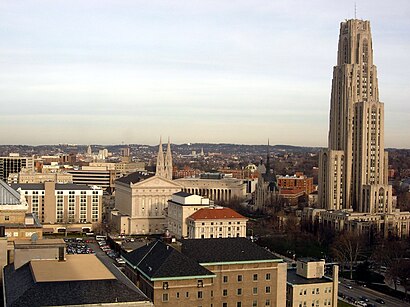
Schenley Farms Address: Lytton And Parkman Avenues street in Pittsburgh
Attractions near Schenley Farms
Patriotbrew,University Dr,Centre Ave,Bryn Mawr Rd at Centre Ave FS,3196 Centre Ave,First Baptist Church,879 Learning Res Devel Ctr,219 Parkman Avenue,4100 Allequippa St,Cheveron Science Center,Islamic Center Of Pittsburgh (ICP),Fanny Edel Falk Laboratory School,Twentieth Century Club,Bryn Mawr Rd at Andover Terr,Robert M Rogers MD,Eberly Hall,North Oakland,700 Chemistry Building,Soldiers & Sailors Lawn,Space Research Coordination CenterHow to get to popular attractions in Pittsburgh with public transit
North Park Swimming Pool,Bridgeville, PA, Bridgeville,Bus Stop At Stanwix & 4th Ave, Pittsburgh,Gianna Via, Whitehall,Pittsburgh International Airport Airside Terminal,O1 Ross Flyer, Pittsburgh,Pittsburgh P&DC, Pittsburgh,Glassport, Glassport,Wilkinsburg, Wilkinsburg,CCAC South Campus- Building G, West Mifflin,UPMC Harbor Garden, Pittsburgh,Coraopolis-Neville Island Bridge!, Coraopolis,Giant Eagle,New Kensington, New Kensington,Tequila Cowboy, Pittsburgh,Mount Oliver, Mount Oliver,Carnegie Science Center, Pittsburgh,Green Tree, Green Tree,Baja Bar And Grill,Mercy Behavioral Health: Reedsdale Center, PittsburghGet around Pittsburgh by public transit!
Traveling around Pittsburgh has never been so easy. See step by step directions as you travel to any attraction, street or major public transit station. View bus and train schedules, arrival times, service alerts and detailed routes on a map, so you know exactly how to get to anywhere in Pittsburgh.
When traveling to any destination around Pittsburgh use Moovit's Live Directions with Get Off Notifications to know exactly where and how far to walk, how long to wait for your line, and how many stops are left. Moovit will alert you when it's time to get off — no need to constantly re-check whether yours is the next stop.
Wondering how to use public transit in Pittsburgh or how to pay for public transit in Pittsburgh? Moovit public transit app can help you navigate your way with public transit easily, and at minimum cost. It includes public transit fees, ticket prices, and costs. Looking for a map of Pittsburgh public transit lines? Moovit public transit app shows all public transit maps in Pittsburgh with all bus routes and stops on an interactive map.
Pittsburgh has 1 transit type(s), including: bus, operated by several transit agencies, including Pittsburgh Regional Transit, Pittsburgh Regional Transit, CamTran, Amtran, Mid Mon Valley Transit, BCTA, Butler Transit Authority, IndiGo, Area Transportation Authority, Freedom Transit, Pittsburgh Regional Transit, Mountain Line Transit Authority, Megabus, Greyhound-us and Fullington Trailways