How to get to Schnabel Engineering DC Inc by bus?
Click on the bus route to see step by step directions with maps, line arrival times and updated time schedules.
From Hampton Inn Crystal City, Arlington County
62 minFrom The Music Center At Strathmore, Montgomery County
81 minFrom 9th Street Northwest & Pennsylvania Avenue Northwest, Washington
52 minFrom La Casa Blanca, Washington
45 minFrom Courtyard by Marriott Washington Downtown Convention Center, Washington
53 minFrom Navy Yard, Washington
74 minFrom Eden Center, Falls Church
82 minFrom Moxy-Washington DC (Moxy Hotels), Washington
52 minFrom Residence Inn-Washington, Washington
50 minFrom Navy Yard, Washington
70 min
How to get to Schnabel Engineering DC Inc by metro?
Click on the metro route to see step by step directions with maps, line arrival times and updated time schedules.
From Hampton Inn Crystal City, Arlington County
46 minFrom The Music Center At Strathmore, Montgomery County
28 minFrom 9th Street Northwest & Pennsylvania Avenue Northwest, Washington
33 minFrom La Casa Blanca, Washington
30 minFrom Courtyard by Marriott Washington Downtown Convention Center, Washington
35 minFrom Navy Yard, Washington
41 minFrom Eden Center, Falls Church
63 minFrom Moxy-Washington DC (Moxy Hotels), Washington
31 minFrom Residence Inn-Washington, Washington
30 minFrom Navy Yard, Washington
43 min
Bus stops near Schnabel Engineering DC Inc in Washington
Metro stations near Schnabel Engineering DC Inc in Washington
Bus lines to Schnabel Engineering DC Inc in Washington
What are the closest stations to Schnabel Engineering DC Inc?
The closest stations to Schnabel Engineering DC Inc are:
- Wisconsin Av Nw+Van Ness St NW is 156 yards away, 3 min walk.
- Van Ness St Nw+Wisconsin Av NW is 233 yards away, 3 min walk.
- Nebraska Av Nw+Van Ness St NW is 320 yards away, 5 min walk.
- Tenleytown Metro Station is 2196 yards away, 26 min walk.
- Columbia Heights is 5062 yards away, 60 min walk.
Which bus lines stop near Schnabel Engineering DC Inc?
These bus lines stop near Schnabel Engineering DC Inc: C51, C87, D80, D82.
Which metro line stops near Schnabel Engineering DC Inc?
RED (Shady Grove)
What’s the nearest metro station to Schnabel Engineering DC Inc in Washington?
The nearest metro station to Schnabel Engineering DC Inc in Washington is Tenleytown Metro Station. It’s a 26 min walk away.
What’s the nearest bus station to Schnabel Engineering DC Inc in Washington?
The nearest bus stations to Schnabel Engineering DC Inc in Washington are Wisconsin Av Nw+Van Ness St NW and Van Ness St Nw+Wisconsin Av NW. The closest one is a 3 min walk away.
What time is the first metro to Schnabel Engineering DC Inc in Washington?
The GREEN is the first metro that goes to Schnabel Engineering DC Inc in Washington. It stops nearby at 5:16 AM.
What time is the last metro to Schnabel Engineering DC Inc in Washington?
The GREEN is the last metro that goes to Schnabel Engineering DC Inc in Washington. It stops nearby at 12:25 AM.
What time is the first bus to Schnabel Engineering DC Inc in Washington?
The C61 is the first bus that goes to Schnabel Engineering DC Inc in Washington. It stops nearby at 3:01 AM.
What time is the last bus to Schnabel Engineering DC Inc in Washington?
The D80 is the last bus that goes to Schnabel Engineering DC Inc in Washington. It stops nearby at 3:25 AM.
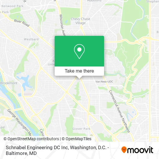
See Schnabel Engineering DC Inc, Washington, on the map
Public Transit to Schnabel Engineering DC Inc in Washington
Wondering how to get to Schnabel Engineering DC Inc in Washington? Moovit helps you find the best way to get to Schnabel Engineering DC Inc with step-by-step directions from the nearest public transit station.
Moovit provides free maps and live directions to help you navigate through your city. View schedules, routes, timetables, and find out how long does it take to get to Schnabel Engineering DC Inc in real time.
Looking for the nearest stop or station to Schnabel Engineering DC Inc? Check out this list of stops closest to your destination: Wisconsin Av Nw+Van Ness St NW; Van Ness St Nw+Wisconsin Av NW; Nebraska Av Nw+Van Ness St NW; Tenleytown Metro Station; Columbia Heights.
Bus: C51, C87, D80, D82, C61, C85, C81, D90.Metro: RED, GREEN, YELLOW.
Want to see if there’s another route that gets you there at an earlier time? Moovit helps you find alternative routes or times. Get directions from and directions to Schnabel Engineering DC Inc easily from the Moovit App or Website.
We make riding to Schnabel Engineering DC Inc easy, which is why over 1.5 million users, including users in Washington, trust Moovit as the best app for public transit. You don’t need to download an individual bus app or train app, Moovit is your all-in-one transit app that helps you find the best bus time or train time available.
For information on prices of metro and bus, costs and ride fares to Schnabel Engineering DC Inc, please check the Moovit app.
Use the app to navigate to popular places including to the airport, hospital, stadium, grocery store, mall, coffee shop, school, college, and university.
Schnabel Engineering DC Inc Address: 4200 Wisconsin Ave NW Washington, DC 20016 street in Washington
- Medstar Georgetown Pediatrics,
- American University,
- Deducive,
- APCOA PARKING,
- No Line Waiters,
- Saku Saku Flakerie,
- Johnson's Florist & Garden Center,
- Psych Care Pharmacy,
- Greenberg Theatre,
- Fannie Mae Federal Credit Union,
- Constable Court Services - Process Server,
- Silk Rug Cleaning,
- Shred Nations,
- Eco Logistics Group Shipping Services,
- Jerold M Share MD,
- Datz Foundation,
- Carolyn B Robinowitz,
- &Pizza - Tenleytown,
- WUSA9,
- Locks Re Key Washington
Places Near Schnabel Engineering DC Inc (Washington)
- Amazon Hq2, Arlington County,
- Warner Theatre, Washington,
- Capital One Arena, Washington,
- Washington National Cathedral, Washington,
- National Museum of African American History and Culture, Washington,
- Georgetown, Washington,
- Basilica of the National Shrine, Washington,
- National Theatre, Washington,
- Museum Of The Bible, Washington,
- Sibley Memorial Hospital, Washington,
- Westfield Montgomery Mall, Montgomery County,
- Rock Creek Tennis Center, Washington,
- Pennsylvania Ave NW (3rd st and pennsylvania), Washington,
- Marriott Marquis Washington, DC, Washington,
- National Zoo, Washington,
- The Anthem, Washington,
- PG Mall, Prince George's County,
- M&T Bank Stadium, Baltimore,
- Washington DC VA Medical Center, Washington,
- Camden Yards, Baltimore
How to get to popular places in Washington, D.C. - Baltimore, MD with public transit
Get around Washington by public transit!
Traveling around Washington has never been so easy. See step by step directions as you travel to any attraction, street or major public transit station. View bus and train schedules, arrival times, service alerts and detailed routes on a map, so you know exactly how to get to anywhere in Washington.
When traveling to any destination around Washington use Moovit's Live Directions with Get Off Notifications to know exactly where and how far to walk, how long to wait for your line, and how many stops are left. Moovit will alert you when it's time to get off — no need to constantly re-check whether yours is the next stop.
Wondering how to use public transit in Washington or how to pay for public transit in Washington? Moovit public transit app can help you navigate your way with public transit easily, and at minimum cost. It includes public transit fees, ticket prices, and costs. Looking for a map of Washington public transit lines? Moovit public transit app shows all public transit maps in Washington with all Bus, Train, Metro, Light Rail and Ferry routes and stops on an interactive map.
Washington, D.C. - Baltimore, MD has 5 transit type(s), including: Bus, Train, Metro, Light Rail and Ferry, operated by several transit agencies, including WMATA, Montgomery County Ride On, Fairfax Connector, TheBus, PRTC, DASH - Alexandria, Arlington Transit (ART), RTA of Central Maryland, MDOT MTA, MDOT MTA Light RailLink, MDOT MTA Commuter Bus, MDOT MTA Local Bus, FXBGO!, Virginia Railway Express (VRE) and MARC