How to get to School For Community Learning by bus?
Click on the bus route to see step by step directions with maps, line arrival times and updated time schedules.
From Indianapolis Urban League, Indianapolis City (Balance)
37 minFrom 119 W 19th St Parking, Indianapolis City (Balance)
44 minFrom Massachusetts Ave, Indianapolis City (Balance)
72 minFrom Social Security, Indianapolis City (Balance)
59 minFrom HOOTERS, Indianapolis City (Balance)
60 minFrom St Vincent Women's Hospital, Indianapolis City (Balance)
74 minFrom Brebeuf Baseball Field, Indianapolis City (Balance)
68 minFrom Dave's Mechanic Shop, Indianapolis City (Balance)
93 minFrom Benjamin Elliot Lippincott, Indianapolis City (Balance)
74 minFrom St. Vincent entrance #1, Indianapolis City (Balance)
70 min
Bus stop near School For Community Learning in Indianapolis City (Balance)
- 38th St & Guion Rd, 21 min walk,VIEW
Bus lines to School For Community Learning in Indianapolis City (Balance)
- 38, Transit Center,VIEW
What are the closest stations to School For Community Learning?
The closest stations to School For Community Learning are:
- 38th St & Guion Rd is 1745 yards away, 21 min walk.
Which bus lines stop near School For Community Learning?
These bus lines stop near School For Community Learning: 15, 30, 37, 38.
What time is the first bus to School For Community Learning in Indianapolis City (Balance)?
The 38 is the first bus that goes to School For Community Learning in Indianapolis City (Balance). It stops nearby at 6:53 AM.
What time is the last bus to School For Community Learning in Indianapolis City (Balance)?
The 38 is the last bus that goes to School For Community Learning in Indianapolis City (Balance). It stops nearby at 9:45 PM.
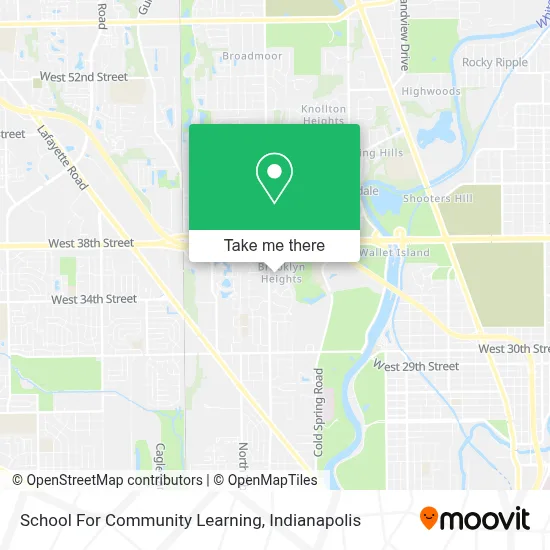
See School For Community Learning, Indianapolis City (Balance), on the map
Public Transit to School For Community Learning in Indianapolis City (Balance)
Wondering how to get to School For Community Learning in Indianapolis City (Balance)? Moovit helps you find the best way to get to School For Community Learning with step-by-step directions from the nearest public transit station.
Moovit provides free maps and live directions to help you navigate through your city. View schedules, routes, timetables, and find out how long does it take to get to School For Community Learning in real time.
Looking for the nearest stop or station to School For Community Learning? Check out this list of stops closest to your destination: 38th St & Guion Rd.
Bus: 15, 30, 37, 38.
Want to see if there’s another route that gets you there at an earlier time? Moovit helps you find alternative routes or times. Get directions from and directions to School For Community Learning easily from the Moovit App or Website.
We make riding to School For Community Learning easy, which is why over 1.5 million users, including users in Indianapolis City (Balance), trust Moovit as the best app for public transit. You don’t need to download an individual bus app or train app, Moovit is your all-in-one transit app that helps you find the best bus time or train time available.
For information on prices of bus, costs and ride fares to School For Community Learning, please check the Moovit app.
Use the app to navigate to popular places including to the airport, hospital, stadium, grocery store, mall, coffee shop, school, college, and university.
School For Community Learning Address: 3535 N Kessler Blvd North Dr street in Indianapolis City (Balance)
- Abney Lake Apartments (Williamsburg on the Lake),
- Daystar Industries,
- Marian University: Oldenburg Hall,
- Carol Adams Nutrition Products,
- Cardinal Ritter High School,
- Marian University Softball Field,
- Alpha Blinds & Home Decor,
- Travis Montgomery DPM (MacDonald, Eugene DPM),
- Saturday Evening Post,
- Foot & Ankle at Westview Hospital,
- Community Westview Urology,
- J Larry George MD MD,
- Marian University,
- Major Taylor Velodrome (Major Taylor Skatepark),
- Center Township Assessor,
- Community Health Network Physical Therapy and Rehab,
- 2 Ambitious Girlz,
- Josef, DDS Bringas MS,
- Riverside High School,
- Travel Agency
Places Near School For Community Learning (Indianapolis City (Balance))
- THE BALT, Indianapolis City (Balance),
- Cotter's Massage Parlor With Happy Endings, Indianapolis City (Balance),
- I U Health Methodist Hospital, Indianapolis City (Balance),
- 119 W 19th St Parking, Indianapolis City (Balance),
- Indiana Convention Center, Indianapolis City (Balance),
- Train Ride At Castleton Mall, Indianapolis City (Balance),
- Eskenazi Hospital, Indianapolis City (Balance),
- Indiana, Indianapolis City (Balance),
- I-465 / I-65 Interchange, Indianapolis City (Balance),
- Jersey Barn, Indianapolis City (Balance),
- St. Vincent Hospital - Indianapolis, Indianapolis City (Balance),
- Methodist Hospital of Indianapolis, Indianapolis City (Balance),
- Lilly Corporate Center (Eli Lilly & Co), Indianapolis City (Balance),
- Lucas Oil Stadium, Indianapolis City (Balance),
- Indianapolis Motor Speedway, Speedway,
- Plainfield, IN, Plainfield,
- St. Vincent entrance #1, Indianapolis City (Balance),
- Castleton Square Mall, Indianapolis,
- Gainbridge Fieldhouse, Indianapolis City (Balance),
- Indianapolis Airport Zone 2, Indianapolis City (Balance)
How to get to popular places in Indianapolis with public transit
Get around Indianapolis City (Balance) by public transit!
Traveling around Indianapolis City (Balance) has never been so easy. See step by step directions as you travel to any attraction, street or major public transit station. View bus and train schedules, arrival times, service alerts and detailed routes on a map, so you know exactly how to get to anywhere in Indianapolis City (Balance).
When traveling to any destination around Indianapolis City (Balance) use Moovit's Live Directions with Get Off Notifications to know exactly where and how far to walk, how long to wait for your line, and how many stops are left. Moovit will alert you when it's time to get off — no need to constantly re-check whether yours is the next stop.
Wondering how to use public transit in Indianapolis City (Balance) or how to pay for public transit in Indianapolis City (Balance)? Moovit public transit app can help you navigate your way with public transit easily, and at minimum cost. It includes public transit fees, ticket prices, and costs. Looking for a map of Indianapolis City (Balance) public transit lines? Moovit public transit app shows all public transit maps in Indianapolis City (Balance) with all bus routes and stops on an interactive map.
Indianapolis has 1 transit type(s), including: bus, operated by several transit agencies, including IndyGo, FlixBus-us and Greyhound-us