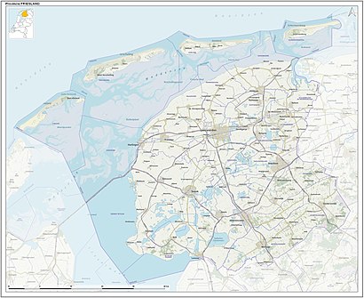
See Schraard, Sdwest Frysl?N, on the map
Directions to Schraard (Sdwest Frysl?N) with public transportation
The following transit lines have routes that pass near Schraard
 Bus:
Bus:
How to get to Schraard by bus?
Click on the bus route to see step by step directions with maps, line arrival times and updated time schedules.
Bus stations near Schraard in Sdwest Frysl?N
- Wons Wonserhoek,16 min walk,
- Witmarsum Koudehuisterdijk,40 min walk,
Bus lines to Schraard in Sdwest Frysl?N
- 98,Kop Afsluitdijk,
- 698,Sneek,
- 692,Leeuwarden,
- 99,Sneek,
- 199,Sneek,
What are the closest stations to Schraard?
The closest stations to Schraard are:
- Wons Wonserhoek is 1223 meters away, 16 min walk.
- Witmarsum Koudehuisterdijk is 3126 meters away, 40 min walk.
Which bus line stops near Schraard?
9151
See Schraard, Sdwest Frysl?N, on the map
Public Transit to Schraard in Sdwest Frysl?N
Wondering how to get to Schraard in Sdwest Frysl?N, Netherlands? Moovit helps you find the best way to get to Schraard with step-by-step directions from the nearest public transit station.
Moovit provides free maps and live directions to help you navigate through your city. View schedules, routes, timetables, and find out how long does it take to get to Schraard in real time.
Looking for the nearest stop or station to Schraard? Check out this list of stops closest to your destination: Wons Wonserhoek; Witmarsum Koudehuisterdijk.
Bus:
Want to see if there’s another route that gets you there at an earlier time? Moovit helps you find alternative routes or times. Get directions from and directions to Schraard easily from the Moovit App or Website.
We make riding to Schraard easy, which is why over 1.5 million users, including users in Sdwest Frysl?N, trust Moovit as the best app for public transit. You don’t need to download an individual bus app or train app, Moovit is your all-in-one transit app that helps you find the best bus time or train time available.
For information on prices of bus and train, costs and ride fares to Schraard, please check the Moovit app.
Use the app to navigate to popular places including to the airport, hospital, stadium, grocery store, mall, coffee shop, school, college, and university.
Schraard Address: Dorpsstraat street in Sdwest Frysl?N
Schraard (West Frisian: Skraard) is a village in Súdwest-Fryslân in the province of Friesland, the Netherlands. It had a population of around 165 in January 2017.Wiki
Attractions near Schraard
Marne, De,Utwijk Dorpshuis, De,De Utwijk Dorpshuis,Deboerhout Bv,Skraarder Feart,8746,Visser, A,Smidstraat 21,Bar Frisia,Strikwerda Lieren,Skraarder Feart,Skraarder Feart,Oosterlaan,Wonserweg,Skraarder Feart,De Marne,Oosterlaan 5,De Boer Hout Bv,A7,Wons, WonserhoekHow to get to popular attractions in Sdwest Frysl?N with public transit
Beneluxtunnel, Rotterdam,Station Hengelo, Hengelo,Diergaarde Blijdorp, Rotterdam,Station Zwijndrecht, Zwijndrecht,Boulevard Scheveningen, 'S-Gravenhage,IKEA, Amersfoort,Pathé Schouwburgplein, Rotterdam,Scheveningse Strand, 'S-Gravenhage,Westerpark, Amsterdam,Breda, Breda,Droomvlucht, Loon Op Zand,Deventer, Deventer,Metrostation Zuidplein, Rotterdam,Kinepolis, Enschede,Stenden Hogeschool, Leeuwarden,Saxion Hogeschool (Ko Wierenga), Enschede,ss Rotterdam, Rotterdam,IKEA, Utrecht,Maastricht Centrum, Maastricht,Knooppunt Terbregseplein, RotterdamGet around Sdwest Frysl?N by public transit!
Traveling around Sdwest Frysl?N has never been so easy. See step by step directions as you travel to any attraction, street or major public transit station. View bus and train schedules, arrival times, service alerts and detailed routes on a map, so you know exactly how to get to anywhere in Sdwest Frysl?N.
When traveling to any destination around Sdwest Frysl?N use Moovit's Live Directions with Get Off Notifications to know exactly where and how far to walk, how long to wait for your line, and how many stops are left. Moovit will alert you when it's time to get off — no need to constantly re-check whether yours is the next stop.
Wondering how to use public transit in Sdwest Frysl?N or how to pay for public transit in Sdwest Frysl?N? Moovit public transit app can help you navigate your way with public transit easily, and at minimum cost. It includes public transit fees, ticket prices, and costs. Looking for a map of Sdwest Frysl?N public transit lines? Moovit public transit app shows all public transit maps in Sdwest Frysl?N with all bus or train routes and stops on an interactive map.
Sdwest Frysl?N has 2 transit type(s), including: bus or train, operated by several transit agencies, including NS, NS International, GVB, GVB, GVB, GVB, U-OV, U-OV, Overal, HTM, R-net, RET, RET, De Lijn and Connexxion