How to get to Scotts Doors And Windows by bus?
Click on the bus route to see step by step directions with maps, line arrival times and updated time schedules.
From Amazon Fulfillment Bos7, Fall River
128 minFrom Bristol Community College, Fall River
78 minFrom Charlton Memorial Hospital, Fall River
143 minFrom Lizzy Borden House, Fall River
71 minFrom Barahona Express, Providence
54 minFrom Walmart Fall River Supercenter, Fall River
138 minFrom B.M.C. Durfee High School, Fall River
124 min
Bus stops near Scotts Doors And Windows in Boston
What are the closest stations to Scotts Doors And Windows?
The closest stations to Scotts Doors And Windows are:
- Main After Vernon is 514 yards away, 7 min walk.
- Opposite 319 Metacom is 634 yards away, 8 min walk.
Which bus line stops near Scotts Doors And Windows?
60 (Newport Via W Main Rd)
What’s the nearest bus station to Scotts Doors And Windows in Boston?
The nearest bus station to Scotts Doors And Windows in Boston is Main After Vernon. It’s a 7 min walk away.
What time is the first bus to Scotts Doors And Windows in Boston?
The 60 is the first bus that goes to Scotts Doors And Windows in Boston. It stops nearby at 5:19 AM.
What time is the last bus to Scotts Doors And Windows in Boston?
The 60 is the last bus that goes to Scotts Doors And Windows in Boston. It stops nearby at 12:41 AM.
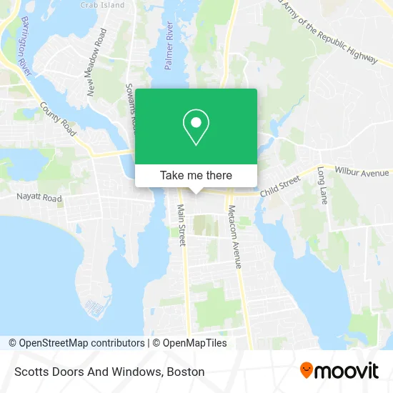
See Scotts Doors And Windows, Boston, on the map
Public Transit to Scotts Doors And Windows in Boston
Wondering how to get to Scotts Doors And Windows in Boston? Moovit helps you find the best way to get to Scotts Doors And Windows with step-by-step directions from the nearest public transit station.
Moovit provides free maps and live directions to help you navigate through your city. View schedules, routes, timetables, and find out how long does it take to get to Scotts Doors And Windows in real time.
Looking for the nearest stop or station to Scotts Doors And Windows? Check out this list of stops closest to your destination: Main After Vernon; Opposite 319 Metacom.
Bus: 60, 61X.
Want to see if there’s another route that gets you there at an earlier time? Moovit helps you find alternative routes or times. Get directions from and directions to Scotts Doors And Windows easily from the Moovit App or Website.
We make riding to Scotts Doors And Windows easy, which is why over 1.7 million users, including users in Boston, trust Moovit as the best app for public transit. You don’t need to download an individual bus app or train app, Moovit is your all-in-one transit app that helps you find the best bus time or train time available.
For information on prices of bus, costs and ride fares to Scotts Doors And Windows, please check the Moovit app.
Use the app to navigate to popular places including to the airport, hospital, stadium, grocery store, mall, coffee shop, school, college, and university.
Scotts Doors And Windows Address: 30 Cutler St street in Boston
- Arn Krebs Mokume,
- Cashmerelux,
- Angel Tucker Photography,
- Old Mill Signs Inc,
- Studio 217 at Cutler Mills,
- Webond Women's Networking Group,
- Susan Freda Studios,
- East Bay Music Together,
- Avtech Software,
- Latelier Hair Salon,
- Right Choice Auto Glass,
- Plumbing Furnaces Heating,
- Toledo Auto-Spa,
- Brown Automotive & Tire,
- Alexandra Morgan's Animal School,
- Jxb Electric,
- The Box East Bay,
- Flowers & Events,
- 24 7 Emerg Locksmith,
- Elle Bee's
Places Near Scotts Doors And Windows (Boston)
- North End, Boston,
- Cheers, Boston,
- Boston Children's Hospital, Boston,
- Td Garden, Boston,
- Faneuil Hall, Boston,
- Boston Common, Boston,
- Mgm Music Hall, Boston,
- Boston Convention & Exhibition Center, Boston,
- Quincy Market, Boston,
- Leader Bank Pavilion (Leader Bank Pavillion), Boston,
- House Of Blues, Boston,
- Castle Island, Boston,
- Wilbur Theatre, Boston,
- Seaport District, Boston,
- Wang Theater, Boston,
- Massachusetts General Hospital, Boston,
- Prudential Center, Boston,
- Boston Medical Center, Boston,
- Museum Of Science, Boston,
- Isabella Stewart Gardner Museum, Boston
How to get to popular places in Boston with public transit
Get around Boston by public transit!
Traveling around Boston has never been so easy. See step by step directions as you travel to any attraction, street or major public transit station. View bus and train schedules, arrival times, service alerts and detailed routes on a map, so you know exactly how to get to anywhere in Boston.
When traveling to any destination around Boston use Moovit's Live Directions with Get Off Notifications to know exactly where and how far to walk, how long to wait for your line, and how many stops are left. Moovit will alert you when it's time to get off — no need to constantly re-check whether yours is the next stop.
Wondering how to use public transit in Boston or how to pay for public transit in Boston? Moovit public transit app can help you navigate your way with public transit easily, and at minimum cost. It includes public transit fees, ticket prices, and costs. Looking for a map of Boston public transit lines? Moovit public transit app shows all public transit maps in Boston with all Bus, Train, Subway and Ferry routes and stops on an interactive map.
Boston has 4 transit type(s), including: Bus, Train, Subway and Ferry, operated by several transit agencies, including MBTA, Southeastern Regional Transit Authority, MetroWest Regional Transit Authority, Rhode Island Public Transit Authority, WRTA, Lowell Regional Transit Authority, Merrimack Valley Transit, Montachusett Regional Transit Authority, Cape Cod Regional Transit Authority, Brockton Area Transit Authority, Martha's Vineyard Transit Authority, the WAVE - Nantucket Regional Transit Authority, GATRA, Cape Ann Transportation Authority and Massport