Directions to Screenco (Newburyport) with public transportation
The following transit lines have routes that pass near Screenco
 Bus: 11, 19, 20.
- Train: NEWBURYPORT/ROCKPORT.
How to get to Screenco by bus?
Click on the bus route to see step by step directions with maps, line arrival times and updated time schedules.
How to get to Screenco by train?
Click on the train route to see step by step directions with maps, line arrival times and updated time schedules.
Bus stops near Screenco in Newburyport
Train station near Screenco in Newburyport
- Newburyport, 25 min walk,VIEW
What are the closest stations to Screenco?
The closest stations to Screenco are:
- Parker St & Graf Rd is 686 yards away, 9 min walk.
- Boston Way Ob is 1227 yards away, 15 min walk.
- Newburyport is 2112 yards away, 25 min walk.
Which bus lines stop near Screenco?
These bus lines stop near Screenco: 11, 19, 20.
Which train line stops near Screenco?
NEWBURYPORT/ROCKPORT (#131 | Newburyport)
What’s the nearest train station to Screenco in Newburyport?
The nearest train station to Screenco in Newburyport is Newburyport. It’s a 25 min walk away.
What’s the nearest bus station to Screenco in Newburyport?
The nearest bus station to Screenco in Newburyport is Parker St & Graf Rd. It’s a 9 min walk away.
What time is the first train to Screenco in Newburyport?
The NEWBURYPORT/ROCKPORT is the first train that goes to Screenco in Newburyport. It stops nearby at 4:48 AM.
What time is the last train to Screenco in Newburyport?
The NEWBURYPORT/ROCKPORT is the last train that goes to Screenco in Newburyport. It stops nearby at 1:03 AM.
What time is the first bus to Screenco in Newburyport?
The 19 is the first bus that goes to Screenco in Newburyport. It stops nearby at 5:30 AM.
What time is the last bus to Screenco in Newburyport?
The 20 is the last bus that goes to Screenco in Newburyport. It stops nearby at 7:11 PM.
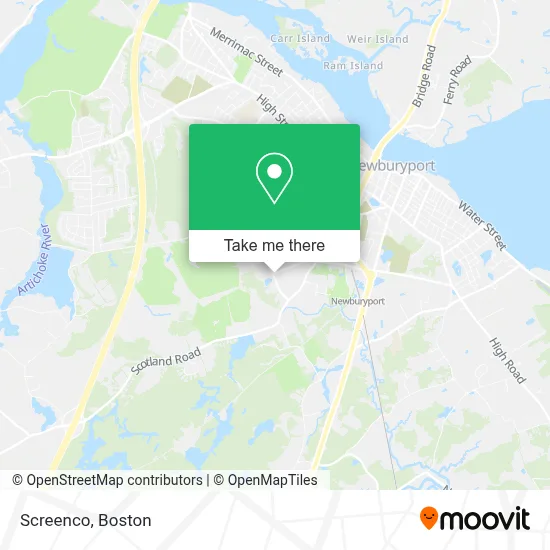
See Screenco, Newburyport, on the map
Public Transit to Screenco in Newburyport
Wondering how to get to Screenco in Newburyport? Moovit helps you find the best way to get to Screenco with step-by-step directions from the nearest public transit station.
Moovit provides free maps and live directions to help you navigate through your city. View schedules, routes, timetables, and find out how long does it take to get to Screenco in real time.
Looking for the nearest stop or station to Screenco? Check out this list of stops closest to your destination: Parker St & Graf Rd; Boston Way Ob; Newburyport.
Bus: 11, 19, 20.Train: NEWBURYPORT/ROCKPORT.
Want to see if there’s another route that gets you there at an earlier time? Moovit helps you find alternative routes or times. Get directions from and directions to Screenco easily from the Moovit App or Website.
We make riding to Screenco easy, which is why over 1.7 million users, including users in Newburyport, trust Moovit as the best app for public transit. You don’t need to download an individual bus app or train app, Moovit is your all-in-one transit app that helps you find the best bus time or train time available.
For information on prices of bus and train, costs and ride fares to Screenco, please check the Moovit app.
Use the app to navigate to popular places including to the airport, hospital, stadium, grocery store, mall, coffee shop, school, college, and university.
Screenco Address: 4 Malcolm Hoyt Dr street in Newburyport
- The Journeyman Press,
- Mailforce Inc.,
- Hero Coatings,
- Safe Harbor Psychiatry,
- Appledore Medical Group,
- Ghiasuddin Salman MD Facc,
- Professional Physical Therapy,
- Synapse Wellness,
- Tring Live Media,
- Northeast Quality Products Co.,
- Zar-Tech,
- Dry Air Systems Inc,
- U.S. Postal Service - Newburyport Carrier Annex,
- Get Decor and More,
- Essex County Wildlife Control,
- Custodial Partners, Llc,
- Micrometal Technologies,
- Advanced Diesel Repair,
- Physical Therapy North,
- Wilmington Research & Devmnt
Places Near Screenco (Newburyport)
- Castle Island, Boston,
- Wang Theater, Boston,
- Museum Of Science, Boston,
- Wilbur Theatre, Boston,
- Massachusetts General Hospital, Boston,
- Boston Medical Center, Boston,
- Cheers, Boston,
- Mgm Music Hall, Boston,
- Boston Children's Hospital, Boston,
- Td Garden, Boston,
- House Of Blues, Boston,
- Faneuil Hall, Boston,
- Leader Bank Pavilion (Leader Bank Pavillion), Boston,
- Boston Convention & Exhibition Center, Boston,
- Seaport District, Boston,
- Quincy Market, Boston,
- Prudential Center, Boston,
- North End, Boston,
- Isabella Stewart Gardner Museum, Boston,
- Boston Common, Boston
How to get to popular places in Boston with public transit
Get around Newburyport by public transit!
Traveling around Newburyport has never been so easy. See step by step directions as you travel to any attraction, street or major public transit station. View bus and train schedules, arrival times, service alerts and detailed routes on a map, so you know exactly how to get to anywhere in Newburyport.
When traveling to any destination around Newburyport use Moovit's Live Directions with Get Off Notifications to know exactly where and how far to walk, how long to wait for your line, and how many stops are left. Moovit will alert you when it's time to get off — no need to constantly re-check whether yours is the next stop.
Wondering how to use public transit in Newburyport or how to pay for public transit in Newburyport? Moovit public transit app can help you navigate your way with public transit easily, and at minimum cost. It includes public transit fees, ticket prices, and costs. Looking for a map of Newburyport public transit lines? Moovit public transit app shows all public transit maps in Newburyport with all Bus, Train, Subway and Ferry routes and stops on an interactive map.
Boston has 4 transit type(s), including: Bus, Train, Subway and Ferry, operated by several transit agencies, including MBTA, Southeastern Regional Transit Authority, MetroWest Regional Transit Authority, Rhode Island Public Transit Authority, WRTA, Lowell Regional Transit Authority, Merrimack Valley Transit, Montachusett Regional Transit Authority, Cape Cod Regional Transit Authority, Brockton Area Transit Authority, Martha's Vineyard Transit Authority, the WAVE - Nantucket Regional Transit Authority, GATRA, Cape Ann Transportation Authority and Massport