Directions to Seaport Boulevard Boston with public transportation
The following transit lines have routes that pass near Seaport Boulevard Boston
 Bus: 4, 7, SL1, SL2, SL3.
- Train: FRAMINGHAM/WORCESTER, PROVIDENCE/STOUGHTON.
- Subway: ORANGE LINE, RED LINE.
- Ferry: FAST FERRY, QUINCY FERRY, WINTHROP FERRY, WINTHROP/QUINCY FERRY, EAST.
How to get to Seaport Boulevard Boston by bus?
Click on the bus route to see step by step directions with maps, line arrival times and updated time schedules.
From Harvard T.H. Chan School of Public Health
52 minFrom La Quinta
49 minFrom Folkman Auditorium, Children's Hospital Boston
55 minFrom Belmont, MA
73 minFrom Ac Hotel Cambridge
119 minFrom Hampton Inn & Suites-Hampton Watertown Boston (Hampton Inn & Suites Watertown Boston)
71 minFrom Angell Animal Medical Center (Mspca Angell)
57 minFrom Massachusetts
72 minFrom Alumni Stadium
71 minFrom Milton Academy
117 min
How to get to Seaport Boulevard Boston by train?
Click on the train route to see step by step directions with maps, line arrival times and updated time schedules.
How to get to Seaport Boulevard Boston by subway?
Click on the subway route to see step by step directions with maps, line arrival times and updated time schedules.
Bus stops near Seaport Boulevard Boston
Ferry stations near Seaport Boulevard Boston
Bus lines to Seaport Boulevard Boston
What are the closest stations to Seaport Boulevard Boston?
The closest stations to Seaport Boulevard Boston are:
- Congress St @ World Trade Center Sta is 199 yards away, 3 min walk.
- Seaport Blvd @ Pier 4 Blvd is 206 yards away, 3 min walk.
- 1 | Congress St is 211 yards away, 3 min walk.
- Summer St @ Pappas Way is 277 yards away, 4 min walk.
- World Trade Center Pier, Boston, MA is 430 yards away, 6 min walk.
- Seaport (Fan Pier) is 616 yards away, 8 min walk.
- Rowes Wharf is 1255 yards away, 16 min walk.
Which bus lines stop near Seaport Boulevard Boston?
These bus lines stop near Seaport Boulevard Boston: 4, 7, SL1, SL2, SL3, SL4.
Which train lines stop near Seaport Boulevard Boston?
These train lines stop near Seaport Boulevard Boston: FRAMINGHAM/WORCESTER, PROVIDENCE/STOUGHTON.
Which subway lines stop near Seaport Boulevard Boston?
These subway lines stop near Seaport Boulevard Boston: ORANGE LINE, RED LINE.
What’s the nearest bus station to Seaport Boulevard Boston?
The nearest bus stations to Seaport Boulevard Boston are Congress St @ World Trade Center Sta, Seaport Blvd @ Pier 4 Blvd and 1 | Congress St. The closest one is a 3 min walk away.
What’s the nearest ferry station to Seaport Boulevard Boston?
The nearest ferry station to Seaport Boulevard Boston is World Trade Center Pier, Boston, MA. It’s a 6 min walk away.
What time is the first bus to Seaport Boulevard Boston?
The SLW is the first bus that goes to Seaport Boulevard Boston. It stops nearby at 4:14 AM.
What time is the last bus to Seaport Boulevard Boston?
The SL1 is the last bus that goes to Seaport Boulevard Boston. It stops nearby at 1:29 AM.
What time is the first ferry to Seaport Boulevard Boston?
The EAST is the first ferry that goes to Seaport Boulevard Boston. It stops nearby at 6:01 AM.
What time is the last ferry to Seaport Boulevard Boston?
The FAST FERRY is the last ferry that goes to Seaport Boulevard Boston. It stops nearby at 9:05 PM.
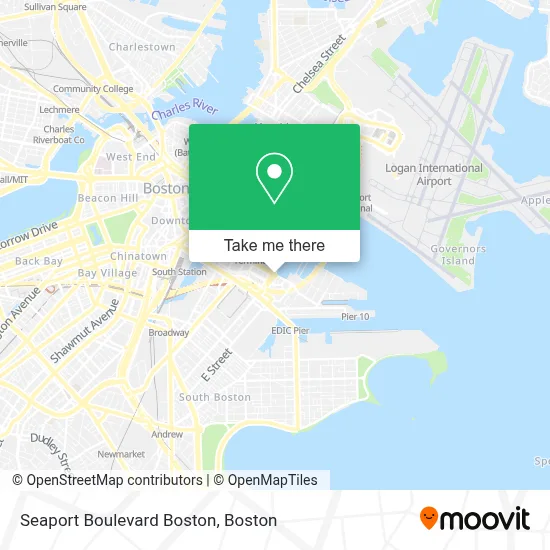
See Seaport Boulevard Boston on the map
Public Transportation to Seaport Boulevard Boston
Wondering how to get to Seaport Boulevard Boston? Moovit helps you find the best way to get to Seaport Boulevard Boston with step-by-step directions from the nearest public transit station.
Moovit provides free maps and live directions to help you navigate through your city. View schedules, routes, timetables, and find out how long does it take to get to Seaport Boulevard Boston in real time.
Looking for the nearest stop or station to Seaport Boulevard Boston? Check out this list of stops closest to your destination: Congress St @ World Trade Center Sta; Seaport Blvd @ Pier 4 Blvd; 1 | Congress St; Summer St @ Pappas Way; World Trade Center Pier; Seaport (Fan Pier); Rowes Wharf.
Bus: 4, 7, SL1, SL2, SL3, SL4, SLW.Train: FRAMINGHAM/WORCESTER, PROVIDENCE/STOUGHTON.Subway: ORANGE LINE, RED LINE.Ferry: FAST FERRY, QUINCY FERRY, WINTHROP FERRY, WINTHROP/QUINCY FERRY, EAST, LOVEJOY - FAN PIER - PIER 10.
Want to see if there’s another route that gets you there at an earlier time? Moovit helps you find alternative routes or times. Get directions from and directions to Seaport Boulevard Boston easily from the Moovit App or Website.
We make riding to Seaport Boulevard Boston easy, which is why over 1.7 million users, including users in Boston, trust Moovit as the best app for public transit. You don’t need to download an individual bus app or train app, Moovit is your all-in-one transit app that helps you find the best bus time or train time available.
For information on prices of bus, subway and train, costs and ride fares to Seaport Boulevard Boston, please check the Moovit app.
Use the app to navigate to popular places including to the airport, hospital, stadium, grocery store, mall, coffee shop, school, college, and university.
Location: Boston
- Ltk: the Legal Test Kitchen,
- Del Frisco's Double Eagle Steak House - Boston,
- Del Frisco's,
- Boston Maritime Park in the Seaport,
- Park Lane Seaport,
- Boston Fish Pier - East Lot,
- Renaissance Boston Waterfront Hotel (Renaissance Waterfront Conference Center),
- Legal Harborside,
- Strega Waterfront,
- Seaport East,
- Lyndell's Bakery,
- Cabot,
- Morton's The Steakhouse,
- Silver Line SL1,
- Seaport Hotel,
- Seaport Hotel & World Trade Center,
- Seaport Boston Hotel,
- Silver Line Way & Starboard Way,
- Boston Convention Center Hotels Hynes Convention Center Hotels Hotels,
- Boston Innovation District
Places Near Seaport Boulevard Boston
- Wang Theater, Boston,
- Isabella Stewart Gardner Museum, Boston,
- Leader Bank Pavilion (Leader Bank Pavillion), Boston,
- North End, Boston,
- Castle Island, Boston,
- Quincy Market, Boston,
- Boston Common, Boston,
- Boston Children's Hospital, Boston,
- Prudential Center, Boston,
- Faneuil Hall, Boston,
- Seaport District, Boston,
- House Of Blues, Boston,
- Boston Medical Center, Boston,
- Museum Of Science, Boston,
- Cheers, Boston,
- Mgm Music Hall, Boston,
- Boston Convention & Exhibition Center, Boston,
- Wilbur Theatre, Boston,
- Td Garden, Boston,
- Massachusetts General Hospital, Boston
How to get to popular places in Boston with public transit
Get around Boston by public transit!
Traveling around Boston has never been so easy. See step by step directions as you travel to any attraction, street or major public transit station. View bus and train schedules, arrival times, service alerts and detailed routes on a map, so you know exactly how to get to anywhere in Boston.
When traveling to any destination around Boston use Moovit's Live Directions with Get Off Notifications to know exactly where and how far to walk, how long to wait for your line, and how many stops are left. Moovit will alert you when it's time to get off — no need to constantly re-check whether yours is the next stop.
Wondering how to use public transit in Boston or how to pay for public transit in Boston? Moovit public transit app can help you navigate your way with public transit easily, and at minimum cost. It includes public transit fees, ticket prices, and costs. Looking for a map of Boston public transit lines? Moovit public transit app shows all public transit maps in Boston with all Bus, Train, Subway and Ferry routes and stops on an interactive map.
Boston has 4 transit type(s), including: Bus, Train, Subway and Ferry, operated by several transit agencies, including MBTA, Southeastern Regional Transit Authority, MetroWest Regional Transit Authority, Rhode Island Public Transit Authority, WRTA, Lowell Regional Transit Authority, Merrimack Valley Transit, Montachusett Regional Transit Authority, Cape Cod Regional Transit Authority, Brockton Area Transit Authority, Martha's Vineyard Transit Authority, the WAVE - Nantucket Regional Transit Authority, GATRA, Cape Ann Transportation Authority and Massport