Directions to Searingtown (Searingtown, Ny) with public transportation
The following transit lines have routes that pass near Searingtown
How to get to Searingtown by bus?
Click on the bus route to see step by step directions with maps, line arrival times and updated time schedules.
How to get to Searingtown by train?
Click on the train route to see step by step directions with maps, line arrival times and updated time schedules.
Bus stations near Searingtown in Searingtown, Ny
- Mineola Ave + Old Powerhouse Rd,21 min walk,
- Lincoln Ave at Warner St,37 min walk,
Train stations near Searingtown in Searingtown, Ny
- Albertson,23 min walk,
Bus lines to Searingtown in Searingtown, Ny
- N23,Manorhaven,
- N27,Roosevelt Field,
What are the closest stations to Searingtown?
The closest stations to Searingtown are:
- Mineola Ave + Old Powerhouse Rd is 1733 yards away, 21 min walk.
- Albertson is 1849 yards away, 23 min walk.
- Lincoln Ave at Warner St is 3015 yards away, 37 min walk.
Which bus line stops near Searingtown?
N23
Which train line stops near Searingtown?
OYSTER BAY
What’s the nearest train station to Searingtown in Searingtown, Ny?
The nearest train station to Searingtown in Searingtown, Ny is Albertson. It’s a 23 min walk away.
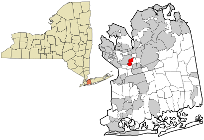
See Searingtown, Searingtown, Ny, on the map
Public Transit to Searingtown in Searingtown, Ny
Wondering how to get to Searingtown in Searingtown, Ny, United States? Moovit helps you find the best way to get to Searingtown with step-by-step directions from the nearest public transit station.
Moovit provides free maps and live directions to help you navigate through your city. View schedules, routes, timetables, and find out how long does it take to get to Searingtown in real time.
Looking for the nearest stop or station to Searingtown? Check out this list of stops closest to your destination: Mineola Ave + Old Powerhouse Rd; Albertson; Lincoln Ave at Warner St.
Bus:N23N27Train:OYSTER BAYOYSTER BAY BRANCH
Want to see if there’s another route that gets you there at an earlier time? Moovit helps you find alternative routes or times. Get directions from and directions to Searingtown easily from the Moovit App or Website.
We make riding to Searingtown easy, which is why over 1.5 million users, including users in Searingtown, Ny, trust Moovit as the best app for public transit. You don’t need to download an individual bus app or train app, Moovit is your all-in-one transit app that helps you find the best bus time or train time available.
For information on prices of bus, train and subway, costs and ride fares to Searingtown, please check the Moovit app.
Use the app to navigate to popular places including to the airport, hospital, stadium, grocery store, mall, coffee shop, school, college, and university.
Searingtown Address: Nassau Drive street in Searingtown, Ny
Attractions near Searingtown
Nassau Dr (nassau drive green),Nassau Dr,Jewish Gift Place,Capitol Elevator Co,Serpentine Ln Nassau Dr,133 Serpentine Ln,Bushlow Bruce E Atty,Green Way,Kydon Construction Inc,Magid Realty & Development LLC,Expositions Unlimited Inc,195 Nassau Dr,Ysg Solar,Harvey B Etess, Md Pc,Early Times Co LTD,P & A Marketing Inc,Searingtown School,Integreon Managed Solutions,Future Software Services Inc,Granton MarketingHow to get to popular attractions in Searingtown, Ny with public transit
Barrio Chino, Manhattan,Lexington Avenue & East 53rd Street, Manhattan,Commack, Commack, Ny,Pier 35 Park, Manhattan,225 Liberty St, Manhattan,Hackensack Hospital, Hackensack, Nj,Dix Hills, NY, Dix Hills, Ny,Pier 11, Manhattan,Pier 83, Manhattan,200 Varick St, Manhattan,89-17 Sutphin Boulevard, Queens,Bayonne, NJ, Bayonne, Nj,Queens College, Queens,West Village, Manhattan,MTA Subway - Franklin Ave (2 / 3/4 / 5),Museo Americano de Historia Natural, Manhattan,High Line, Manhattan,King Spa, Palisades Park, Nj,East Village, Manhattan,Pacific St (pacific street brooklyn)Get around Searingtown, Ny by public transit!
Traveling around Searingtown, Ny has never been so easy. See step by step directions as you travel to any attraction, street or major public transit station. View bus and train schedules, arrival times, service alerts and detailed routes on a map, so you know exactly how to get to anywhere in Searingtown, Ny.
When traveling to any destination around Searingtown, Ny use Moovit's Live Directions with Get Off Notifications to know exactly where and how far to walk, how long to wait for your line, and how many stops are left. Moovit will alert you when it's time to get off — no need to constantly re-check whether yours is the next stop.
Wondering how to use public transit in Searingtown, Ny or how to pay for public transit in Searingtown, Ny? Moovit public transit app can help you navigate your way with public transit easily, and at minimum cost. It includes public transit fees, ticket prices, and costs. Looking for a map of Searingtown, Ny public transit lines? Moovit public transit app shows all public transit maps in Searingtown, Ny with all bus, train or subway routes and stops on an interactive map.
Searingtown, Ny has 3 transit type(s), including: bus, train or subway, operated by several transit agencies, including MTA Subway, Metro-North Railroad, LIRR, PATH, Shore Line East, MTA Bus Company, MTA New York City Transit - Express routes, MTA Bus, NJ Transit, NYC Ferry, NICE bus, Bee-Line Bus, NJ Transit Rail, NJ Transit Rail and Norwalk Transit District