Directions to Seaside Cemetery Gloucester, MA with public transportation
The following transit lines have routes that pass near Seaside Cemetery Gloucester, MA
 Bus: LANESVILLE.
- Train: NEWBURYPORT/ROCKPORT.
How to get to Seaside Cemetery Gloucester, MA by bus?
Click on the bus route to see step by step directions with maps, line arrival times and updated time schedules.
Bus stop near Seaside Cemetery Gloucester, MA
- Washington St & Woodbury St, 1 min walk,VIEW
Train station near Seaside Cemetery Gloucester, MA
- Rockport, 16 min walk,VIEW
Bus lines to Seaside Cemetery Gloucester, MA
- LANESVILLE, Rose Baker Senior Center,VIEW
What are the closest stations to Seaside Cemetery Gloucester, MA?
The closest stations to Seaside Cemetery Gloucester, MA are:
- Washington St & Woodbury St is 79 yards away, 1 min walk.
- Rockport is 1346 yards away, 16 min walk.
Which bus line stops near Seaside Cemetery Gloucester, MA?
LANESVILLE (Rockport Market→Rose Baker Senior Center)
What’s the nearest train station to Seaside Cemetery Gloucester, MA?
The nearest train station to Seaside Cemetery Gloucester, MA is Rockport. It’s a 16 min walk away.
What’s the nearest bus station to Seaside Cemetery Gloucester, MA?
The nearest bus station to Seaside Cemetery Gloucester, MA is Washington St & Woodbury St. It’s a 1 min walk away.
What time is the first train to Seaside Cemetery Gloucester, MA?
The NEWBURYPORT/ROCKPORT is the first train that goes to Seaside Cemetery Gloucester, MA. It stops nearby at 5:06 AM.
What time is the last train to Seaside Cemetery Gloucester, MA?
The NEWBURYPORT/ROCKPORT is the last train that goes to Seaside Cemetery Gloucester, MA. It stops nearby at 1:01 AM.
What time is the first bus to Seaside Cemetery Gloucester, MA?
The LANESVILLE is the first bus that goes to Seaside Cemetery Gloucester, MA. It stops nearby at 6:50 AM.
What time is the last bus to Seaside Cemetery Gloucester, MA?
The LANESVILLE is the last bus that goes to Seaside Cemetery Gloucester, MA. It stops nearby at 6:02 PM.
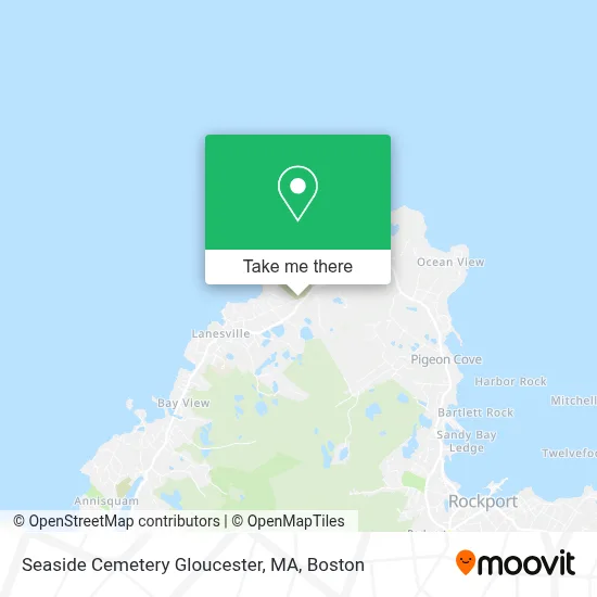
See Seaside Cemetery Gloucester, MA on the map
Public Transportation to Seaside Cemetery Gloucester, MA
Wondering how to get to Seaside Cemetery Gloucester, MA? Moovit helps you find the best way to get to Seaside Cemetery Gloucester, MA with step-by-step directions from the nearest public transit station.
Moovit provides free maps and live directions to help you navigate through your city. View schedules, routes, timetables, and find out how long does it take to get to Seaside Cemetery Gloucester, MA in real time.
Looking for the nearest stop or station to Seaside Cemetery Gloucester, MA? Check out this list of stops closest to your destination: Washington St & Woodbury St; Rockport.
Bus: LANESVILLE.Train: NEWBURYPORT/ROCKPORT.
Want to see if there’s another route that gets you there at an earlier time? Moovit helps you find alternative routes or times. Get directions from and directions to Seaside Cemetery Gloucester, MA easily from the Moovit App or Website.
We make riding to Seaside Cemetery Gloucester, MA easy, which is why over 1.7 million users, including users in Gloucester, trust Moovit as the best app for public transit. You don’t need to download an individual bus app or train app, Moovit is your all-in-one transit app that helps you find the best bus time or train time available.
For information on prices of bus and train, costs and ride fares to Seaside Cemetery Gloucester, MA, please check the Moovit app.
Use the app to navigate to popular places including to the airport, hospital, stadium, grocery store, mall, coffee shop, school, college, and university.
Seaside Cemetery Gloucester, MA Address: 88 Langsford St street in Gloucester
- Canney Pit / Canney Quarry,
- Orthodox Congregational Church in Lanesville,
- Kapetanopoulos Sculpture: Fine Art Carvings,
- Lanesville Preschool Center,
- Lanes Cove House (On the Cove),
- Lanes Cove (Lane's Cove Fish Shack),
- USPS Collection Box - Blue Box,
- St Paul Lutheran Church Lanesville,
- Old Farm Inn,
- Halibut Point State Park,
- Gott House,
- Steel Derrick Quarry,
- New England Bamboo Company,
- Cape Ann Shakespeare Troupe,
- Interstate Batteries,
- Rockport Granite Pier,
- Rockpile Recording,
- Manning Park,
- Morrell Wayne Home & Gallery,
- Washington & Revere Streets
Places Near Seaside Cemetery Gloucester, MA
- Boston Children's Hospital, Boston,
- North End, Boston,
- Cheers, Boston,
- Wang Theater, Boston,
- Boston Convention & Exhibition Center, Boston,
- Museum Of Science, Boston,
- Mgm Music Hall, Boston,
- House Of Blues, Boston,
- Boston Medical Center, Boston,
- Wilbur Theatre, Boston,
- Boston Common, Boston,
- Leader Bank Pavilion (Leader Bank Pavillion), Boston,
- Massachusetts General Hospital, Boston,
- Prudential Center, Boston,
- Castle Island, Boston,
- Td Garden, Boston,
- Faneuil Hall, Boston,
- Isabella Stewart Gardner Museum, Boston,
- Seaport District, Boston,
- Quincy Market, Boston
How to get to popular places in Boston with public transit
Get around Gloucester by public transit!
Traveling around Gloucester has never been so easy. See step by step directions as you travel to any attraction, street or major public transit station. View bus and train schedules, arrival times, service alerts and detailed routes on a map, so you know exactly how to get to anywhere in Gloucester.
When traveling to any destination around Gloucester use Moovit's Live Directions with Get Off Notifications to know exactly where and how far to walk, how long to wait for your line, and how many stops are left. Moovit will alert you when it's time to get off — no need to constantly re-check whether yours is the next stop.
Wondering how to use public transit in Gloucester or how to pay for public transit in Gloucester? Moovit public transit app can help you navigate your way with public transit easily, and at minimum cost. It includes public transit fees, ticket prices, and costs. Looking for a map of Gloucester public transit lines? Moovit public transit app shows all public transit maps in Gloucester with all Bus, Train, Subway and Ferry routes and stops on an interactive map.
Boston has 4 transit type(s), including: Bus, Train, Subway and Ferry, operated by several transit agencies, including MBTA, Southeastern Regional Transit Authority, MetroWest Regional Transit Authority, Rhode Island Public Transit Authority, WRTA, Lowell Regional Transit Authority, Merrimack Valley Transit, Montachusett Regional Transit Authority, Cape Cod Regional Transit Authority, Brockton Area Transit Authority, Martha's Vineyard Transit Authority, the WAVE - Nantucket Regional Transit Authority, GATRA, Cape Ann Transportation Authority and Massport