See Second Leiter Building, Chicago, on the map
Directions to Second Leiter Building (Chicago) with public transportation
The following transit lines have routes that pass near Second Leiter Building
 Bus:
Bus: - Train:
- Chicago 'L':
How to get to Second Leiter Building by bus?
Click on the bus route to see step by step directions with maps, line arrival times and updated time schedules.
How to get to Second Leiter Building by train?
Click on the train route to see step by step directions with maps, line arrival times and updated time schedules.
How to get to Second Leiter Building by Chicago 'L'?
Click on the Chicago 'L' route to see step by step directions with maps, line arrival times and updated time schedules.
Bus stations near Second Leiter Building in Chicago
- State & Van Buren (South),2 min walk,
- State & Harrison/Ida B Wells Drive (South),3 min walk,
- Dearborn & Ida B Wells Drive (North),3 min walk,
- Dearborn St & Ida B. Wells Dr,3 min walk,
- Jackson & State (East),3 min walk,
- Ida B Wells Drive & Wabash (West),3 min walk,
Chicago 'l' stations near Second Leiter Building in Chicago
- Harold Washington Library-State/Van Buren,2 min walk,
- Jackson (Red),2 min walk,
- Jackson-Blue,7 min walk,
Bus lines to Second Leiter Building in Chicago
- 2,Midway Plaisance & Cottage Grove (East),
- 6,79th Street & Lake Shore Drive (West),
- 10,Chestnut & Mies Van Der Rohe (West),
- 29,Navy Pier Terminal (North),
- 36,Financial Place & Ida B Wells Drive (Lasalle St Station) (North),
- 62,Midway Orange Line Station (Sw),
- 146,Roosevelt & State (East),
- 148,Marine Drive & Winona (North),
- 130,Clinton & Washington (South),
- 22,Paulina & Howard Terminal,
- 24,Dearborn & Randolph (North),
- 850,North Bolingbrook – East Loop Express,
- 855,Plainfield-East Loop Express,
- 1,Bronzeville/Union Station,
- 7,Harrison,
- 28,Stony Island,
- 126,Jackson,
- 147,Paulina & Howard Terminal (North),
What are the closest stations to Second Leiter Building?
The closest stations to Second Leiter Building are:
- State & Van Buren (South) is 90 yards away, 2 min walk.
- Harold Washington Library-State/Van Buren is 109 yards away, 2 min walk.
- Jackson (Red) is 120 yards away, 2 min walk.
- State & Harrison/Ida B Wells Drive (South) is 163 yards away, 3 min walk.
- Dearborn & Ida B Wells Drive (North) is 217 yards away, 3 min walk.
- Dearborn St & Ida B. Wells Dr is 225 yards away, 3 min walk.
- Jackson & State (East) is 229 yards away, 3 min walk.
- Ida B Wells Drive & Wabash (West) is 230 yards away, 3 min walk.
- Jackson-Blue is 489 yards away, 7 min walk.
Which bus lines stop near Second Leiter Building?
These bus lines stop near Second Leiter Building: 126, 146, 147, 29, 36, 6.
Which train lines stop near Second Leiter Building?
These train lines stop near Second Leiter Building: MD-N, MD-W, ME, UP-N, UP-NW.
Which Chicago 'L' lines stop near Second Leiter Building?
These Chicago 'L' lines stop near Second Leiter Building: BLUE LINE, GREEN LINE, RED LINE.
What’s the nearest Chicago 'L' station to Second Leiter Building in Chicago?
The nearest Chicago 'L' stations to Second Leiter Building in Chicago are Harold Washington Library-State/Van Buren and Jackson (Red). The closest one is a 2 min walk away.
What’s the nearest bus stop to Second Leiter Building in Chicago?
The nearest bus stop to Second Leiter Building in Chicago is State & Van Buren (South). It’s a 2 min walk away.
What time is the first Chicago 'L' to Second Leiter Building in Chicago?
The BLUE LINE is the first Chicago 'L' that goes to Second Leiter Building in Chicago. It stops nearby at 3:01 AM.
What time is the last Chicago 'L' to Second Leiter Building in Chicago?
The RED LINE is the last Chicago 'L' that goes to Second Leiter Building in Chicago. It stops nearby at 3:25 AM.
What time is the first bus to Second Leiter Building in Chicago?
The 22 is the first bus that goes to Second Leiter Building in Chicago. It stops nearby at 3:03 AM.
What time is the last bus to Second Leiter Building in Chicago?
The 62 is the last bus that goes to Second Leiter Building in Chicago. It stops nearby at 3:22 AM.
How much is the Chicago 'L' fare to Second Leiter Building?
The Chicago 'L' fare to Second Leiter Building costs about $2.50 - $5.00.
How much is the bus fare to Second Leiter Building?
The bus fare to Second Leiter Building costs about $2.25.
See Second Leiter Building, Chicago, on the map
Public Transit to Second Leiter Building in Chicago
Wondering how to get to Second Leiter Building in Chicago, United States? Moovit helps you find the best way to get to Second Leiter Building with step-by-step directions from the nearest public transit station.
Moovit provides free maps and live directions to help you navigate through your city. View schedules, routes, timetables, and find out how long does it take to get to Second Leiter Building in real time.
Looking for the nearest stop or station to Second Leiter Building? Check out this list of stops closest to your destination: State & Van Buren (South); Harold Washington Library-State/Van Buren; Jackson (Red); State & Harrison/Ida B Wells Drive (South); Dearborn & Ida B Wells Drive (North); Dearborn St & Ida B. Wells Dr; Jackson & State (East); Ida B Wells Drive & Wabash (West); Jackson-Blue.
Bus:Train:Chicago 'L':
Want to see if there’s another route that gets you there at an earlier time? Moovit helps you find alternative routes or times. Get directions from and directions to Second Leiter Building easily from the Moovit App or Website.
We make riding to Second Leiter Building easy, which is why over 1.5 million users, including users in Chicago, trust Moovit as the best app for public transit. You don’t need to download an individual bus app or train app, Moovit is your all-in-one transit app that helps you find the best bus time or train time available.
For information on prices of bus, Chicago 'L' and train, costs and ride fares to Second Leiter Building, please check the Moovit app.
Use the app to navigate to popular places including to the airport, hospital, stadium, grocery store, mall, coffee shop, school, college, and university.
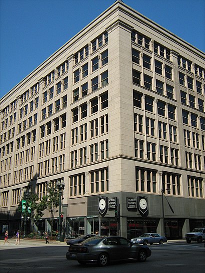
Second Leiter Building Address: 401 S State St street in Chicago
Attractions near Second Leiter Building
Cetera Labs,Harold Washington Library Winter Garden,Harold Washington Library Center,400,S State St S State St,Chicago Public Library,Harold Washington Library,Goose Island,Northerly Island,Illinois,Chicago,Harold Washington Library State Van Buren Station,DePaul University Career Center Loop Campus,HI Chicago Hostel,E Ida B Wells Dr / W Ida B Wells Dr,Dunkin',Hi Chicago Hostel (Hostelling International),State St & Van Buren St,Hi Chicago Hostel,Harold Washington Library-State / Van Buren,Hero Coffee BarHow to get to popular attractions in Chicago with public transit
Metra - Forest Glen, Chicago,Edison Park, Chicago,1350 North Lake Shore Drive Apartments, Chicago,Tri-Taylor Neighborhood, Chicago,Metra - Wheaton, Wheaton,Woodfield Mall, Schaumburg,Target, South Elgin,Garrett Popcorn Shops, Chicago,I-355 & 63rd St, Woodridge,Chama Gaucha Brazilian Steakhouse, Downers Grove,Portage Park Neighborhood, Chicago,Palos Heights, IL,127th St, Cicero Ave & I-294, Alsip,200 W Adams, Chicago,Museum Of Science And Industry, Chicago,Chicago Marriott Southwest at Burr Ridge, Burr Ridge,Al Bawadi Grill, Bridgeview,Chicago Ridge Mall, Chicago Ridge,Boeing Building, Chicago,Sheraton Lisle Hotel, LisleGet around Chicago by public transit!
Traveling around Chicago has never been so easy. See step by step directions as you travel to any attraction, street or major public transit station. View bus and train schedules, arrival times, service alerts and detailed routes on a map, so you know exactly how to get to anywhere in Chicago.
When traveling to any destination around Chicago use Moovit's Live Directions with Get Off Notifications to know exactly where and how far to walk, how long to wait for your line, and how many stops are left. Moovit will alert you when it's time to get off — no need to constantly re-check whether yours is the next stop.
Wondering how to use public transit in Chicago or how to pay for public transit in Chicago? Moovit public transit app can help you navigate your way with public transit easily, and at minimum cost. It includes public transit fees, ticket prices, and costs. Looking for a map of Chicago public transit lines? Moovit public transit app shows all public transit maps in Chicago with all bus, Chicago 'L' or train routes and stops on an interactive map.
Chicago has 3 transit type(s), including: bus, Chicago 'L' or train, operated by several transit agencies, including CTA 'L', Metra, Northern Indiana Commuter Transportation District, CTA, PACE, O'Hare International Airport Shuttle Bus, Gary Public Transit, Amtrak, River Valley Metro, Valpo Transit, DeKalb Public Transit, FlixBus-us, Greyhound-us, Van Galder (Coach USA) and Wisconsin Coach Lines