Directions to Secure Future Tech Solutions (Boston) with public transportation
The following transit lines have routes that pass near Secure Future Tech Solutions
 Bus: 1, 14, 20, 66, PROVIDENCE LINE SHUTTLE.
- Train: PROVIDENCE/STOUGHTON.
How to get to Secure Future Tech Solutions by bus?
Click on the bus route to see step by step directions with maps, line arrival times and updated time schedules.
How to get to Secure Future Tech Solutions by train?
Click on the train route to see step by step directions with maps, line arrival times and updated time schedules.
Bus stops near Secure Future Tech Solutions in Boston
Train station near Secure Future Tech Solutions in Boston
- T.F. Green Airport, 45 min walk,VIEW
Bus lines to Secure Future Tech Solutions in Boston
What are the closest stations to Secure Future Tech Solutions?
The closest stations to Secure Future Tech Solutions are:
- Opposite 639 Jefferson is 732 yards away, 9 min walk.
- TF Green Airport is 862 yards away, 11 min walk.
- T.F. Green Airport is 3796 yards away, 45 min walk.
Which bus lines stop near Secure Future Tech Solutions?
These bus lines stop near Secure Future Tech Solutions: 1, 14, 20, 66.
Which train line stops near Secure Future Tech Solutions?
PROVIDENCE/STOUGHTON (#827 | Wickford Junction)
What’s the nearest bus station to Secure Future Tech Solutions in Boston?
The nearest bus station to Secure Future Tech Solutions in Boston is Opposite 639 Jefferson. It’s a 9 min walk away.
What time is the first train to Secure Future Tech Solutions in Boston?
The PROVIDENCE/STOUGHTON is the first train that goes to Secure Future Tech Solutions in Boston. It stops nearby at 6:00 AM.
What time is the last train to Secure Future Tech Solutions in Boston?
The PROVIDENCE/STOUGHTON is the last train that goes to Secure Future Tech Solutions in Boston. It stops nearby at 7:56 PM.
What time is the first bus to Secure Future Tech Solutions in Boston?
The 14 is the first bus that goes to Secure Future Tech Solutions in Boston. It stops nearby at 5:43 AM.
What time is the last bus to Secure Future Tech Solutions in Boston?
The 14 is the last bus that goes to Secure Future Tech Solutions in Boston. It stops nearby at 8:54 PM.
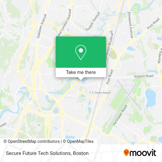
See Secure Future Tech Solutions, Boston, on the map
Public Transit to Secure Future Tech Solutions in Boston
Wondering how to get to Secure Future Tech Solutions in Boston? Moovit helps you find the best way to get to Secure Future Tech Solutions with step-by-step directions from the nearest public transit station.
Moovit provides free maps and live directions to help you navigate through your city. View schedules, routes, timetables, and find out how long does it take to get to Secure Future Tech Solutions in real time.
Looking for the nearest stop or station to Secure Future Tech Solutions? Check out this list of stops closest to your destination: Opposite 639 Jefferson; TF Green Airport; T.F. Green Airport.
Bus: 1, 14, 20, 66, PROVIDENCE LINE SHUTTLE.Train: PROVIDENCE/STOUGHTON.
Want to see if there’s another route that gets you there at an earlier time? Moovit helps you find alternative routes or times. Get directions from and directions to Secure Future Tech Solutions easily from the Moovit App or Website.
We make riding to Secure Future Tech Solutions easy, which is why over 1.7 million users, including users in Boston, trust Moovit as the best app for public transit. You don’t need to download an individual bus app or train app, Moovit is your all-in-one transit app that helps you find the best bus time or train time available.
For information on prices of bus and train, costs and ride fares to Secure Future Tech Solutions, please check the Moovit app.
Use the app to navigate to popular places including to the airport, hospital, stadium, grocery store, mall, coffee shop, school, college, and university.
Secure Future Tech Solutions Address: 475 Kilvert St Ste 110 street in Boston
- Kent Superb Locksmith,
- Volk Manufacturing,
- Northeast Noise Abatement,
- Rhode Island Spca,
- Rispca,
- Buckhead Meat of New England,
- Wmi Urban Services,
- Takeout Depot,
- Hill Enterprises,
- State Institution Cemetery 2,
- William Basile,
- Manny's Cleaning Services,
- United Parcel Service UPS,
- Buildpros,
- Amenity Aid,
- A.C.E K9 Academy,
- Kent Hospital,
- Ost Medical,
- Zaxie,
- Motion Industries
Places Near Secure Future Tech Solutions (Boston)
- Seaport District, Boston,
- Museum Of Science, Boston,
- Boston Children's Hospital, Boston,
- Faneuil Hall, Boston,
- Leader Bank Pavilion (Leader Bank Pavillion), Boston,
- Wilbur Theatre, Boston,
- House Of Blues, Boston,
- North End, Boston,
- Boston Medical Center, Boston,
- Castle Island, Boston,
- Boston Convention & Exhibition Center, Boston,
- Quincy Market, Boston,
- Boston Common, Boston,
- Td Garden, Boston,
- Wang Theater, Boston,
- Massachusetts General Hospital, Boston,
- Cheers, Boston,
- Mgm Music Hall, Boston,
- Prudential Center, Boston,
- Isabella Stewart Gardner Museum, Boston
How to get to popular places in Boston with public transit
Get around Boston by public transit!
Traveling around Boston has never been so easy. See step by step directions as you travel to any attraction, street or major public transit station. View bus and train schedules, arrival times, service alerts and detailed routes on a map, so you know exactly how to get to anywhere in Boston.
When traveling to any destination around Boston use Moovit's Live Directions with Get Off Notifications to know exactly where and how far to walk, how long to wait for your line, and how many stops are left. Moovit will alert you when it's time to get off — no need to constantly re-check whether yours is the next stop.
Wondering how to use public transit in Boston or how to pay for public transit in Boston? Moovit public transit app can help you navigate your way with public transit easily, and at minimum cost. It includes public transit fees, ticket prices, and costs. Looking for a map of Boston public transit lines? Moovit public transit app shows all public transit maps in Boston with all Bus, Train, Subway and Ferry routes and stops on an interactive map.
Boston has 4 transit type(s), including: Bus, Train, Subway and Ferry, operated by several transit agencies, including MBTA, Southeastern Regional Transit Authority, MetroWest Regional Transit Authority, Rhode Island Public Transit Authority, WRTA, Lowell Regional Transit Authority, Merrimack Valley Transit, Montachusett Regional Transit Authority, Cape Cod Regional Transit Authority, Brockton Area Transit Authority, Martha's Vineyard Transit Authority, the WAVE - Nantucket Regional Transit Authority, GATRA, Cape Ann Transportation Authority and Massport