Directions to Security Pest Elimination (Medford) with public transportation
The following transit lines have routes that pass near Security Pest Elimination
 Bus: 77, 80, 94, 95, 101.
- Train: LOWELL.
- Subway: GREEN LINE E, RED LINE, GREEN LINE B, GREEN LINE C.
How to get to Security Pest Elimination by bus?
Click on the bus route to see step by step directions with maps, line arrival times and updated time schedules.
From Boston Arts Academy, Boston
59 minFrom DoubleTree by Hilton Boston Logan Airport Chelsea, Chelsea
64 minFrom Harvard Museum Of Natural History, Cambridge
42 minFrom MBTA-Aquarium, Boston
45 minFrom Matthews Arena, Boston
57 minFrom The Westin Waltham Boston, Waltham
119 minFrom Club Quarters, Boston
44 minFrom Boston Navy Yard, Boston
42 minFrom Harvard T.H. Chan School of Public Health, Boston
78 minFrom Bistro du Midi, Boston
64 min
How to get to Security Pest Elimination by train?
Click on the train route to see step by step directions with maps, line arrival times and updated time schedules.
How to get to Security Pest Elimination by subway?
Click on the subway route to see step by step directions with maps, line arrival times and updated time schedules.
From Boston Arts Academy, Boston
86 minFrom Harvard Museum Of Natural History, Cambridge
65 minFrom MBTA-Aquarium, Boston
67 minFrom Matthews Arena, Boston
71 minFrom Club Quarters, Boston
69 minFrom Boston Navy Yard, Boston
81 minFrom Harvard T.H. Chan School of Public Health, Boston
86 minFrom Bistro du Midi, Boston
71 min
Bus stops near Security Pest Elimination in Medford
Subway stations near Security Pest Elimination in Medford
Train station near Security Pest Elimination in Medford
- West Medford, 28 min walk,VIEW
Bus lines to Security Pest Elimination in Medford
What are the closest stations to Security Pest Elimination?
The closest stations to Security Pest Elimination are:
- High St @ Jerome St is 98 yards away, 2 min walk.
- Boston Ave @ Harvard Ave is 446 yards away, 6 min walk.
- Davis Sq. is 1836 yards away, 23 min walk.
- Medford/Tufts Station is 2258 yards away, 27 min walk.
- West Medford is 2283 yards away, 28 min walk.
Which bus lines stop near Security Pest Elimination?
These bus lines stop near Security Pest Elimination: 77, 80, 94, 95.
Which train line stops near Security Pest Elimination?
LOWELL (#327 | Lowell)
Which subway lines stop near Security Pest Elimination?
These subway lines stop near Security Pest Elimination: GREEN LINE E, RED LINE.
What’s the nearest subway station to Security Pest Elimination in Medford?
The nearest subway station to Security Pest Elimination in Medford is Davis Sq.. It’s a 23 min walk away.
What’s the nearest train station to Security Pest Elimination in Medford?
The nearest train station to Security Pest Elimination in Medford is West Medford. It’s a 28 min walk away.
What’s the nearest bus station to Security Pest Elimination in Medford?
The nearest bus station to Security Pest Elimination in Medford is High St @ Jerome St. It’s a 2 min walk away.
What time is the first subway to Security Pest Elimination in Medford?
The GREEN LINE E is the first subway that goes to Security Pest Elimination in Medford. It stops nearby at 4:57 AM.
What time is the last subway to Security Pest Elimination in Medford?
The GREEN LINE E is the last subway that goes to Security Pest Elimination in Medford. It stops nearby at 2:41 AM.
What time is the first train to Security Pest Elimination in Medford?
The LOWELL is the first train that goes to Security Pest Elimination in Medford. It stops nearby at 5:29 AM.
What time is the last train to Security Pest Elimination in Medford?
The LOWELL is the last train that goes to Security Pest Elimination in Medford. It stops nearby at 12:20 AM.
What time is the first bus to Security Pest Elimination in Medford?
The 95 is the first bus that goes to Security Pest Elimination in Medford. It stops nearby at 4:57 AM.
What time is the last bus to Security Pest Elimination in Medford?
The 80 is the last bus that goes to Security Pest Elimination in Medford. It stops nearby at 1:30 AM.
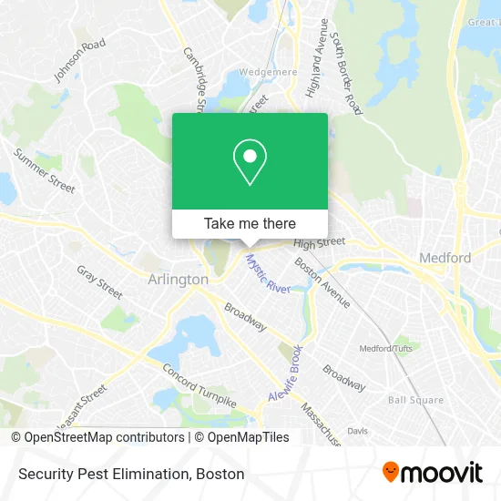
See Security Pest Elimination, Medford, on the map
Public Transit to Security Pest Elimination in Medford
Wondering how to get to Security Pest Elimination in Medford? Moovit helps you find the best way to get to Security Pest Elimination with step-by-step directions from the nearest public transit station.
Moovit provides free maps and live directions to help you navigate through your city. View schedules, routes, timetables, and find out how long does it take to get to Security Pest Elimination in real time.
Looking for the nearest stop or station to Security Pest Elimination? Check out this list of stops closest to your destination: High St @ Jerome St; Boston Ave @ Harvard Ave; Davis Sq.; Medford/Tufts Station; West Medford.
Bus: 77, 80, 94, 95, 101.Train: LOWELL.Subway: GREEN LINE E, RED LINE, GREEN LINE B, GREEN LINE C.
Want to see if there’s another route that gets you there at an earlier time? Moovit helps you find alternative routes or times. Get directions from and directions to Security Pest Elimination easily from the Moovit App or Website.
We make riding to Security Pest Elimination easy, which is why over 1.7 million users, including users in Medford, trust Moovit as the best app for public transit. You don’t need to download an individual bus app or train app, Moovit is your all-in-one transit app that helps you find the best bus time or train time available.
For information on prices of bus, subway and train, costs and ride fares to Security Pest Elimination, please check the Moovit app.
Use the app to navigate to popular places including to the airport, hospital, stadium, grocery store, mall, coffee shop, school, college, and university.
Security Pest Elimination Address: High St street in Medford
- Thrive Pet Healthcare,
- Galvin Property Management,
- AAA Stables,
- Post Run Bench,
- Mls Property Information Network, Inc.,
- Massachusetts,
- Amsell Colebrooke Playground,
- John L Greco Attorney,
- Phillips Electrical Maintenance and Construction,
- Carmaci Cleaning Services,
- Little Red Fox Day Care,
- Bni Powder House,
- Affordable Locksmith,
- SKBN Plumbing,
- Medford Vinyl Products,
- New England Meow Outfi,
- Sue Randall Family Daycare,
- Klassical Kidz Music Studio,
- Pappas Furniture Refinishing Company,
- Mls Property Information Network, Inc.
Places Near Security Pest Elimination (Medford)
- Boston Children's Hospital, Boston,
- Boston Common, Boston,
- Td Garden, Boston,
- Castle Island, Boston,
- Museum Of Science, Boston,
- North End, Boston,
- Leader Bank Pavilion (Leader Bank Pavillion), Boston,
- Boston Medical Center, Boston,
- Wilbur Theatre, Boston,
- Prudential Center, Boston,
- Wang Theater, Boston,
- Boston Convention & Exhibition Center, Boston,
- Massachusetts General Hospital, Boston,
- House Of Blues, Boston,
- Seaport District, Boston,
- Faneuil Hall, Boston,
- Quincy Market, Boston,
- Cheers, Boston,
- Isabella Stewart Gardner Museum, Boston,
- Mgm Music Hall, Boston
How to get to popular places in Boston with public transit
Get around Medford by public transit!
Traveling around Medford has never been so easy. See step by step directions as you travel to any attraction, street or major public transit station. View bus and train schedules, arrival times, service alerts and detailed routes on a map, so you know exactly how to get to anywhere in Medford.
When traveling to any destination around Medford use Moovit's Live Directions with Get Off Notifications to know exactly where and how far to walk, how long to wait for your line, and how many stops are left. Moovit will alert you when it's time to get off — no need to constantly re-check whether yours is the next stop.
Wondering how to use public transit in Medford or how to pay for public transit in Medford? Moovit public transit app can help you navigate your way with public transit easily, and at minimum cost. It includes public transit fees, ticket prices, and costs. Looking for a map of Medford public transit lines? Moovit public transit app shows all public transit maps in Medford with all Bus, Train, Subway and Ferry routes and stops on an interactive map.
Boston has 4 transit type(s), including: Bus, Train, Subway and Ferry, operated by several transit agencies, including MBTA, Southeastern Regional Transit Authority, MetroWest Regional Transit Authority, Rhode Island Public Transit Authority, WRTA, Lowell Regional Transit Authority, Merrimack Valley Transit, Montachusett Regional Transit Authority, Cape Cod Regional Transit Authority, Brockton Area Transit Authority, Martha's Vineyard Transit Authority, the WAVE - Nantucket Regional Transit Authority, GATRA, Cape Ann Transportation Authority and Massport