How to get to Security Plate Locksmith by bus?
Click on the bus route to see step by step directions with maps, line arrival times and updated time schedules.
From Chinese Embassy, Washington
58 minFrom Target, Washington
61 minFrom Tenleytown, Washington
35 minFrom The LINE Hotel DC Washington, Washington
69 minFrom Rock Creek Park, Washington
59 minFrom Dumbarton Oaks, Washington
58 minFrom Glover Park, Washington
51 minFrom Songbyrd Music House & Record Cafe, Washington
70 minFrom Wegmans, Washington
42 minFrom Children's National Columbia heights shuttle, Washington
61 min
How to get to Security Plate Locksmith by metro?
Click on the metro route to see step by step directions with maps, line arrival times and updated time schedules.
From Target, Washington
56 minFrom Tenleytown, Washington
32 minFrom The LINE Hotel DC Washington, Washington
51 minFrom Dumbarton Oaks, Washington
65 minFrom Songbyrd Music House & Record Cafe, Washington
50 minFrom Wegmans, Washington
47 minFrom Children's National Columbia heights shuttle, Washington
56 min
Bus stops near Security Plate Locksmith in Montgomery County
Bus lines to Security Plate Locksmith in Montgomery County
What are the closest stations to Security Plate Locksmith?
The closest stations to Security Plate Locksmith are:
- Old Georgetown Rd & Glenwood Rd is 351 yards away, 5 min walk.
- Huntington Pkwy & Moorland Ln is 503 yards away, 7 min walk.
Which bus lines stop near Security Plate Locksmith?
These bus lines stop near Security Plate Locksmith: 30, 47, 70.
Which metro line stops near Security Plate Locksmith?
RED (Shady Grove)
What’s the nearest bus station to Security Plate Locksmith in Montgomery County?
The nearest bus station to Security Plate Locksmith in Montgomery County is Old Georgetown Rd & Glenwood Rd. It’s a 5 min walk away.
What time is the first bus to Security Plate Locksmith in Montgomery County?
The 47 is the first bus that goes to Security Plate Locksmith in Montgomery County. It stops nearby at 5:17 AM.
What time is the last bus to Security Plate Locksmith in Montgomery County?
The 47 is the last bus that goes to Security Plate Locksmith in Montgomery County. It stops nearby at 11:25 PM.
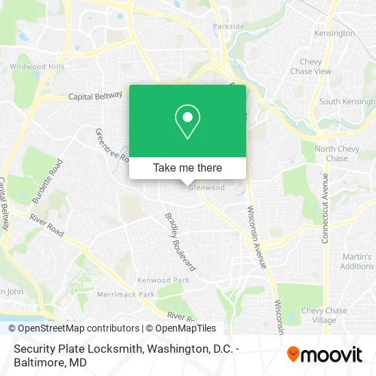
See Security Plate Locksmith, Montgomery County, on the map
Public Transit to Security Plate Locksmith in Montgomery County
Wondering how to get to Security Plate Locksmith in Montgomery County? Moovit helps you find the best way to get to Security Plate Locksmith with step-by-step directions from the nearest public transit station.
Moovit provides free maps and live directions to help you navigate through your city. View schedules, routes, timetables, and find out how long does it take to get to Security Plate Locksmith in real time.
Looking for the nearest stop or station to Security Plate Locksmith? Check out this list of stops closest to your destination: Old Georgetown Rd & Glenwood Rd; Huntington Pkwy & Moorland Ln.
Bus: 30, 47, 70.Metro: RED.
Want to see if there’s another route that gets you there at an earlier time? Moovit helps you find alternative routes or times. Get directions from and directions to Security Plate Locksmith easily from the Moovit App or Website.
We make riding to Security Plate Locksmith easy, which is why over 1.5 million users, including users in Montgomery County, trust Moovit as the best app for public transit. You don’t need to download an individual bus app or train app, Moovit is your all-in-one transit app that helps you find the best bus time or train time available.
For information on prices of bus and metro, costs and ride fares to Security Plate Locksmith, please check the Moovit app.
Use the app to navigate to popular places including to the airport, hospital, stadium, grocery store, mall, coffee shop, school, college, and university.
Security Plate Locksmith Address: 5501 Roosevelt St Bethesda, MD 20817 street in Montgomery County
- Women's Club Productions,
- Philip Corcoran, MD,
- Suburban Hospital,
- Johns Hopkins Suburban Hospital,
- Suburban Hospital Emergency Room,
- Silverstream,
- Nationwide Insurance,
- The Doggie Trail,
- John Edward Porter Neuroscience Research Center (Pnrc),
- Pepco,
- Building 37,
- Lot 501 - MLP 8,
- MCF Consulting,
- All Star Aquatics,
- USPS Collection Box - Blue Box,
- Bradley Hills Elementary School,
- Forefront Dermatology Bethesda, MD,
- Free Little Library,
- EvGateway,
- Dental & Craniofacial Res Nih
Places Near Security Plate Locksmith (Montgomery County)
- Westfield Montgomery Mall, Montgomery County,
- Washington National Cathedral, Washington,
- Amazon Hq2, Arlington County,
- Capital One Arena, Washington,
- National Mall, Washington,
- Rock Creek Tennis Center, Washington,
- PG Mall, Prince George's County,
- National Zoo, Washington,
- M&T Bank Stadium, Baltimore,
- Georgetown, Washington,
- Museum Of The Bible, Washington,
- Sibley Memorial Hospital, Washington,
- The Anthem, Washington,
- Washington DC VA Medical Center, Washington,
- Marriott Marquis Washington, DC, Washington,
- Camden Yards, Baltimore,
- Basilica of the National Shrine, Washington,
- Pennsylvania Ave NW (3rd st and pennsylvania), Washington,
- Warner Theatre, Washington,
- National Museum of African American History and Culture, Washington
How to get to popular places in Washington, D.C. - Baltimore, MD with public transit
Get around Montgomery County by public transit!
Traveling around Montgomery County has never been so easy. See step by step directions as you travel to any attraction, street or major public transit station. View bus and train schedules, arrival times, service alerts and detailed routes on a map, so you know exactly how to get to anywhere in Montgomery County.
When traveling to any destination around Montgomery County use Moovit's Live Directions with Get Off Notifications to know exactly where and how far to walk, how long to wait for your line, and how many stops are left. Moovit will alert you when it's time to get off — no need to constantly re-check whether yours is the next stop.
Wondering how to use public transit in Montgomery County or how to pay for public transit in Montgomery County? Moovit public transit app can help you navigate your way with public transit easily, and at minimum cost. It includes public transit fees, ticket prices, and costs. Looking for a map of Montgomery County public transit lines? Moovit public transit app shows all public transit maps in Montgomery County with all Bus, Train, Metro, Light Rail and Ferry routes and stops on an interactive map.
Washington, D.C. - Baltimore, MD has 5 transit type(s), including: Bus, Train, Metro, Light Rail and Ferry, operated by several transit agencies, including WMATA, Montgomery County Ride On, Fairfax Connector, TheBus, PRTC, DASH - Alexandria, Arlington Transit (ART), RTA of Central Maryland, MDOT MTA, MDOT MTA Light RailLink, MDOT MTA Commuter Bus, MDOT MTA Local Bus, FXBGO!, Virginia Railway Express (VRE) and MARC