Directions to Seeking Safety (Newton) with public transportation
The following transit lines have routes that pass near Seeking Safety
 Bus: 52, GREEN LINE D SHUTTLE, GREEN LINE D SHUTTLE, GREEN LINE D SHUTTLE, GREEN LINE D SHUTTLE.
- Train: FRAMINGHAM/WORCESTER.
- Subway: GREEN LINE D, GREEN LINE B.
How to get to Seeking Safety by bus?
Click on the bus route to see step by step directions with maps, line arrival times and updated time schedules.
From J.J. Foley's Cafe, Boston
45 minFrom Mass Eye and Ear Infirmary, Boston
54 minFrom Prudential Center, Boston
38 minFrom Found Hotel Boston Common, Boston
38 minFrom The Mapparium, Boston
44 minFrom Public Garden (Boston Public Garden), Boston
43 minFrom New England Law | Boston, Boston
36 minFrom Sam Adams Boston Brewery Tour, Boston
85 minFrom Massachusetts Eye And Ear, Boston
54 minFrom Boston Arts Academy, Boston
55 min
How to get to Seeking Safety by train?
Click on the train route to see step by step directions with maps, line arrival times and updated time schedules.
From J.J. Foley's Cafe, Boston
70 minFrom Mass Eye and Ear Infirmary, Boston
145 minFrom Prudential Center, Boston
64 minFrom Found Hotel Boston Common, Boston
67 minFrom The Mapparium, Boston
71 minFrom Public Garden (Boston Public Garden), Boston
133 minFrom New England Law | Boston, Boston
67 minFrom Sam Adams Boston Brewery Tour, Boston
169 minFrom Massachusetts Eye And Ear, Boston
150 minFrom Boston Arts Academy, Boston
59 min
How to get to Seeking Safety by subway?
Click on the subway route to see step by step directions with maps, line arrival times and updated time schedules.
From J.J. Foley's Cafe, Boston
64 minFrom Mass Eye and Ear Infirmary, Boston
64 minFrom Prudential Center, Boston
55 minFrom Found Hotel Boston Common, Boston
58 minFrom The Mapparium, Boston
49 minFrom Public Garden (Boston Public Garden), Boston
57 minFrom New England Law | Boston, Boston
56 minFrom Sam Adams Boston Brewery Tour, Boston
73 minFrom Massachusetts Eye And Ear, Boston
64 minFrom Boston Arts Academy, Boston
51 min
Bus stops near Seeking Safety in Newton
Subway stations near Seeking Safety in Newton
Train station near Seeking Safety in Newton
- Newtonville, 52 min walk,VIEW
Bus lines to Seeking Safety in Newton
- 52, Dedham Mall,VIEW
- GREEN LINE D SHUTTLE, Newton Highlands - Kenmore,VIEW
- GREEN LINE D SHUTTLE, Riverside - Kenmore via Saint Mary's Street,VIEW
- GREEN LINE D SHUTTLE, Riverside - Brookline Hills,VIEW
- GREEN LINE D SHUTTLE, Newton Highlands - Brookline Hills,VIEW
- GREEN LINE D SHUTTLE, Newton Highlands - Fenway,VIEW
- GREEN LINE D SHUTTLE, Riverside - Fenway,VIEW
- GREEN LINE D SHUTTLE, Riverside - Kenmore (Shuttle),VIEW
- GREEN LINE D SHUTTLE, Riverside - Brookline Village,VIEW
- GREEN LINE D SHUTTLE, Riverside - Reservoir,VIEW
- GREEN LINE D SHUTTLE, Newton Highlands - Kenmore via Saint Mary's Street,VIEW
- GREEN LINE D SHUTTLE, Newton Highlands - Reservoir,VIEW
- GREEN LINE D SHUTTLE, Riverside - Kenmore,VIEW
What are the closest stations to Seeking Safety?
The closest stations to Seeking Safety are:
- Centre St @ Langley Rd is 604 yards away, 8 min walk.
- Newton Centre - Langley Rd Opp Braeland Ave is 1007 yards away, 12 min walk.
- Newton Centre is 1605 yards away, 19 min walk.
- Boston College is 2379 yards away, 28 min walk.
- Newtonville is 4417 yards away, 52 min walk.
Which bus line stops near Seeking Safety?
52 (Charles River Loop)
Which train line stops near Seeking Safety?
FRAMINGHAM/WORCESTER (#521 | Worcester)
Which subway line stops near Seeking Safety?
GREEN LINE D (Riverside)
What’s the nearest subway station to Seeking Safety in Newton?
The nearest subway station to Seeking Safety in Newton is Newton Centre. It’s a 19 min walk away.
What’s the nearest bus station to Seeking Safety in Newton?
The nearest bus station to Seeking Safety in Newton is Centre St @ Langley Rd. It’s a 8 min walk away.
What time is the first subway to Seeking Safety in Newton?
The GREEN LINE D is the first subway that goes to Seeking Safety in Newton. It stops nearby at 4:52 AM.
What time is the last subway to Seeking Safety in Newton?
The GREEN LINE D is the last subway that goes to Seeking Safety in Newton. It stops nearby at 2:39 AM.
What time is the first train to Seeking Safety in Newton?
The FRAMINGHAM/WORCESTER is the first train that goes to Seeking Safety in Newton. It stops nearby at 5:25 AM.
What time is the last train to Seeking Safety in Newton?
The FRAMINGHAM/WORCESTER is the last train that goes to Seeking Safety in Newton. It stops nearby at 12:17 AM.
What time is the first bus to Seeking Safety in Newton?
The 52 is the first bus that goes to Seeking Safety in Newton. It stops nearby at 6:44 AM.
What time is the last bus to Seeking Safety in Newton?
The 52 is the last bus that goes to Seeking Safety in Newton. It stops nearby at 7:00 PM.
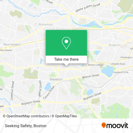
See Seeking Safety, Newton, on the map
Public Transit to Seeking Safety in Newton
Wondering how to get to Seeking Safety in Newton? Moovit helps you find the best way to get to Seeking Safety with step-by-step directions from the nearest public transit station.
Moovit provides free maps and live directions to help you navigate through your city. View schedules, routes, timetables, and find out how long does it take to get to Seeking Safety in real time.
Looking for the nearest stop or station to Seeking Safety? Check out this list of stops closest to your destination: Centre St @ Langley Rd; Newton Centre - Langley Rd Opp Braeland Ave; Newton Centre; Boston College; Newtonville.
Bus: 52, GREEN LINE D SHUTTLE, GREEN LINE D SHUTTLE, GREEN LINE D SHUTTLE, GREEN LINE D SHUTTLE, GREEN LINE D SHUTTLE.Train: FRAMINGHAM/WORCESTER.Subway: GREEN LINE D, GREEN LINE B.
Want to see if there’s another route that gets you there at an earlier time? Moovit helps you find alternative routes or times. Get directions from and directions to Seeking Safety easily from the Moovit App or Website.
We make riding to Seeking Safety easy, which is why over 1.7 million users, including users in Newton, trust Moovit as the best app for public transit. You don’t need to download an individual bus app or train app, Moovit is your all-in-one transit app that helps you find the best bus time or train time available.
For information on prices of subway, bus and train, costs and ride fares to Seeking Safety, please check the Moovit app.
Use the app to navigate to popular places including to the airport, hospital, stadium, grocery store, mall, coffee shop, school, college, and university.
Seeking Safety Address: 28 Westbourne Rd street in Newton
- Palmer, Jonathan MD,
- Temple Emanuel Preschool,
- ATM Holdings,
- Cteen Newton Centre,
- Architectural Art Technology,
- Tufts University,
- Heartbreak Hill,
- Newton, MA,
- Dr. Timothy Davis,
- Kitchen Plus,
- David Polstein,
- Titan Excavating,
- Atlas Contracting Inc,
- Boston Integrated Body,
- John Gregory Salon,
- Meridian Care,
- Move2boston Group,
- All Season Sports,
- Allguard Locksmith,
- Heartbreak Hill Running Company
Places Near Seeking Safety (Newton)
- Isabella Stewart Gardner Museum, Boston,
- Wang Theater, Boston,
- House Of Blues, Boston,
- Cheers, Boston,
- Faneuil Hall, Boston,
- Leader Bank Pavilion (Leader Bank Pavillion), Boston,
- Td Garden, Boston,
- Castle Island, Boston,
- Massachusetts General Hospital, Boston,
- Mgm Music Hall, Boston,
- Prudential Center, Boston,
- North End, Boston,
- Museum Of Science, Boston,
- Seaport District, Boston,
- Boston Children's Hospital, Boston,
- Quincy Market, Boston,
- Boston Common, Boston,
- Boston Medical Center, Boston,
- Boston Convention & Exhibition Center, Boston,
- Wilbur Theatre, Boston
How to get to popular places in Boston with public transit
Get around Newton by public transit!
Traveling around Newton has never been so easy. See step by step directions as you travel to any attraction, street or major public transit station. View bus and train schedules, arrival times, service alerts and detailed routes on a map, so you know exactly how to get to anywhere in Newton.
When traveling to any destination around Newton use Moovit's Live Directions with Get Off Notifications to know exactly where and how far to walk, how long to wait for your line, and how many stops are left. Moovit will alert you when it's time to get off — no need to constantly re-check whether yours is the next stop.
Wondering how to use public transit in Newton or how to pay for public transit in Newton? Moovit public transit app can help you navigate your way with public transit easily, and at minimum cost. It includes public transit fees, ticket prices, and costs. Looking for a map of Newton public transit lines? Moovit public transit app shows all public transit maps in Newton with all Bus, Train, Subway and Ferry routes and stops on an interactive map.
Boston has 4 transit type(s), including: Bus, Train, Subway and Ferry, operated by several transit agencies, including MBTA, Southeastern Regional Transit Authority, MetroWest Regional Transit Authority, Rhode Island Public Transit Authority, WRTA, Lowell Regional Transit Authority, Merrimack Valley Transit, Montachusett Regional Transit Authority, Cape Cod Regional Transit Authority, Brockton Area Transit Authority, Martha's Vineyard Transit Authority, the WAVE - Nantucket Regional Transit Authority, GATRA, Cape Ann Transportation Authority and Massport