Directions to Segal Roitman (Boston) with public transportation
The following transit lines have routes that pass near Segal Roitman
 Bus: 504, 92, 93, SL3, SL4.
- Train: FRAMINGHAM/WORCESTER, HAVERHILL, LOWELL, NEEDHAM, COMMUTER RAIL SHUTTLE.
- Subway: GREEN LINE D, ORANGE LINE, RED LINE, GREEN LINE B, GREEN LINE C.
How to get to Segal Roitman by bus?
Click on the bus route to see step by step directions with maps, line arrival times and updated time schedules.
From Milton Academy, Milton
91 minFrom Lemuel Shattuck Hospital, Boston
55 minFrom Revere Beach, Revere
77 minFrom Malden, MA, Malden
71 minFrom Costco, Everett
63 minFrom La Quinta Inn & Suites Boston Somerville, Somerville
61 minFrom The Mall At Chestnut Hill, Newton
66 minFrom Regent Theatre, Arlington
74 minFrom FOUR POINTS BY SHERATON Boston Newton, Newton
24 minFrom AC Hotel Boston Cambridge, Cambridge
94 min
How to get to Segal Roitman by train?
Click on the train route to see step by step directions with maps, line arrival times and updated time schedules.
How to get to Segal Roitman by subway?
Click on the subway route to see step by step directions with maps, line arrival times and updated time schedules.
From Milton Academy, Milton
58 minFrom Lemuel Shattuck Hospital, Boston
35 minFrom Revere Beach, Revere
46 minFrom Malden, MA, Malden
31 minFrom Costco, Everett
32 minFrom La Quinta Inn & Suites Boston Somerville, Somerville
25 minFrom The Mall At Chestnut Hill, Newton
61 minFrom AC Hotel Boston Cambridge, Cambridge
44 min
Bus stops near Segal Roitman in Boston
Subway stations near Segal Roitman in Boston
Train station near Segal Roitman in Boston
- South Station, 19 min walk,VIEW
Bus lines to Segal Roitman in Boston
- 7, Otis & Summer - City Point,VIEW
- 501, Downtown via Copley (Express) - Brighton via Copley (Express),VIEW
- 504, Downtown via Copley (Express) - Watertown via Copley and Newton Corner (Express),VIEW
- 505, Downtown (Express) - Waltham (Express),VIEW
- RED LINE SHUTTLE, Harvard - JFK/UMass via Congress Street,VIEW
- RED LINE SHUTTLE, Harvard - Broadway,VIEW
- RED LINE SHUTTLE, Kendall/MIT - JFK/UMass,VIEW
- RED LINE SHUTTLE, Harvard - JFK/UMass via State Street,VIEW
- RED LINE SHUTTLE, JFK/UMass - Kendall/MIT (Shuttle),VIEW
- 39, Haymarket Via Forest Hills,VIEW
- 57, Haymarket Via Kenmore,VIEW
- SL4, Nubian,VIEW
- 43, Ruggles,VIEW
- 11, City Point,VIEW
- 15, Mattapan Via Nubian & Fields Corner,VIEW
- SL5, Nubian,VIEW
- GREEN LINE E SHUTTLE, Heath Street (Shuttle),VIEW
- GREEN LINE SHUTTLE, Blandford Street (Shuttle),VIEW
What are the closest stations to Segal Roitman?
The closest stations to Segal Roitman are:
- Otis St @ Summer St is 94 yards away, 2 min walk.
- Stuart St @ Charles St S is 143 yards away, 3 min walk.
- Chinatown Gate is 309 yards away, 4 min walk.
- 285 Tremont St is 325 yards away, 5 min walk.
- Washington St @ Essex St is 332 yards away, 5 min walk.
- Downtown Crossing is 553 yards away, 7 min walk.
- Tremont St @ Boylston Station is 587 yards away, 7 min walk.
- South Station is 1566 yards away, 19 min walk.
- Boylston is 1972 yards away, 24 min walk.
Which bus lines stop near Segal Roitman?
These bus lines stop near Segal Roitman: 504, 92, 93, SL3, SL4, SL5.
Which train lines stop near Segal Roitman?
These train lines stop near Segal Roitman: FRAMINGHAM/WORCESTER, HAVERHILL, LOWELL, NEEDHAM.
Which subway lines stop near Segal Roitman?
These subway lines stop near Segal Roitman: GREEN LINE D, ORANGE LINE, RED LINE.
What’s the nearest subway station to Segal Roitman in Boston?
The nearest subway station to Segal Roitman in Boston is Downtown Crossing. It’s a 7 min walk away.
What’s the nearest train station to Segal Roitman in Boston?
The nearest train station to Segal Roitman in Boston is South Station. It’s a 19 min walk away.
What’s the nearest bus station to Segal Roitman in Boston?
The nearest bus station to Segal Roitman in Boston is Otis St @ Summer St. It’s a 2 min walk away.
What time is the first subway to Segal Roitman in Boston?
The GREEN LINE D is the first subway that goes to Segal Roitman in Boston. It stops nearby at 5:09 AM.
What time is the last subway to Segal Roitman in Boston?
The GREEN LINE E is the last subway that goes to Segal Roitman in Boston. It stops nearby at 2:16 AM.
What time is the first train to Segal Roitman in Boston?
The PROVIDENCE/STOUGHTON is the first train that goes to Segal Roitman in Boston. It stops nearby at 4:20 AM.
What time is the last train to Segal Roitman in Boston?
The LAKE SHORE LIMITED is the last train that goes to Segal Roitman in Boston. It stops nearby at 8:32 PM.
What time is the first bus to Segal Roitman in Boston?
The SLW is the first bus that goes to Segal Roitman in Boston. It stops nearby at 4:19 AM.
What time is the last bus to Segal Roitman in Boston?
The 11 is the last bus that goes to Segal Roitman in Boston. It stops nearby at 1:15 AM.
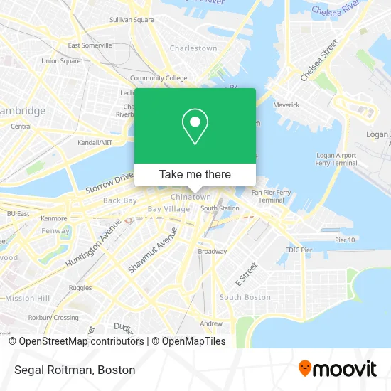
See Segal Roitman, Boston, on the map
Public Transit to Segal Roitman in Boston
Wondering how to get to Segal Roitman in Boston? Moovit helps you find the best way to get to Segal Roitman with step-by-step directions from the nearest public transit station.
Moovit provides free maps and live directions to help you navigate through your city. View schedules, routes, timetables, and find out how long does it take to get to Segal Roitman in real time.
Looking for the nearest stop or station to Segal Roitman? Check out this list of stops closest to your destination: Otis St @ Summer St; Stuart St @ Charles St S; Chinatown Gate; 285 Tremont St; Washington St @ Essex St; Downtown Crossing; Tremont St @ Boylston Station; South Station; Boylston.
Bus: 504, 92, 93, SL3, SL4, SL5, 7, 501, 505, RED LINE SHUTTLE, 39, 57.Train: FRAMINGHAM/WORCESTER, HAVERHILL, LOWELL, NEEDHAM, COMMUTER RAIL SHUTTLE, FAIRMOUNT LINE SHUTTLE, FRANKLIN LINE SHUTTLE, KINGSTON LINE SHUTTLE, SL1.Subway: GREEN LINE D, ORANGE LINE, RED LINE, GREEN LINE B, GREEN LINE C, GREEN LINE E.
Want to see if there’s another route that gets you there at an earlier time? Moovit helps you find alternative routes or times. Get directions from and directions to Segal Roitman easily from the Moovit App or Website.
We make riding to Segal Roitman easy, which is why over 1.7 million users, including users in Boston, trust Moovit as the best app for public transit. You don’t need to download an individual bus app or train app, Moovit is your all-in-one transit app that helps you find the best bus time or train time available.
For information on prices of bus, subway and train, costs and ride fares to Segal Roitman, please check the Moovit app.
Use the app to navigate to popular places including to the airport, hospital, stadium, grocery store, mall, coffee shop, school, college, and university.
Segal Roitman Address: 33 Harrison Ave street in Boston
- Royal Entertainment,
- Locks & Locksmith 24 Hrs (Locks and Locksmiths),
- Fong Massage Therapy,
- Q Restaurant USA,
- Phillips Square Tactical Plaza,
- Global Luxury Suites Downtown Boston,
- Wingwah (Wing Wah Mini Store in),
- Wakuwaku,
- Kok Wa,
- My Thai Vegan Cafe,
- Tufts University - Health Sciences Bookstore,
- Dewey Square Park on the Greenway,
- 12 Tyler St,
- Le's Salon & Beauty (Les Salon Beauty),
- Tufts Dental,
- Aqua World,
- Tufts Medical Center MBTA Station - Orange & Silver Line,
- Verizon,
- Combat Zone,
- Department of Neuroscience, Tufts University School of Medicine
Places Near Segal Roitman (Boston)
- Faneuil Hall, Boston,
- Mgm Music Hall, Boston,
- Leader Bank Pavilion (Leader Bank Pavillion), Boston,
- Castle Island, Boston,
- Museum Of Science, Boston,
- Prudential Center, Boston,
- Cheers, Boston,
- Td Garden, Boston,
- Isabella Stewart Gardner Museum, Boston,
- Boston Children's Hospital, Boston,
- Boston Medical Center, Boston,
- North End, Boston,
- House Of Blues, Boston,
- Wilbur Theatre, Boston,
- Seaport District, Boston,
- Wang Theater, Boston,
- Boston Convention & Exhibition Center, Boston,
- Massachusetts General Hospital, Boston,
- Quincy Market, Boston,
- Boston Common, Boston
How to get to popular places in Boston with public transit
Get around Boston by public transit!
Traveling around Boston has never been so easy. See step by step directions as you travel to any attraction, street or major public transit station. View bus and train schedules, arrival times, service alerts and detailed routes on a map, so you know exactly how to get to anywhere in Boston.
When traveling to any destination around Boston use Moovit's Live Directions with Get Off Notifications to know exactly where and how far to walk, how long to wait for your line, and how many stops are left. Moovit will alert you when it's time to get off — no need to constantly re-check whether yours is the next stop.
Wondering how to use public transit in Boston or how to pay for public transit in Boston? Moovit public transit app can help you navigate your way with public transit easily, and at minimum cost. It includes public transit fees, ticket prices, and costs. Looking for a map of Boston public transit lines? Moovit public transit app shows all public transit maps in Boston with all Bus, Train, Subway and Ferry routes and stops on an interactive map.
Boston has 4 transit type(s), including: Bus, Train, Subway and Ferry, operated by several transit agencies, including MBTA, Southeastern Regional Transit Authority, MetroWest Regional Transit Authority, Rhode Island Public Transit Authority, WRTA, Lowell Regional Transit Authority, Merrimack Valley Transit, Montachusett Regional Transit Authority, Cape Cod Regional Transit Authority, Brockton Area Transit Authority, Martha's Vineyard Transit Authority, the WAVE - Nantucket Regional Transit Authority, GATRA, Cape Ann Transportation Authority and Massport