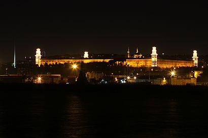
See Selimiye Kışlası, Selimiye, Üsküdar, on the map
Directions to Selimiye Kışlası (Selimiye, Üsküdar) with public transportation
The following transit lines have routes that pass near Selimiye Kışlası
 Bus:
Bus: - Train:
- Dolmus & Minibus:
- Ferry:
How to get to Selimiye Kışlası by bus?
Click on the bus route to see step by step directions with maps, line arrival times and updated time schedules.
How to get to Selimiye Kışlası by train?
Click on the train route to see step by step directions with maps, line arrival times and updated time schedules.
Ferry stations near Selimiye Kışlası in Selimiye, Üsküdar
- Harem,6 min walk,
What are the closest stations to Selimiye Kışlası?
The closest stations to Selimiye Kışlası are:
- Harem is 417 meters away, 6 min walk.
Which bus lines stop near Selimiye Kışlası?
These bus lines stop near Selimiye Kışlası: 11C, 11D, 11M, 9.
Which train line stops near Selimiye Kışlası?
MARMARAY
Which Dolmus & Minibus line stops near Selimiye Kışlası?
ÜSKÜDAR - FERHATPAŞA
What’s the nearest ferry station to Selimiye Kışlası in Selimiye, Üsküdar?
The nearest ferry station to Selimiye Kışlası in Selimiye, Üsküdar is Harem. It’s a 6 min walk away.
See Selimiye Kışlası, Selimiye, Üsküdar, on the map
Public Transit to Selimiye Kışlası in Selimiye, Üsküdar
Wondering how to get to Selimiye Kışlası in Selimiye, Üsküdar, Turkey? Moovit helps you find the best way to get to Selimiye Kışlası with step-by-step directions from the nearest public transit station.
Moovit provides free maps and live directions to help you navigate through your city. View schedules, routes, timetables, and find out how long does it take to get to Selimiye Kışlası in real time.
Looking for the nearest stop or station to Selimiye Kışlası? Check out this list of stops closest to your destination: Harem.
Bus:Train:Dolmus & Minibus:Ferry:
Want to see if there’s another route that gets you there at an earlier time? Moovit helps you find alternative routes or times. Get directions from and directions to Selimiye Kışlası easily from the Moovit App or Website.
We make riding to Selimiye Kışlası easy, which is why over 1.5 million users, including users in Selimiye, Üsküdar, trust Moovit as the best app for public transit. You don’t need to download an individual bus app or train app, Moovit is your all-in-one transit app that helps you find the best bus time or train time available.
For information on prices of bus, train and Dolmus & Minibus, costs and ride fares to Selimiye Kışlası, please check the Moovit app.
Use the app to navigate to popular places including to the airport, hospital, stadium, grocery store, mall, coffee shop, school, college, and university.
Location: Selimiye, Üsküdar, Istanbul
Attractions near Selimiye Kışlası
harem otogar & kafeterya,Harem Otogarı Vib Turizm,Efetur,Sakarya Vib,Harem Otogarı,Harem Sahili,akabe tesisleri,İstanbul-Karasu Yolu,Efetur Harem-İzmit Otobüsü,İstanbul Sakarya Yolu,İzmit Seyahat Otobüsü,Harem Pamukkale anadolu turizm 🚐,İzmit Seyahat Harem,HAREM POLİS NOKTASI,Harem otogar & Harika Büfe,Harem Otogarı, Peron 6,38,93,Harem➡️Adapazarı (Vib),Üsküdar Harem OtogarıHow to get to popular attractions in Selimiye, Üsküdar with public transit
Maltepe Park, Maltepe,Altıntepe Sahil, Maltepe,Acıbadem Maslak Hastanesi, Sariyer,Dondurmacı Efe Usta, Üsküdar,Acıbadem Üniversitesi Kerem Aydınlar Yerleşkesi, Ataşehir,Lido Restaurant,Başakşehir, Basaksehir,Piyata Cafe Pub & Restaurant, Üsküdar,Marmara Üniversitesi Pendik Eğitim Ve Araştırma Hastanesi, Pendik,Lavazza, Maltepe,Park Sitesi, Gebze,Barbun, Maltepe,Cakes&Bakes, Esenyurt,Akbatı Avm, Esenyurt,Yeşilköy Marina Live Club, Bakirköy,Unkapanı, Fatih,Bursa Kebap Evi, Pendik,Çimenli Sitesi, Sariyer,Marina Karaoke Club, Bakirköy,Mola Cafe, SariyerGet around Selimiye, Üsküdar by public transit!
Traveling around Selimiye, Üsküdar has never been so easy. See step by step directions as you travel to any attraction, street or major public transit station. View bus and train schedules, arrival times, service alerts and detailed routes on a map, so you know exactly how to get to anywhere in Selimiye, Üsküdar.
When traveling to any destination around Selimiye, Üsküdar use Moovit's Live Directions with Get Off Notifications to know exactly where and how far to walk, how long to wait for your line, and how many stops are left. Moovit will alert you when it's time to get off — no need to constantly re-check whether yours is the next stop.
Wondering how to use public transit in Selimiye, Üsküdar or how to pay for public transit in Selimiye, Üsküdar? Moovit public transit app can help you navigate your way with public transit easily, and at minimum cost. It includes public transit fees, ticket prices, and costs. Looking for a map of Selimiye, Üsküdar public transit lines? Moovit public transit app shows all public transit maps in Selimiye, Üsküdar with all bus, train or Dolmus & Minibus routes and stops on an interactive map.
Selimiye, Üsküdar has 3 transit type(s), including: bus, train or Dolmus & Minibus, operated by several transit agencies, including Metro İstanbul, UAB, Marmaray, Metrobüs, UAB, Metro İstanbul, İETT, İETT, Şehir Hatları, Dentur Avrasya, Beyden, Turyol, Mavi Marmara, Prenstur and İETT