Directions to Sencorpwhite (Barnstable Town) with public transportation
The following transit lines have routes that pass near Sencorpwhite
How to get to Sencorpwhite by bus?
Click on the bus route to see step by step directions with maps, line arrival times and updated time schedules.
Bus stops near Sencorpwhite in Barnstable Town
Train station near Sencorpwhite in Barnstable Town
- Hyannis, 32 min walk,VIEW
Bus lines to Sencorpwhite in Barnstable Town
What are the closest stations to Sencorpwhite?
The closest stations to Sencorpwhite are:
- Cape Cod Mall (Mens Warehouse), Hyannis is 375 yards away, 5 min walk.
- Cape Cod Mall Entrance/Route 28, Hyannis is 796 yards away, 10 min walk.
- Hyannis is 2673 yards away, 32 min walk.
Which bus lines stop near Sencorpwhite?
These bus lines stop near Sencorpwhite: BARNSTABLE VILLAGER, PETER PAN, SEALINE HYANNIS-FALMOUTH/WOODS HOLE.
What’s the nearest bus station to Sencorpwhite in Barnstable Town?
The nearest bus station to Sencorpwhite in Barnstable Town is Cape Cod Mall (Mens Warehouse), Hyannis. It’s a 5 min walk away.
What time is the first bus to Sencorpwhite in Barnstable Town?
The SEALINE HYANNIS-FALMOUTH/WOODS HOLE is the first bus that goes to Sencorpwhite in Barnstable Town. It stops nearby at 5:35 AM.
What time is the last bus to Sencorpwhite in Barnstable Town?
The SEALINE HYANNIS-FALMOUTH/WOODS HOLE is the last bus that goes to Sencorpwhite in Barnstable Town. It stops nearby at 9:05 PM.
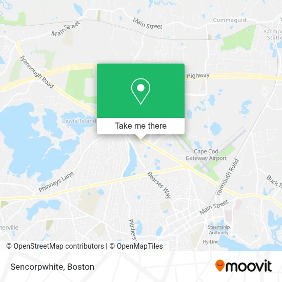
See Sencorpwhite, Barnstable Town, on the map
Public Transit to Sencorpwhite in Barnstable Town
Wondering how to get to Sencorpwhite in Barnstable Town? Moovit helps you find the best way to get to Sencorpwhite with step-by-step directions from the nearest public transit station.
Moovit provides free maps and live directions to help you navigate through your city. View schedules, routes, timetables, and find out how long does it take to get to Sencorpwhite in real time.
Looking for the nearest stop or station to Sencorpwhite? Check out this list of stops closest to your destination: Cape Cod Mall (Mens Warehouse); Cape Cod Mall Entrance/Route 28; Hyannis.
Bus: BARNSTABLE VILLAGER, PETER PAN, SEALINE HYANNIS-FALMOUTH/WOODS HOLE, HYANNIS CROSSTOWN.Train: CAPEFLYER.
Want to see if there’s another route that gets you there at an earlier time? Moovit helps you find alternative routes or times. Get directions from and directions to Sencorpwhite easily from the Moovit App or Website.
We make riding to Sencorpwhite easy, which is why over 1.7 million users, including users in Barnstable Town, trust Moovit as the best app for public transit. You don’t need to download an individual bus app or train app, Moovit is your all-in-one transit app that helps you find the best bus time or train time available.
For information on prices of bus and ferry, costs and ride fares to Sencorpwhite, please check the Moovit app.
Use the app to navigate to popular places including to the airport, hospital, stadium, grocery store, mall, coffee shop, school, college, and university.
Sencorpwhite Address: 400 Kidds Hill Rd street in Barnstable Town
- Amazon Locker-Hyannis,
- Chick-Fil-A,
- Coinstar,
- Interstate Batteries,
- Olive Garden Italian Restaurant,
- Depot,
- Adt Security Services,
- Bank of America,
- WW Studio,
- Cold Noses Foundation,
- Telegraph Hill Home Buyers - Sell Your House Fast,
- Clearview Realty,
- Gutter Pro,
- Elite Capital Connection,
- Greenhow,
- Cedar Wood Mortgage,
- Davis Automotive,
- Premium Auto Body Repair,
- Cooke's Seafood - Hyannis,
- Sally Beauty Supply
Places Near Sencorpwhite (Barnstable Town)
- Cheers, Boston,
- Wilbur Theatre, Boston,
- Td Garden, Boston,
- Isabella Stewart Gardner Museum, Boston,
- Boston Convention & Exhibition Center, Boston,
- Prudential Center, Boston,
- Boston Medical Center, Boston,
- Leader Bank Pavilion (Leader Bank Pavillion), Boston,
- Boston Children's Hospital, Boston,
- Mgm Music Hall, Boston,
- Museum Of Science, Boston,
- Faneuil Hall, Boston,
- Quincy Market, Boston,
- House Of Blues, Boston,
- Wang Theater, Boston,
- Seaport District, Boston,
- Boston Common, Boston,
- Massachusetts General Hospital, Boston,
- North End, Boston,
- Castle Island, Boston
How to get to popular places in Boston with public transit
Get around Barnstable Town by public transit!
Traveling around Barnstable Town has never been so easy. See step by step directions as you travel to any attraction, street or major public transit station. View bus and train schedules, arrival times, service alerts and detailed routes on a map, so you know exactly how to get to anywhere in Barnstable Town.
When traveling to any destination around Barnstable Town use Moovit's Live Directions with Get Off Notifications to know exactly where and how far to walk, how long to wait for your line, and how many stops are left. Moovit will alert you when it's time to get off — no need to constantly re-check whether yours is the next stop.
Wondering how to use public transit in Barnstable Town or how to pay for public transit in Barnstable Town? Moovit public transit app can help you navigate your way with public transit easily, and at minimum cost. It includes public transit fees, ticket prices, and costs. Looking for a map of Barnstable Town public transit lines? Moovit public transit app shows all public transit maps in Barnstable Town with all Bus, Train, Subway and Ferry routes and stops on an interactive map.
Boston has 4 transit type(s), including: Bus, Train, Subway and Ferry, operated by several transit agencies, including MBTA, Southeastern Regional Transit Authority, MetroWest Regional Transit Authority, Rhode Island Public Transit Authority, WRTA, Lowell Regional Transit Authority, Merrimack Valley Transit, Montachusett Regional Transit Authority, Cape Cod Regional Transit Authority, Brockton Area Transit Authority, Martha's Vineyard Transit Authority, the WAVE - Nantucket Regional Transit Authority, GATRA, Cape Ann Transportation Authority and Massport