Directions to Senningen station (Niederanven) with public transit
The following transit lines have routes that pass near Senningen
How to get to Senningen station by bus?
Click on the bus route to see step by step directions with maps, line arrival times and updated time schedules.
Bus stops near Senningen in Niederanven
- Senningerberg, Gromscheed, 2 min walk,
- Senningen, Um Kiem, 6 min walk,
- Senningerberg, Charlys Statioun, 7 min walk,
- Senningerberg, Mënsterbësch, 15 min walk,
Light Rail stations near Senningen in Niederanven
- Senningerberg, Héienhaff P+R, 43 min walk,
Train station near Senningen in Niederanven
- Munsbach, Gare, 55 min walk,
Bus lines to Senningen station in Niederanven
- 322, Wecker-Gare, Gare Routière,
- 326, Kirchberg, Gare Routière Luxexpo,
- C09, Contern, Birewee,
- H04, Ernster, Duerfplaz,
- 311, Kirchberg, Gare Routière Luxexpo,
- 321, Oberanven, Gemeng,
- 323, Canach, Huehlgaass,
- 325, Kirchberg, Gare Routière Luxexpo,
- 327, Kirchberg, Gare Routière Luxexpo,
- C01, Merl, Geesseknäppchen (S),
- D02, Merl, Geesseknäppchen (S),
- D03, Machtum, Bei Kallek's,
- E04, Limpertsberg, L.T.C.,
- E05, Limpertsberg, L.T.C.,
- E33, Kirchberg, Gare Routière Luxexpo,
- 29, Hesperange, Cité Um Schlass,
- 212, Kirchberg, Europe Gare Routière,
- 223, Bonnevoie, Lycée Bouneweg Pe,
- 850, Bertrange, Belle Etoile,
- D01, Junglinster, Op Der Gare,
What are the closest stations to Senningen?
The closest stations to Senningen are:
- Senningerberg, Gromscheed is 85 meters away, 2 min walk.
- Senningen, Um Kiem is 470 meters away, 6 min walk.
- Senningerberg, Charlys Statioun is 528 meters away, 7 min walk.
- Senningerberg, Mënsterbësch is 1171 meters away, 15 min walk.
- Senningerberg, Héienhaff P+R is 3317 meters away, 43 min walk.
- Munsbach, Gare is 4281 meters away, 55 min walk.
Which bus lines stop near Senningen?
These bus lines stop near Senningen: 29, 311, 321, 327, 850.
What’s the nearest bus stop to Senningen in Niederanven?
The nearest bus stop to Senningen in Niederanven is Senningerberg, Gromscheed. It’s a 2 min walk away.
What time is the first light rail to Senningen in Niederanven?
The T1 is the first light rail that goes to Senningen in Niederanven. It stops nearby at 4:44 AM.
What time is the last light rail to Senningen in Niederanven?
The T1 is the last light rail that goes to Senningen in Niederanven. It stops nearby at 12:09 AM.
What time is the first train to Senningen in Niederanven?
The RB is the first train that goes to Senningen in Niederanven. It stops nearby at 5:00 AM.
What time is the last train to Senningen in Niederanven?
The RB is the last train that goes to Senningen in Niederanven. It stops nearby at 12:00 AM.
What time is the first bus to Senningen in Niederanven?
The 29 is the first bus that goes to Senningen in Niederanven. It stops nearby at 4:30 AM.
What time is the last bus to Senningen in Niederanven?
The 325 is the last bus that goes to Senningen in Niederanven. It stops nearby at 12:20 AM.
See Senningen, Niederanven, on the map
Public Transit to Senningen in Niederanven
Wondering how to get to Senningen in Niederanven, Luxembourg? Moovit helps you find the best way to get to Senningen with step-by-step directions from the nearest public transit station.
Moovit provides free maps and live directions to help you navigate through your city. View schedules, routes, timetables, and find out how long does it take to get to Senningen in real time.
Looking for the nearest stop or station to Senningen? Check out this list of stops closest to your destination: Senningerberg; Senningen; Senningerberg; Senningerberg; Senningerberg; Munsbach.
Bus: 29, 311, 321, 327, 850, 322, 326, C09, H04, 323, 325, 212, 223, D01, 361.Train: RB.
Want to see if there’s another route that gets you there at an earlier time? Moovit helps you find alternative routes or times. Get directions from and directions to Senningen easily from the Moovit App or Website.
We make riding to Senningen easy, which is why over 1.5 million users, including users in Niederanven, trust Moovit as the best app for public transit. You don’t need to download an individual bus app or train app, Moovit is your all-in-one transit app that helps you find the best bus time or train time available.
For information on prices of bus, costs and ride fares to Senningen, please check the Moovit app.
Use the app to navigate to popular places including to the airport, hospital, stadium, grocery store, mall, coffee shop, school, college, and university.
Senningen Address: Route de Trèves street in Niederanven
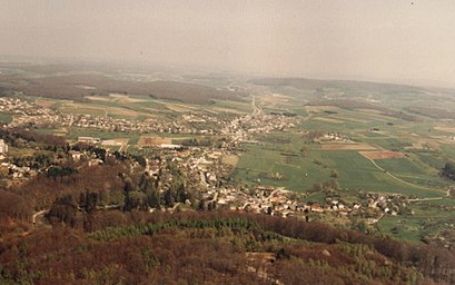
Senningen (Luxembourgish: Senneng), is a small town in the commune of Niederanven, in central Luxembourg. As of 2024, the town has a population of 749.Wiki
Places Near Senningen (Niederanven)
How to get to popular places in Luxembourg with public transit
Get around Niederanven by public transit!
Traveling around Niederanven has never been so easy. See step by step directions as you travel to any attraction, street or major public transit station. View bus and train schedules, arrival times, service alerts and detailed routes on a map, so you know exactly how to get to anywhere in Niederanven.
When traveling to any destination around Niederanven use Moovit's Live Directions with Get Off Notifications to know exactly where and how far to walk, how long to wait for your line, and how many stops are left. Moovit will alert you when it's time to get off — no need to constantly re-check whether yours is the next stop.
Wondering how to use public transit in Niederanven or how to pay for public transit in Niederanven? Moovit public transit app can help you navigate your way with public transit easily, and at minimum cost. It includes public transit fees, ticket prices, and costs. Looking for a map of Niederanven public transit lines? Moovit public transit app shows all public transit maps in Niederanven with all Bus, Train and Light Rail routes and stops on an interactive map.
Luxembourg has 3 transit type(s), including: Bus, Train and Light Rail, operated by several transit agencies, including Ville de Luxembourg - Service Autobus, TICE, Chemins de Fer Luxembourgeois, Régime Général des Transports Routiers, Luxtram, FlixBus and Société Nationale des Chemins de Fer Luxembourgeois