Directions to Sentry Auto Group (Medford) with public transportation
The following transit lines have routes that pass near Sentry Auto Group
 Bus: 134, 85, 100, 108.
- Subway: ORANGE LINE, GREEN LINE B, GREEN LINE C, GREEN LINE E.
How to get to Sentry Auto Group by bus?
Click on the bus route to see step by step directions with maps, line arrival times and updated time schedules.
From Hyatt Regency Cambridge - Overlooking Boston, Cambridge
54 minFrom Rochambeau, Boston
85 minFrom Children's Hospital, Boston
119 minFrom The Strand Theater, Boston
104 minFrom Fairmont Copley Plaza Boston, Boston
87 minFrom The Cheesecake Factory, Boston
85 minFrom Uphams Corner, Boston
110 minFrom Samuel Adams Brewery, Boston
112 minFrom Eataly, Boston
90 minFrom Doubletree-Boston Bayside, Boston
116 min
How to get to Sentry Auto Group by subway?
Click on the subway route to see step by step directions with maps, line arrival times and updated time schedules.
From Hyatt Regency Cambridge - Overlooking Boston, Cambridge
67 minFrom Rochambeau, Boston
41 minFrom Children's Hospital, Boston
44 minFrom The Strand Theater, Boston
59 minFrom Fairmont Copley Plaza Boston, Boston
33 minFrom The Cheesecake Factory, Boston
39 minFrom Uphams Corner, Boston
51 minFrom Samuel Adams Brewery, Boston
44 minFrom Eataly, Boston
36 minFrom Doubletree-Boston Bayside, Boston
46 min
Bus stops near Sentry Auto Group in Medford
Subway stations near Sentry Auto Group in Medford
Bus lines to Sentry Auto Group in Medford
What are the closest stations to Sentry Auto Group?
The closest stations to Sentry Auto Group are:
- Riverside Ave @ Fellsway is 51 yards away, 1 min walk.
- Gilman Square is 234 yards away, 3 min walk.
- Fellsway @ Middlesex Ave - Wellington Circle is 395 yards away, 5 min walk.
- Assembly is 2212 yards away, 27 min walk.
Which bus lines stop near Sentry Auto Group?
These bus lines stop near Sentry Auto Group: 134, 85.
Which subway line stops near Sentry Auto Group?
ORANGE LINE (Oak Grove)
What’s the nearest subway station to Sentry Auto Group in Medford?
The nearest subway station to Sentry Auto Group in Medford is Gilman Square. It’s a 3 min walk away.
What’s the nearest bus station to Sentry Auto Group in Medford?
The nearest bus station to Sentry Auto Group in Medford is Riverside Ave @ Fellsway. It’s a 1 min walk away.
What time is the first subway to Sentry Auto Group in Medford?
The GREEN LINE E is the first subway that goes to Sentry Auto Group in Medford. It stops nearby at 4:51 AM.
What time is the last subway to Sentry Auto Group in Medford?
The GREEN LINE E is the last subway that goes to Sentry Auto Group in Medford. It stops nearby at 2:39 AM.
What time is the first bus to Sentry Auto Group in Medford?
The 100 is the first bus that goes to Sentry Auto Group in Medford. It stops nearby at 5:03 AM.
What time is the last bus to Sentry Auto Group in Medford?
The 108 is the last bus that goes to Sentry Auto Group in Medford. It stops nearby at 1:29 AM.
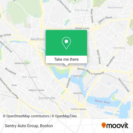
See Sentry Auto Group, Medford, on the map
Public Transit to Sentry Auto Group in Medford
Wondering how to get to Sentry Auto Group in Medford? Moovit helps you find the best way to get to Sentry Auto Group with step-by-step directions from the nearest public transit station.
Moovit provides free maps and live directions to help you navigate through your city. View schedules, routes, timetables, and find out how long does it take to get to Sentry Auto Group in real time.
Looking for the nearest stop or station to Sentry Auto Group? Check out this list of stops closest to your destination: Riverside Ave @ Fellsway; Gilman Square; Fellsway @ Middlesex Ave - Wellington Circle; Assembly.
Bus: 134, 85, 100, 108.Subway: ORANGE LINE, GREEN LINE B, GREEN LINE C, GREEN LINE E.
Want to see if there’s another route that gets you there at an earlier time? Moovit helps you find alternative routes or times. Get directions from and directions to Sentry Auto Group easily from the Moovit App or Website.
We make riding to Sentry Auto Group easy, which is why over 1.7 million users, including users in Medford, trust Moovit as the best app for public transit. You don’t need to download an individual bus app or train app, Moovit is your all-in-one transit app that helps you find the best bus time or train time available.
For information on prices of subway and bus, costs and ride fares to Sentry Auto Group, please check the Moovit app.
Use the app to navigate to popular places including to the airport, hospital, stadium, grocery store, mall, coffee shop, school, college, and university.
Sentry Auto Group Address: 4100 Mystic Valley Pkwy # 100 street in Medford
- Quick Lane(R) Tire & Auto Center,
- Mystic Valley Pkwy,
- EVgo,
- Lafountain & Wollman P.C.,
- Stretchlab,
- 3rd District Court of Middlesex,
- McDonald Park,
- Wellington Circle Shopping Plaza,
- Amazon Locker-Mintaka,
- Team Blood,
- Aldi,
- Dave's Hot Chicken,
- Boston Market,
- Massachusetts State Police A-4 Medford,
- Biolife,
- Mystic Valley Pkwy & Revere Beach Pkwy,
- Lowe's,
- Longcross,
- Brancato Barber,
- STARBUCKS
Places Near Sentry Auto Group (Medford)
- Td Garden, Boston,
- Mgm Music Hall, Boston,
- Seaport District, Boston,
- Isabella Stewart Gardner Museum, Boston,
- Boston Medical Center, Boston,
- Wilbur Theatre, Boston,
- Prudential Center, Boston,
- Cheers, Boston,
- Quincy Market, Boston,
- House Of Blues, Boston,
- Boston Children's Hospital, Boston,
- Boston Common, Boston,
- Boston Convention & Exhibition Center, Boston,
- Massachusetts General Hospital, Boston,
- Museum Of Science, Boston,
- Wang Theater, Boston,
- Leader Bank Pavilion (Leader Bank Pavillion), Boston,
- North End, Boston,
- Faneuil Hall, Boston,
- Castle Island, Boston
How to get to popular places in Boston with public transit
Get around Medford by public transit!
Traveling around Medford has never been so easy. See step by step directions as you travel to any attraction, street or major public transit station. View bus and train schedules, arrival times, service alerts and detailed routes on a map, so you know exactly how to get to anywhere in Medford.
When traveling to any destination around Medford use Moovit's Live Directions with Get Off Notifications to know exactly where and how far to walk, how long to wait for your line, and how many stops are left. Moovit will alert you when it's time to get off — no need to constantly re-check whether yours is the next stop.
Wondering how to use public transit in Medford or how to pay for public transit in Medford? Moovit public transit app can help you navigate your way with public transit easily, and at minimum cost. It includes public transit fees, ticket prices, and costs. Looking for a map of Medford public transit lines? Moovit public transit app shows all public transit maps in Medford with all Bus, Train, Subway and Ferry routes and stops on an interactive map.
Boston has 4 transit type(s), including: Bus, Train, Subway and Ferry, operated by several transit agencies, including MBTA, Southeastern Regional Transit Authority, MetroWest Regional Transit Authority, Rhode Island Public Transit Authority, WRTA, Lowell Regional Transit Authority, Merrimack Valley Transit, Montachusett Regional Transit Authority, Cape Cod Regional Transit Authority, Brockton Area Transit Authority, Martha's Vineyard Transit Authority, the WAVE - Nantucket Regional Transit Authority, GATRA, Cape Ann Transportation Authority and Massport