How to get to Sepac Lccps by bus?
Click on the bus route to see step by step directions with maps, line arrival times and updated time schedules.
How to get to Sepac Lccps by train?
Click on the train route to see step by step directions with maps, line arrival times and updated time schedules.
Bus stops near Sepac Lccps in Lowell
Bus lines to Sepac Lccps in Lowell
- 9, Loop,VIEW
- 18, Kennedy Center,VIEW
- 11, IRS/Raytheon via Rte. 133,VIEW
- 12, Tewksbury via Rte. 38/Wilmington Train Station,VIEW
- 2, White Dove Plaza,VIEW
- 24, Robert B. Kennedy Transfer Center,VIEW
- 3, Kennedy Center,VIEW
- 1, Christian Hill,VIEW
- 6, Broadway/UMass Lowell,VIEW
- 7, Pawtucketville/UMass Lowell North,VIEW
- 8, Centralville,VIEW
- 10, Dracut/Tyngsboro,VIEW
- 20, Kennedy Center,VIEW
What are the closest stations to Sepac Lccps?
The closest stations to Sepac Lccps are:
- Central St & Jackson St is 133 yards away, 2 min walk.
- Middlesex St & Pearl St is 191 yards away, 3 min walk.
- Middlesex St & Moulton Ave is 217 yards away, 3 min walk.
- Middlesex Street & Moulton Avenue is 221 yards away, 3 min walk.
- Gorham St & Appleton St is 338 yards away, 5 min walk.
- Dutton St And Broadway St is 359 yards away, 5 min walk.
- Dutton St & Broadway St is 372 yards away, 5 min walk.
Which bus lines stop near Sepac Lccps?
These bus lines stop near Sepac Lccps: 12, 24.
Which train line stops near Sepac Lccps?
LOWELL (#331 | Lowell)
What’s the nearest bus station to Sepac Lccps in Lowell?
The nearest bus station to Sepac Lccps in Lowell is Central St & Jackson St. It’s a 2 min walk away.
What time is the first bus to Sepac Lccps in Lowell?
The 24 is the first bus that goes to Sepac Lccps in Lowell. It stops nearby at 5:36 AM.
What time is the last bus to Sepac Lccps in Lowell?
The 24 is the last bus that goes to Sepac Lccps in Lowell. It stops nearby at 9:36 PM.
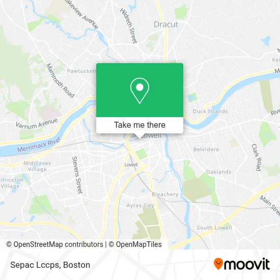
See Sepac Lccps, Lowell, on the map
Public Transit to Sepac Lccps in Lowell
Wondering how to get to Sepac Lccps in Lowell? Moovit helps you find the best way to get to Sepac Lccps with step-by-step directions from the nearest public transit station.
Moovit provides free maps and live directions to help you navigate through your city. View schedules, routes, timetables, and find out how long does it take to get to Sepac Lccps in real time.
Looking for the nearest stop or station to Sepac Lccps? Check out this list of stops closest to your destination: Central St & Jackson St; Middlesex St & Pearl St; Middlesex St & Moulton Ave; Middlesex Street & Moulton Avenue; Gorham St & Appleton St; Dutton St And Broadway St; Dutton St & Broadway St.
Bus: 12, 24, 9, 18, 11, 2, 3, 1, 6, 7, 8, 10.Train: LOWELL.
Want to see if there’s another route that gets you there at an earlier time? Moovit helps you find alternative routes or times. Get directions from and directions to Sepac Lccps easily from the Moovit App or Website.
We make riding to Sepac Lccps easy, which is why over 1.7 million users, including users in Lowell, trust Moovit as the best app for public transit. You don’t need to download an individual bus app or train app, Moovit is your all-in-one transit app that helps you find the best bus time or train time available.
For information on prices of bus and train, costs and ride fares to Sepac Lccps, please check the Moovit app.
Use the app to navigate to popular places including to the airport, hospital, stadium, grocery store, mall, coffee shop, school, college, and university.
Sepac Lccps Address: 206 Jackson St street in Lowell
- Millworks Gallery,
- Mill City Music Studio,
- Barbara Rodriguez Co.,
- Second And New,
- Elite Roofing And Siding Massachusetts,
- Amazon Locker - Slalom,
- Hospital,
- The Tone Loft,
- Sitzens,
- Eyeformation Shop,
- Kale Yeah,
- Dahc Art,
- Fragile State Vintage,
- Pizzuti Studios Photography,
- First Line Collision Center,
- New Century Auto,
- The Emery Lowell,
- New Life Christian Ministries,
- Living Faith Church,
- Senat Insurance Agency
Places Near Sepac Lccps (Lowell)
- Prudential Center, Boston,
- Seaport District, Boston,
- Mgm Music Hall, Boston,
- Td Garden, Boston,
- Boston Common, Boston,
- Wilbur Theatre, Boston,
- Boston Medical Center, Boston,
- Quincy Market, Boston,
- North End, Boston,
- Museum Of Science, Boston,
- Massachusetts General Hospital, Boston,
- Castle Island, Boston,
- Leader Bank Pavilion (Leader Bank Pavillion), Boston,
- Boston Convention & Exhibition Center, Boston,
- Isabella Stewart Gardner Museum, Boston,
- Boston Children's Hospital, Boston,
- House Of Blues, Boston,
- Wang Theater, Boston,
- Faneuil Hall, Boston,
- Cheers, Boston
How to get to popular places in Boston with public transit
Get around Lowell by public transit!
Traveling around Lowell has never been so easy. See step by step directions as you travel to any attraction, street or major public transit station. View bus and train schedules, arrival times, service alerts and detailed routes on a map, so you know exactly how to get to anywhere in Lowell.
When traveling to any destination around Lowell use Moovit's Live Directions with Get Off Notifications to know exactly where and how far to walk, how long to wait for your line, and how many stops are left. Moovit will alert you when it's time to get off — no need to constantly re-check whether yours is the next stop.
Wondering how to use public transit in Lowell or how to pay for public transit in Lowell? Moovit public transit app can help you navigate your way with public transit easily, and at minimum cost. It includes public transit fees, ticket prices, and costs. Looking for a map of Lowell public transit lines? Moovit public transit app shows all public transit maps in Lowell with all Bus, Train, Subway and Ferry routes and stops on an interactive map.
Boston has 4 transit type(s), including: Bus, Train, Subway and Ferry, operated by several transit agencies, including MBTA, Southeastern Regional Transit Authority, MetroWest Regional Transit Authority, Rhode Island Public Transit Authority, WRTA, Lowell Regional Transit Authority, Merrimack Valley Transit, Montachusett Regional Transit Authority, Cape Cod Regional Transit Authority, Brockton Area Transit Authority, Martha's Vineyard Transit Authority, the WAVE - Nantucket Regional Transit Authority, GATRA, Cape Ann Transportation Authority and Massport