How to get to Sepadu Tech by bus?
Click on the bus route to see step by step directions with maps, line arrival times and updated time schedules.
From Nigdi Bus Stop, Nigdi, Pune & Velhe
74 minFrom Aamby Valley City, Paud
67 minFrom Sangvi, Pune & Velhe
51 minFrom Indian Institute Of Science Education And Research (Iiser), Pune, Pune & Velhe
46 minFrom Pashan Lake, Pune & Velhe
51 minFrom Panchwati-C-Dac, Pune & Velhe
76 minFrom Govind Garden, Pune & Velhe
40 minFrom Pimpri Sky Walk, Pune & Velhe
60 minFrom Bhimashankar, Pune & Velhe
60 min
Bus stops near Sepadu Tech in Paud
Bus lines to Sepadu Tech in Paud
- 320, Hinjawadi Maan Phase 3,VIEW
- 383C, Hinjawadi Megapolis Phase 3 Via Maan,VIEW
- 74, Chinchwadgaon - Paud Shashkiya Vishramgruha,VIEW
- 77, Hinjawadi Maan Phase 3 - Ganpati Matha,VIEW
- 79, Hinjawadi Maan Phase 3 - Deccan Gymkhana,VIEW
- 100, Ma.Na.Pa Bhavan - Hinjawadi Maan Phase 3,VIEW
- 115, Hinjawadi Maan Phase 3 - Pune Station,VIEW
- 124, Aundh Gaon - Neilsoft Company Infosys (Phase 3),VIEW
- 208, Bhekrainagar Depot - Hinjawadi Maan Phase 3,VIEW
- 225, Kharadi Gaon - Hinjawadi Maan Phase 3,VIEW
- 306, Dange Chowk - Hinjawadi Megapolis Phase 3,VIEW
- 313, Chinchwadgaon - Chandkhed,VIEW
- 316, Chinchwadgaon - Katarkhadak,VIEW
- 324, Bhosari Terminal - Hinjawadi Maan Phase 3,VIEW
- 327, Alandi Darshan - Hinjawadi Maan Phase 3,VIEW
- 328, Kesnand Phata Wagholi - Hinjawadi Maan Phase 3,VIEW
- 333, Pune Station - Hinjawadi Maan Phase 3,VIEW
- 345, Hinjawadi Maan Phase 3 - Bhosari Terminal,VIEW
- 372, Nigdi Bhakti Shakti Terminal - Hinjawadi Megapolis Phase 3,VIEW
- 373, Neilsoft Company Infosys (Phase 3) - Sangvi Gaon,VIEW
What are the closest stations to Sepadu Tech?
The closest stations to Sepadu Tech are:
- PDCC Bank Maan Road is 15 meters away, 1 min walk.
- Infosys Phase 1 is 565 meters away, 8 min walk.
Which bus lines stop near Sepadu Tech?
These bus lines stop near Sepadu Tech: 100, 100A, 124, 320, 324, 43A.
What’s the nearest bus station to Sepadu Tech in Paud?
The nearest bus station to Sepadu Tech in Paud is PDCC Bank Maan Road. It’s a 1 min walk away.
What time is the first bus to Sepadu Tech in Paud?
The 100 is the first bus that goes to Sepadu Tech in Paud. It stops nearby at 5:36 AM.
What time is the last bus to Sepadu Tech in Paud?
The 115 is the last bus that goes to Sepadu Tech in Paud. It stops nearby at 12:40 AM.
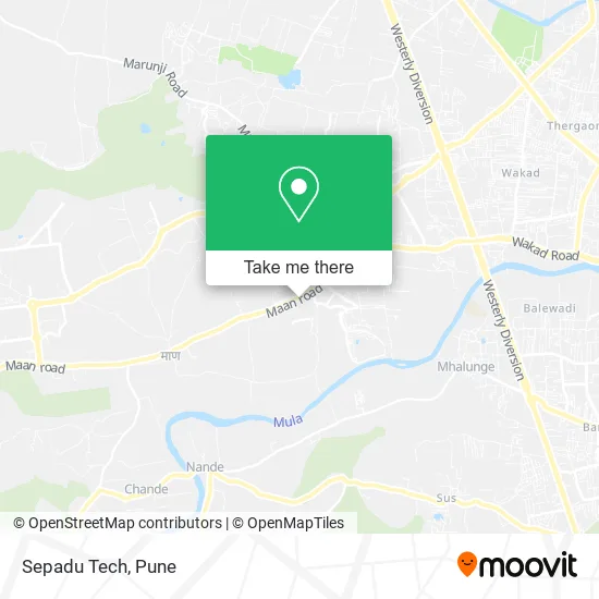
See Sepadu Tech, Paud, on the map
Public Transit to Sepadu Tech in Paud
Wondering how to get to Sepadu Tech in Paud? Moovit helps you find the best way to get to Sepadu Tech with step-by-step directions from the nearest public transit station.
Moovit provides free maps and live directions to help you navigate through your city. View schedules, routes, timetables, and find out how long does it take to get to Sepadu Tech in real time.
Looking for the nearest stop or station to Sepadu Tech? Check out this list of stops closest to your destination: PDCC Bank Maan Road; Infosys Phase 1.
Bus: 100, 100A, 124, 320, 324, 43A, 383C, 74, 77, 79, 115.
Want to see if there’s another route that gets you there at an earlier time? Moovit helps you find alternative routes or times. Get directions from and directions to Sepadu Tech easily from the Moovit App or Website.
We make riding to Sepadu Tech easy, which is why over 1.5 million users, including users in Paud, trust Moovit as the best app for public transit. You don’t need to download an individual bus app or train app, Moovit is your all-in-one transit app that helps you find the best bus time or train time available.
For information on prices of bus, costs and ride fares to Sepadu Tech, please check the Moovit app.
Use the app to navigate to popular places including to the airport, hospital, stadium, grocery store, mall, coffee shop, school, college, and university.
Sepadu Tech Address: Hinjwadi Maan Link Road हिंजवाडी 411057 MH street in Paud
- Chaayos,
- Osar Technologies,
- Chai Point,
- Cupcake Bliss Cakes & Desserts,
- Capital O Hoteldeluxe,
- Sai Avenue,
- Fabexpress Deluxe - Hotelin Hinjewadi,
- Peppy Parathas Rolls by Chai Point,
- Baskin-Robbins,
- Warmoven,
- Madras Circle,
- Ornate Camp,
- R Mart Stores,
- Hoteldeluxe,
- Propertywise,
- Faizan Electrical,
- Pk S Resto & Bar,
- Ctara Decor,
- Glass Homoeopathic Healing Centre,
- Mahaveer Furniture Mall
Places Near Sepadu Tech (Paud)
- Fc Road, Pune & Velhe,
- Cognizant Deccan Campus (CDC), Paud,
- Dagadusheth Halwai Ganapati Temple, Pune & Velhe,
- Senapati Bapat Road, Pune & Velhe,
- Pvr Icon - Pavilion Mall, Pune & Velhe,
- Laxmi Road, Pune & Velhe,
- Chaturshringi Temple, Pune & Velhe,
- Dagdusheth Halwai Ganpati Mandir, Pune & Velhe,
- Symbiosis Lavale Bus Stop, Pune & Velhe,
- Ion Digital Zone, Pune & Velhe,
- Westend Mall, Pune & Velhe,
- ISKCON Pune, Pune & Velhe,
- Pune Okayama Friendship Garden, Pune & Velhe,
- Tulshibaug, Pune & Velhe,
- M G Road, Pune & Velhe,
- Swaminarayan Mandir, Pune & Velhe,
- Sarasbaug, Pune & Velhe,
- BAPS Shri Swaminarayan Mandir, Pune & Velhe,
- ISKCON Nvcc Temple, Pune & Velhe,
- Vishwakarma Institute Of Technology (Vit), Pune & Velhe
How to get to popular places in Pune with public transit
Get around Paud by public transit!
Traveling around Paud has never been so easy. See step by step directions as you travel to any attraction, street or major public transit station. View bus and train schedules, arrival times, service alerts and detailed routes on a map, so you know exactly how to get to anywhere in Paud.
When traveling to any destination around Paud use Moovit's Live Directions with Get Off Notifications to know exactly where and how far to walk, how long to wait for your line, and how many stops are left. Moovit will alert you when it's time to get off — no need to constantly re-check whether yours is the next stop.
Wondering how to use public transit in Paud or how to pay for public transit in Paud? Moovit public transit app can help you navigate your way with public transit easily, and at minimum cost. It includes public transit fees, ticket prices, and costs. Looking for a map of Paud public transit lines? Moovit public transit app shows all public transit maps in Paud with all Bus, Train and Metro routes and stops on an interactive map.
Pune has 3 transit type(s), including: Bus, Train and Metro, operated by several transit agencies, including Pune Metro (Maha Metro), PMPML, PMPML Night Bus Service (Ratrani) and Central Railways (Indian Railways)