Directions to Sereda Danceworks (Boston) with public transportation
The following transit lines have routes that pass near Sereda Danceworks
 Bus: 11, NCS, 10, MWES.
- Train: FRAMINGHAM/WORCESTER.
How to get to Sereda Danceworks by bus?
Click on the bus route to see step by step directions with maps, line arrival times and updated time schedules.
From Framingham, MA, Framingham
58 minFrom I-95 / Route 128 & Route 16 Interchange (Exit 21), Newton
97 minFrom Babson College, Wellesley
92 minFrom Newton Wellesley Hospital Green Building, Newton
100 minFrom Newton-Wellesley Hospital, Newton
100 minFrom Lasell College, Newton
114 minFrom Wellesley, MA, Wellesley
94 minFrom Staples Corporate HQ, Framingham
83 minFrom Bose Corp, Framingham
96 minFrom Boston Marriott Newton, Newton
123 min
How to get to Sereda Danceworks by train?
Click on the train route to see step by step directions with maps, line arrival times and updated time schedules.
Bus stops near Sereda Danceworks in Boston
Train station near Sereda Danceworks in Boston
- West Natick, 14 min walk,VIEW
Bus lines to Sereda Danceworks in Boston
What are the closest stations to Sereda Danceworks?
The closest stations to Sereda Danceworks are:
- Natick Common is 857 yards away, 11 min walk.
- Kansas St & Route 27 is 924 yards away, 11 min walk.
- Natick Center Mbta is 1065 yards away, 13 min walk.
- West Natick is 1123 yards away, 14 min walk.
Which bus lines stop near Sereda Danceworks?
These bus lines stop near Sereda Danceworks: 11, NCS.
Which train line stops near Sereda Danceworks?
FRAMINGHAM/WORCESTER (#526 | South Station)
What’s the nearest train station to Sereda Danceworks in Boston?
The nearest train station to Sereda Danceworks in Boston is West Natick. It’s a 14 min walk away.
What’s the nearest bus station to Sereda Danceworks in Boston?
The nearest bus stations to Sereda Danceworks in Boston are Natick Common and Kansas St & Route 27. The closest one is a 11 min walk away.
What time is the first train to Sereda Danceworks in Boston?
The FRAMINGHAM/WORCESTER is the first train that goes to Sereda Danceworks in Boston. It stops nearby at 4:59 AM.
What time is the last train to Sereda Danceworks in Boston?
The FRAMINGHAM/WORCESTER is the last train that goes to Sereda Danceworks in Boston. It stops nearby at 12:41 AM.
What time is the first bus to Sereda Danceworks in Boston?
The NCS is the first bus that goes to Sereda Danceworks in Boston. It stops nearby at 6:50 AM.
What time is the last bus to Sereda Danceworks in Boston?
The 11 is the last bus that goes to Sereda Danceworks in Boston. It stops nearby at 8:03 PM.
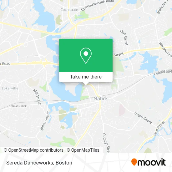
See Sereda Danceworks, Boston, on the map
Public Transit to Sereda Danceworks in Boston
Wondering how to get to Sereda Danceworks in Boston? Moovit helps you find the best way to get to Sereda Danceworks with step-by-step directions from the nearest public transit station.
Moovit provides free maps and live directions to help you navigate through your city. View schedules, routes, timetables, and find out how long does it take to get to Sereda Danceworks in real time.
Looking for the nearest stop or station to Sereda Danceworks? Check out this list of stops closest to your destination: Natick Common; Kansas St & Route 27; Natick Center Mbta; West Natick.
Bus: 11, NCS, 10, MWES.Train: FRAMINGHAM/WORCESTER.
Want to see if there’s another route that gets you there at an earlier time? Moovit helps you find alternative routes or times. Get directions from and directions to Sereda Danceworks easily from the Moovit App or Website.
We make riding to Sereda Danceworks easy, which is why over 1.7 million users, including users in Boston, trust Moovit as the best app for public transit. You don’t need to download an individual bus app or train app, Moovit is your all-in-one transit app that helps you find the best bus time or train time available.
For information on prices of bus and train, costs and ride fares to Sereda Danceworks, please check the Moovit app.
Use the app to navigate to popular places including to the airport, hospital, stadium, grocery store, mall, coffee shop, school, college, and university.
Sereda Danceworks Address: 89H Washington St street in Boston
- Boston Limo Service - BCC Limos,
- MCRT Natick clubhouse,
- ATM,
- Milch Motors,
- Exxon,
- Tony Anniballi Memorial Park at Pegan Cove,
- First Images,
- Cochituate Rail Trail Natick Terminus,
- Dannin Management,
- Capoeira Classes,
- Jeremy Gransky,
- Heritage Properties,
- Studio Fitness,
- A & 1 Avail Locksmith,
- Afterschool Professional Network,
- ABC Global School,
- Chaulk Ambulance Service,
- Daryl Lippman Gri CBR Senior Real Estate Specialist,
- Moulton Plumbing,
- DVG Tax Returns
Places Near Sereda Danceworks (Boston)
- Boston Medical Center, Boston,
- North End, Boston,
- Prudential Center, Boston,
- Castle Island, Boston,
- Boston Children's Hospital, Boston,
- Td Garden, Boston,
- Museum Of Science, Boston,
- Wilbur Theatre, Boston,
- Quincy Market, Boston,
- Boston Convention & Exhibition Center, Boston,
- Isabella Stewart Gardner Museum, Boston,
- House Of Blues, Boston,
- Wang Theater, Boston,
- Cheers, Boston,
- Massachusetts General Hospital, Boston,
- Mgm Music Hall, Boston,
- Leader Bank Pavilion (Leader Bank Pavillion), Boston,
- Faneuil Hall, Boston,
- Boston Common, Boston,
- Seaport District, Boston
How to get to popular places in Boston with public transit
Get around Boston by public transit!
Traveling around Boston has never been so easy. See step by step directions as you travel to any attraction, street or major public transit station. View bus and train schedules, arrival times, service alerts and detailed routes on a map, so you know exactly how to get to anywhere in Boston.
When traveling to any destination around Boston use Moovit's Live Directions with Get Off Notifications to know exactly where and how far to walk, how long to wait for your line, and how many stops are left. Moovit will alert you when it's time to get off — no need to constantly re-check whether yours is the next stop.
Wondering how to use public transit in Boston or how to pay for public transit in Boston? Moovit public transit app can help you navigate your way with public transit easily, and at minimum cost. It includes public transit fees, ticket prices, and costs. Looking for a map of Boston public transit lines? Moovit public transit app shows all public transit maps in Boston with all Bus, Train, Subway and Ferry routes and stops on an interactive map.
Boston has 4 transit type(s), including: Bus, Train, Subway and Ferry, operated by several transit agencies, including MBTA, Southeastern Regional Transit Authority, MetroWest Regional Transit Authority, Rhode Island Public Transit Authority, WRTA, Lowell Regional Transit Authority, Merrimack Valley Transit, Montachusett Regional Transit Authority, Cape Cod Regional Transit Authority, Brockton Area Transit Authority, Martha's Vineyard Transit Authority, the WAVE - Nantucket Regional Transit Authority, GATRA, Cape Ann Transportation Authority and Massport