Directions to Serenity Nails (Baltimore County) with public transportation
The following transit lines have routes that pass near Serenity Nails
 Bus: 30, 34, 94, 33.
- Light Rail: LIGHT RAILLINK.
How to get to Serenity Nails by bus?
Click on the bus route to see step by step directions with maps, line arrival times and updated time schedules.
From Baltimore Penn Station, Baltimore
85 minFrom Renaissance Baltimore Harborplace Hotel, Baltimore
66 minFrom Hilton Baltimore, Baltimore
54 minFrom Mercy Medical Center, Baltimore
66 minFrom Johns Hopkins University, Baltimore
60 minFrom Power Plant Live, Baltimore
65 minFrom Inner Harbor, Baltimore
65 minFrom Joseph Meyerhoff Symphony Hall, Baltimore
67 minFrom Lexington Market, Baltimore
48 minFrom Good Samaritan Hospital, Baltimore
36 min
Bus stop near Serenity Nails in Baltimore County
- Kelly Ave & Sulgrave Ave Wb, 1 min walk,VIEW
Light Rail stations near Serenity Nails in Baltimore County
- Cold Spring Lane, 22 min walk,VIEW
Bus lines to Serenity Nails in Baltimore County
What are the closest stations to Serenity Nails?
The closest stations to Serenity Nails are:
- Kelly Ave & Sulgrave Ave Wb is 19 yards away, 1 min walk.
- Cold Spring Lane is 1807 yards away, 22 min walk.
Which bus lines stop near Serenity Nails?
These bus lines stop near Serenity Nails: 30, 34, 94.
Which light rail line stops near Serenity Nails?
LIGHT RAILLINK (Northbound)
What’s the nearest light rail station to Serenity Nails in Baltimore County?
The nearest light rail station to Serenity Nails in Baltimore County is Cold Spring Lane. It’s a 22 min walk away.
What’s the nearest bus station to Serenity Nails in Baltimore County?
The nearest bus station to Serenity Nails in Baltimore County is Kelly Ave & Sulgrave Ave Wb. It’s a 1 min walk away.
What time is the first light rail to Serenity Nails in Baltimore County?
The LIGHT RAILLINK is the first light rail that goes to Serenity Nails in Baltimore County. It stops nearby at 4:28 AM.
What time is the last light rail to Serenity Nails in Baltimore County?
The LIGHT RAILLINK is the last light rail that goes to Serenity Nails in Baltimore County. It stops nearby at 1:09 AM.
What time is the first bus to Serenity Nails in Baltimore County?
The 94 is the first bus that goes to Serenity Nails in Baltimore County. It stops nearby at 3:49 AM.
What time is the last bus to Serenity Nails in Baltimore County?
The 94 is the last bus that goes to Serenity Nails in Baltimore County. It stops nearby at 2:57 AM.
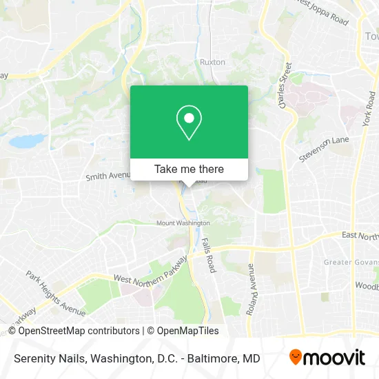
See Serenity Nails, Baltimore County, on the map
Public Transit to Serenity Nails in Baltimore County
Wondering how to get to Serenity Nails in Baltimore County? Moovit helps you find the best way to get to Serenity Nails with step-by-step directions from the nearest public transit station.
Moovit provides free maps and live directions to help you navigate through your city. View schedules, routes, timetables, and find out how long does it take to get to Serenity Nails in real time.
Looking for the nearest stop or station to Serenity Nails? Check out this list of stops closest to your destination: Kelly Ave & Sulgrave Ave Wb; Cold Spring Lane.
Bus: 30, 34, 94, 33.Light Rail: LIGHT RAILLINK.
Want to see if there’s another route that gets you there at an earlier time? Moovit helps you find alternative routes or times. Get directions from and directions to Serenity Nails easily from the Moovit App or Website.
We make riding to Serenity Nails easy, which is why over 1.7 million users, including users in Baltimore County, trust Moovit as the best app for public transit. You don’t need to download an individual bus app or train app, Moovit is your all-in-one transit app that helps you find the best bus time or train time available.
For information on prices of bus and light rail, costs and ride fares to Serenity Nails, please check the Moovit app.
Use the app to navigate to popular places including to the airport, hospital, stadium, grocery store, mall, coffee shop, school, college, and university.
Serenity Nails Address: 6080 Falls Rd street in Baltimore County
- Mason-Mayes,
- Long & Foster Lake Roland Baltimore, Md - Realty,
- Jennifer Bayne Real Estate,
- Cane Collective,
- Banksy's Cafe,
- Kitchen Design by Idan,
- Robert E. Lee Park,
- The Yog House,
- 49,
- Thrive Doula Services,
- Falls Road Light Rail Station,
- Jones Falls Park,
- Ameriprise Financial,
- Alan Robin,
- Clipper City Capital - Ameriprise Financial Services, Llc,
- Michael Hart Davis,
- Benjamin Hoffman - Private Wealth Advisor, Ameriprise Financial Services, Llc,
- Steven M. Heinl - Attorney,
- Divine Life Church,
- Baltimore Museum of Industry
Places Near Serenity Nails (Baltimore County)
- The Anthem, Washington,
- Basilica of the National Shrine, Washington,
- Amazon Hq2, Arlington County,
- Pennsylvania Ave NW (3rd st and pennsylvania), Washington,
- Warner Theatre, Washington,
- Washington DC VA Medical Center, Washington,
- M&T Bank Stadium, Baltimore,
- Capital One Arena, Washington,
- Sibley Memorial Hospital, Washington,
- PG Mall, Prince George's County,
- Washington National Cathedral, Washington,
- Westfield Montgomery Mall, Montgomery County,
- Museum Of The Bible, Washington,
- Camden Yards, Baltimore,
- National Zoo, Washington,
- Georgetown, Washington,
- National Museum of African American History and Culture, Washington,
- Rock Creek Tennis Center, Washington,
- National Theatre, Washington,
- Marriott Marquis Washington, DC, Washington
How to get to popular places in Washington, D.C. - Baltimore, MD with public transit
Get around Baltimore County by public transit!
Traveling around Baltimore County has never been so easy. See step by step directions as you travel to any attraction, street or major public transit station. View bus and train schedules, arrival times, service alerts and detailed routes on a map, so you know exactly how to get to anywhere in Baltimore County.
When traveling to any destination around Baltimore County use Moovit's Live Directions with Get Off Notifications to know exactly where and how far to walk, how long to wait for your line, and how many stops are left. Moovit will alert you when it's time to get off — no need to constantly re-check whether yours is the next stop.
Wondering how to use public transit in Baltimore County or how to pay for public transit in Baltimore County? Moovit public transit app can help you navigate your way with public transit easily, and at minimum cost. It includes public transit fees, ticket prices, and costs. Looking for a map of Baltimore County public transit lines? Moovit public transit app shows all public transit maps in Baltimore County with all Bus, Train, Metro, Light Rail and Ferry routes and stops on an interactive map.
Washington, D.C. - Baltimore, MD has 5 transit type(s), including: Bus, Train, Metro, Light Rail and Ferry, operated by several transit agencies, including WMATA, Montgomery County Ride On, Fairfax Connector, TheBus, PRTC, DASH - Alexandria, Arlington Transit (ART), RTA of Central Maryland, MDOT MTA, MDOT MTA Light RailLink, MDOT MTA Commuter Bus, MDOT MTA Local Bus, FXBGO!, Virginia Railway Express (VRE) and MARC